1950s Maps of Dyer County, Tennessee
Explore 12 historic maps of Dyer County from the 1950s. These maps offer a rare glimpse into what life looked like during the 1950s — showing old roads, neighborhoods, homes, and landmarks that have changed or disappeared over time.
Whether you're researching your family's past, planning a metal detecting trip, or studying how Dyer County's landscape evolved across the 1950s, these high-resolution maps are a powerful tool for exploring the history of this region.
- Focus on a specific era: All maps on this page are from the 1950s, giving you a focused view of this time period.
- See what’s changed: Compare century-old streets, trails, and buildings to today's modern landscape using overlays and satellite layers.
- Research with precision: Use these maps for genealogy, historical research, land use analysis, or educational projects.
- View, download, or print: Maps are fully viewable online in high resolution, and can be downloaded or printed for your own records.
Start exploring Dyer County's history through authentic maps from the 1950s. This is your window into the past.
Dyer County, TN maps
(12)- 1951 Map of Caruthersville, 1968 Print
 1951 Caruthersville1968 Print · USGSThe Missouri Bootheel meets the Tennessee bottomlands in the early fifties, revealing a landscape of river landings and levee-protected towns. Genealogists can trace family roots through sites like Needmore Cem & Ch, Indian Mound, and the old rail stops of the St Louis Southwestern.
 - 1952 Map of Hales Point
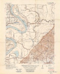 1952 Hales Point1952 Print · USGSThe Mississippi River borderlands of Tennessee and Arkansas are captured here in the early fifties, showing a landscape defined by cut-offs and island formations. Researchers can trace rural life through community landmarks like Walnut Grove Church and Cem, Chic School, and the Needham Cut-Off.4 unique versions available
 - 1952 Map of Bonicord, 1953 Print
 1952 Bonicord1953 Print · USGSDyer and Crockett counties are captured here in the early fifties, showing a rural landscape defined by the river forks and small country crossroads. Genealogists can trace family names through numerous burial sites like St Peter Cem and churches such as Palestine Ch or Zion Hill Ch.2 unique versions available
 - 1952 Map of Newbern, 1953 Print
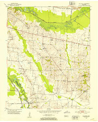
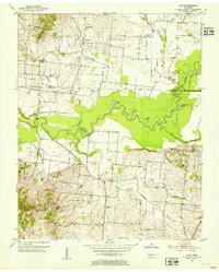
 1952 Newbern1953 Print · USGSDyer County is documented in the early 1950s as a thriving rail and agricultural landscape shaped by two major rail lines. Genealogists can locate family landmarks like the Gauldin Cem or Pierce Cem and study rural centers like Newbern and RoEllen.2 unique versions available
 - 1952 Map of Lane, 1953 Print
 1952 Lane1953 Print · USGSDyer and Obion counties meet along the winding river flats of West Tennessee in the early fifties. Genealogists and historians can trace established rural communities and landmarks like Sharps Ferry, Cloverdale School, and Emmaus Church.2 unique versions available
 - 1952 Map of Dyersburg, 1953 Print
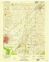
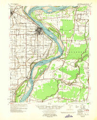
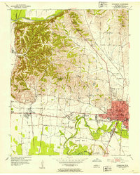 1952 Dyersburg1953 Print · USGSDyer County is seen here during the early fifties, centering on the growing industrial hub of Dyersburg. Genealogists and researchers can trace family landmarks and rural institutions like Neely Chapel Cemetery, Burnt Chapel School, and Big Boy Junction.2 unique versions available
 - 1952 Map of Miston, 1953 Print
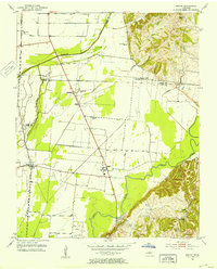 1952 Miston1953 Print · USGSDyer and Lake counties in the early fifties were defined by the winding Obion River and the small hamlets along the Illinois Central tracks. Genealogists can trace family roots through several local landmarks like Horn Ridge Cem, Cunningham Sch, and Bogota.2 unique versions available
 - 1952 Map of Fowlkes, 1954 Print
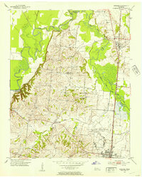 1952 Fowlkes1954 Print · USGSDyer and Lauderdale counties in the early fifties reveal a landscape defined by the winding South Fork Forked Deer River and the Illinois Central rail line. Researchers can trace rural lineages through sites like Williams Chapel, King Cem, and the expansive U S Military Reservation.2 unique versions available
 - 1956 Map of Dyersburg, 1960 Print
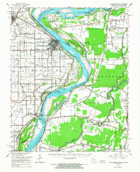
 1956 Dyersburg1960 Print · USGSThe Four Rivers region comes alive in the mid-fifties, capturing the intricate borderlands of Tennessee, Kentucky, and Missouri. Genealogists and historians can trace the rail-and-river networks connecting Dyersburg, Caruthersville, and the shoreline of Reelfoot Lake.4 unique versions available
 - 1956 Map of Blytheville, 1964 Print
 1956 Blytheville1964 Print · USGSWest Tennessee and the Arkansas Delta come alive in this mid-century survey of the river-and-rail corridor connecting Memphis to Jackson. Genealogists and historians can trace the rail lines of the Louisville and Nashville RR and locate landmarks like Western State Hospital or Fort Pillow State Prison Farm.2 unique versions available
 - 1957 Map of Caruthersville
 1957 Caruthersville1957 Print · USGSThe Mississippi River floodplain comes alive in the mid-1950s, detailing a landscape of revetments, dikes, and river landings. Genealogists can trace family roots through numerous rural landmarks like Speers Cem & Ch, Kinfolk Ridge, and Needmore.
 - 1959 Map of Blytheville
 1959 Blytheville1959 Print · USGSWest Tennessee and Northeast Arkansas meet along the river in the late fifties, during a period of steady industrial and agricultural growth. Genealogists can trace the rail corridors of the Illinois Central through Jackson or explore landmarks like Shiloh National Military Park and Fort Pillow State Prison.
End of results
Showing maps 1-12 of 12
Top cities of Dyer County
Frequently asked questions
- What are the different types of historical maps available for Dyer County?
- What is the oldest map of Dyer County?
- Where can I purchase historical maps of Dyer County for my home or office?
- Where can I download high-res historical maps of Dyer County?
- Are there historical topographic maps available for Dyer County?
- Is there historical aerial imagery available for Dyer County?
- Where are historical maps of Dyer County sourced from?