1900s (20th Century) Maps of Rutherford, Tennessee
Explore 7 historic maps of Rutherford from the 1900s (20th Century). These maps offer a rare glimpse into what life looked like during the 1900s — showing old roads, neighborhoods, homes, and landmarks that have changed or disappeared over time.
Whether you're researching your family's past, planning a metal detecting trip, or studying how Rutherford's landscape evolved across the 1900s, these high-resolution maps are a powerful tool for exploring the history of this region.
- Focus on a specific era: All maps on this page are from the 1900s, giving you a focused view of this time period.
- See what’s changed: Compare century-old streets, trails, and buildings to today's modern landscape using overlays and satellite layers.
- Research with precision: Use these maps for genealogy, historical research, land use analysis, or educational projects.
- View, download, or print: Maps are fully viewable online in high resolution, and can be downloaded or printed for your own records.
Start exploring Rutherford's history through authentic maps from the 1900s. This is your window into the past.
Rutherford, TN maps
(7)- 1953 Map of Dyer, 1955 Print
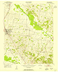 1953 Dyer1955 Print · USGSGibson County life in the early fifties is centered on the rail line and river forks of West Tennessee. Genealogists and local historians can trace family roots through numerous country landmarks like Bucksnort Cem, Mt Zion Sch, and Barrons Corner.3 unique versions available
 - 1954 Map of Rutherford, 1955 Print
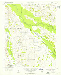 1954 Rutherford1955 Print · USGSGibson County in the mid-1950s is a landscape of river forks and rural rail lines. Trace family history through local landmarks like China Grove Sch, Walnut Grove Ch, and the Gulf Mobile and Ohio railroad through Rutherford.3 unique versions available
 - 1956 Map of Dyersburg, 1960 Print
 1956 Dyersburg1960 Print · USGSThe Four Rivers region comes alive in the mid-fifties, capturing the intricate borderlands of Tennessee, Kentucky, and Missouri. Genealogists and historians can trace the rail-and-river networks connecting Dyersburg, Caruthersville, and the shoreline of Reelfoot Lake.4 unique versions available
 - 1964 Map of Yorkville, 1967 Print
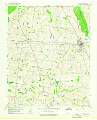
 1964 Yorkville1967 Print · USGSMid-century West Tennessee comes to life here as agricultural communities like Yorkville and Hopewell thrive along the winding North Fork Forked Deer River. Genealogists can trace family footprints across several burial sites and rural steeples, including Flowers Cem, Bethel Cem, and Mt Olive Ch.2 unique versions available
 - 1965 Map of Kenton, 1966 Print
 1965 Kenton1966 Print · USGSThe West Tennessee borderlands of Obion and Gibson counties are captured here in the mid-sixties, centered on the railroad town of Kenton. Local historians can trace old community hubs like Mason Hall, Tyson Store, and family landmarks including Sunny Side Cem.2 unique versions available
 - 1983 Map of Dyersburg
 1983 Dyersburg1983 Print · USGSSpanning the Mississippi River at the start of the 1980s, this area shows the vital river-and-rail connections between Tennessee and Missouri. Researchers can trace family sites at Mount Pisgah Cemetery or study the evolving shoreline near Caruthersville and Reelfoot Lake.
 - 1986 Map of McKenzie
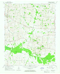
 1986 McKenzie1986 Print · USGSWest Tennessee in the mid-eighties was a landscape defined by its deep river forks and the massive waters of Kentucky Lake. Researchers can trace the rail lines of the Louisville & Nashville RR and find local landmarks from Skullbone to the Paris Landing State Park.3 unique versions available
End of results
Showing maps 1-7 of 7
Top cities near Rutherford
- Martin historical maps
- Trenton historical maps
- Dyer historical maps
- Greenfield historical maps
- Troy historical maps
- Obion historical maps
See more
Frequently asked questions
- What are the different types of historical maps available for Rutherford?
- What is the oldest map of Rutherford?
- Where can I purchase historical maps of Rutherford for my home or office?
- Where can I download high-res historical maps of Rutherford?
- Are there historical topographic maps available for Rutherford?
- Is there historical aerial imagery available for Rutherford?
- Where are historical maps of Rutherford sourced from?