
1953 Map of Dyer
USGS Topo · Published 1955About this map
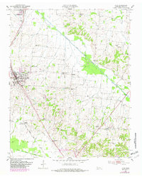
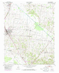
The Gulf Mobile and Ohio railroad corridor anchors this mid-century portrait of Gibson County, connecting the active hubs of Dyer and Rutherford. The landscape is a network of small, rural community centers and family-named landmarks, such as Barrons Corner and Poplar Grove Ch Community Center. The terrain is defined by the broad drainage basin of the Rutherford Fork Obion River and Sand Creek, where the topography transitions from flat bottomlands to the gently rolling hills found near Laneview. For genealogists, the map is remarkably dense with specific local markers, including the Mt Zion Sch and several distinct burial grounds like Bucksnort Cem and Mount Sinai Cem. This survey illustrates the era's agricultural settlement patterns, showing how pocket communities like Good Luck and Georgetown were tied together by winding country roads and the central rail line.
Find a feature on this map
32 named features on this map. Tap any name to fly to it.
Don’t see what you’re looking for? This feature index may not catch every label — zoom into the map to look around manually.
Map Details
Editions of this 1953 Dyer Map
3 editions found
Other maps of this area

1951 · Trenton
USGS Topo · 1:24,000

1952 · Milan
USGS Topo · 1:24,000

1954 · Rutherford
USGS Topo · 1:24,000

1954 · Greenfield
USGS Topo · 1:24,000

1954 · Bradford
USGS Topo · 1:24,000

1956 · Dyersburg
USGS Topo · 1:250,000

1956 · Blytheville
USGS Topo · 1:250,000

1959 · Blytheville
USGS Topo · 1:250,000
1964 · Brazil
USGS Topo · 1:24,000
1964 · Yorkville
USGS Topo · 1:24,000