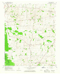
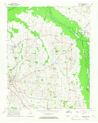
1964 Map of Brazil
USGS Topo · Published 1966About this map
Gibson County and Crockett County farmlands are defined by a dense network of country roads and small community hubs in the mid-1960s. The settlement of Brazil sits at a crossroads near the center of the sheet, surrounded by family-named landmarks and rural institutions like the Poplar Grove Ch and Persimmon Grove Sch. To the south, the Middle Fork Forked Deer River winds through bottomlands, with the Mc Murry Levee providing a glimpse into local water management strategies of the era.
Find a feature on this map
40 named features on this map. Tap any name to fly to it.
Don’t see what you’re looking for? This feature index may not catch every label — zoom into the map to look around manually.
Map Details
Editions of this 1964 Brazil Map
This is the sole edition of this map. No revisions or reprints were ever made.
Other maps of this area

1951 · Trenton
USGS Topo · 1:24,000

1953 · Dyer
USGS Topo · 1:24,000

1956 · Dyersburg
USGS Topo · 1:250,000

1956 · Blytheville
USGS Topo · 1:250,000

1959 · Blytheville
USGS Topo · 1:250,000

1959 · Humboldt
USGS Topo · 1:24,000
1964 · Maury City
USGS Topo · 1:24,000
1964 · Alamo
USGS Topo · 1:24,000
1964 · Yorkville
USGS Topo · 1:24,000
1965 · Friendship
USGS Topo · 1:24,000