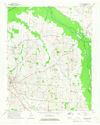
1965 Map of Friendship
USGS Topo · Published 1967About this map
The North Fork Forked Deer River and Middle Fork Forked Deer River define the agrarian landscape of this West Tennessee quadrangle. Between these two major waterways, the Gulf Mobile and Ohio railroad corridor anchors the western edge, serving the community of Tigrett. The settlement pattern is characterized by scattered family-named outposts and rural intersections like Elizabeth, Stokes, and Hodson, connected by a network of local thoroughfares such as Stokes Road and Macklin Store Road.
Find a feature on this map
29 named features on this map. Tap any name to fly to it.
Don’t see what you’re looking for? This feature index may not catch every label — zoom into the map to look around manually.
Map Details
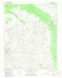
Editions of this 1965 Friendship Map
2 editions found
Other maps of this area

1939 · Dyersburg
USGS Topo · 1:62,500

1939 · Halls
USGS Topo · 1:62,500

1952 · Bonicord
USGS Topo · 1:24,000

1952 · Newbern
USGS Topo · 1:24,000

1952 · Chestnut Bluff
USGS Topo · 1:24,000

1956 · Dyersburg
USGS Topo · 1:250,000

1956 · Blytheville
USGS Topo · 1:250,000

1959 · Blytheville
USGS Topo · 1:250,000

1961 · Halls
USGS Topo · 1:62,500
1961 · Dyersburg
USGS Topo · 1:62,500