1930s Maps of Elm Springs, Tennessee
Explore 2 historic maps of Elm Springs from the 1930s. These maps offer a rare glimpse into what life looked like during the 1930s — showing old roads, neighborhoods, homes, and landmarks that have changed or disappeared over time.
Whether you're researching your family's past, planning a metal detecting trip, or studying how Elm Springs's landscape evolved across the 1930s, these high-resolution maps are a powerful tool for exploring the history of this region.
- Focus on a specific era: All maps on this page are from the 1930s, giving you a focused view of this time period.
- See what’s changed: Compare century-old streets, trails, and buildings to today's modern landscape using overlays and satellite layers.
- Research with precision: Use these maps for genealogy, historical research, land use analysis, or educational projects.
- View, download, or print: Maps are fully viewable online in high resolution, and can be downloaded or printed for your own records.
Start exploring Elm Springs's history through authentic maps from the 1930s. This is your window into the past.
Elm Springs, TN maps
(2)- 1936 Map of Rutledge
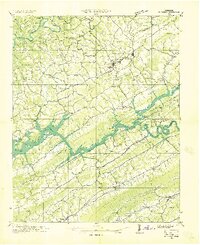 1936 Rutledge1936 Print · USGSClinch River communities faced a major transformation in the mid-1930s as the new reservoir began to fill the valley. You can trace the pre-inundation landscape through landmarks like Beeler Mill, the Straight Creek Mines Sch, and Lone Mountain.
 - 1936 Map of Dutch Valley
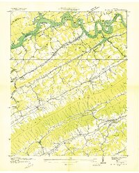 1936 Dutch Valley1936 Print · USGSGrainger County emerges in the mid-1930s as the Tennessee Valley Authority reshapes the landscape with the rising waters of Norris Reservoir. Genealogists and local historians can trace the foundations of Rutledge and Washburn alongside rural landmarks like Beeler Mill and Noe Chapel.
End of results
Showing maps 1-2 of 2
Top cities near Elm Springs
- Morristown historical maps
- Jefferson City historical maps
- Harrogate historical maps
- Maynardville historical maps
- New Tazewell historical maps
- Tazewell historical maps
See more
Frequently asked questions
- What are the different types of historical maps available for Elm Springs?
- What is the oldest map of Elm Springs?
- Where can I purchase historical maps of Elm Springs for my home or office?
- Where can I download high-res historical maps of Elm Springs?
- Are there historical topographic maps available for Elm Springs?
- Is there historical aerial imagery available for Elm Springs?
- Where are historical maps of Elm Springs sourced from?