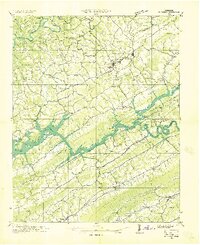
1936 Map of Rutledge
USGS Topo · Published 1936About this map
Norris Reservoir dominates this 1936 landscape, its backwater reaching deep into the Clinch River valley just as the Tennessee Valley Authority was reshaping the region. The map captures a critical transition for communities like Lone Mountain and Liberty Hill, where the rising waters of the reservoir at the 1020-foot elevation mark redefined local geography. Further north, Tazewell and New Tazewell stand as established hubs, connected to the southern reaches of the quadrangle by the Southern Railway.
Find a feature on this map
62 named features on this map. Tap any name to fly to it.
Don’t see what you’re looking for? This feature index may not catch every label — zoom into the map to look around manually.
Map Details
Editions of this 1936 Rutledge Map
This is the sole edition of this map. No revisions or reprints were ever made.
Other maps of this area

1883 · Morristown
USGS Topo · 1:125,000

1886 · Cumberland Gap
USGS Topo · 1:125,000

1887 · Jonesville
USGS Topo · 1:125,000

1888 · Cumberland Gap
USGS Topo · 1:125,000

1891 · Cumberland Gap
USGS Topo · 1:125,000

1891 · Jonesville
USGS Topo · 1:125,000

1893 · Morristown
USGS Topo · 1:125,000

1895 · Morristown
USGS Topo · 1:125,000

1897 · Maynardville
USGS Topo · 1:125,000

1900 · Maynardville
USGS Topo · 1:125,000