2000s (21st Century) Maps of Pleasant Hill, Tennessee
Explore 6 historic maps of Pleasant Hill from the 2000s (21st Century). These maps offer a rare glimpse into what life looked like during the 2000s — showing old roads, neighborhoods, homes, and landmarks that have changed or disappeared over time.
Whether you're researching your family's past, planning a metal detecting trip, or studying how Pleasant Hill's landscape evolved across the 2000s, these high-resolution maps are a powerful tool for exploring the history of this region.
- Focus on a specific era: All maps on this page are from the 2000s, giving you a focused view of this time period.
- See what’s changed: Compare century-old streets, trails, and buildings to today's modern landscape using overlays and satellite layers.
- Research with precision: Use these maps for genealogy, historical research, land use analysis, or educational projects.
- View, download, or print: Maps are fully viewable online in high resolution, and can be downloaded or printed for your own records.
Start exploring Pleasant Hill's history through authentic maps from the 2000s. This is your window into the past.
Pleasant Hill, TN maps
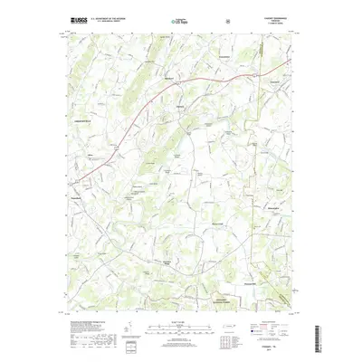
(6)- 2003 Map of Chuckey, 2004 Print
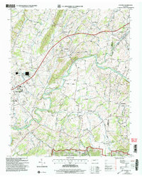 2003 Chuckey2004 Print · USGSEastern Tennessee at the turn of the millennium shows a landscape defined by the NOLICHUCKY RIVER and the NORFOLK SOUTHERN line. Trace local history through Rheatown, Dotsontown, and family-named landmarks like Jordan Knob.
 - 2011 Map of Chuckey, 2011 Print
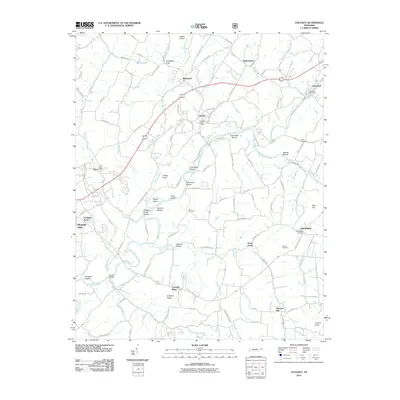 2011 Chuckey2011 Print · USGSCovers Pleasant Hill, including Greeneville, Tusculum, and other nearby areas
 - 2013 Map of Chuckey, 2013 Print
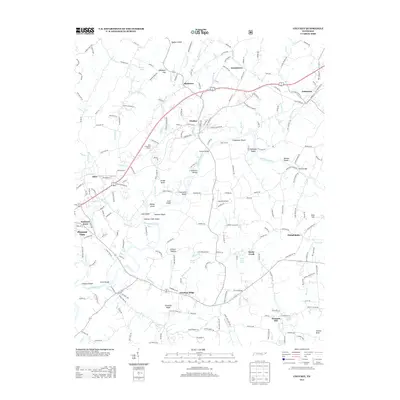 2013 Chuckey2013 Print · USGSCovers Pleasant Hill, including Greeneville, Tusculum, and other nearby areas
 - 2016 Map of Chuckey, 2016 Print
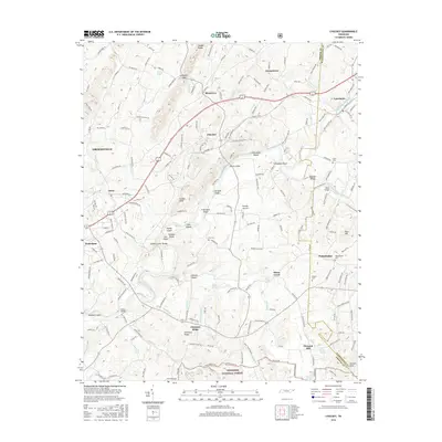 2016 Chuckey2016 Print · USGSCovers Pleasant Hill, including Greeneville, Tusculum, and other nearby areas
 - 2019 Map of Chuckey, 2019 Print
 2019 Chuckey2019 Print · USGSCovers Pleasant Hill, including Greeneville, Tusculum, and other nearby areas
 - 2022 Map of Chuckey, 2022 Print
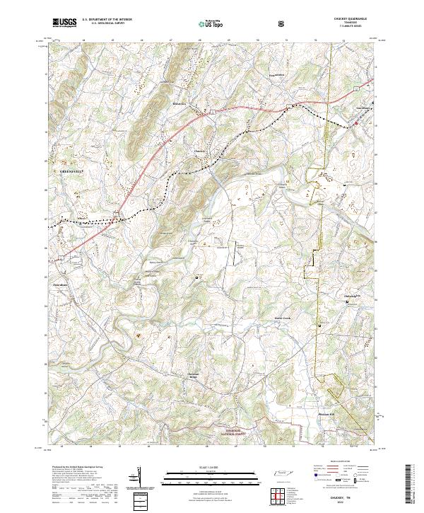 2022 Chuckey2022 Print · USGSThe Nolichucky River valley in East Tennessee remains a patchwork of historic settlements and river shoals in the early twenty-first century. Genealogists and local researchers can trace family landmarks and rural routes, including Philadelphia Cem, Hensley Airpark, and the rolling terrain of Quaker Knobs.
End of results
Showing maps 1-6 of 6
Top cities near Pleasant Hill
- Johnson City historical maps
- Greeneville historical maps
- Erwin historical maps
- Jonesborough historical maps
- Tusculum historical maps
- Hot Springs historical maps
See more
Frequently asked questions
- What are the different types of historical maps available for Pleasant Hill?
- What is the oldest map of Pleasant Hill?
- Where can I purchase historical maps of Pleasant Hill for my home or office?
- Where can I download high-res historical maps of Pleasant Hill?
- Are there historical topographic maps available for Pleasant Hill?
- Is there historical aerial imagery available for Pleasant Hill?
- Where are historical maps of Pleasant Hill sourced from?