1970s Maps of Middle Valley Estates, Tennessee
Explore 2 historic maps of Middle Valley Estates from the 1970s. These maps offer a rare glimpse into what life looked like during the 1970s — showing old roads, neighborhoods, homes, and landmarks that have changed or disappeared over time.
Whether you're researching your family's past, planning a metal detecting trip, or studying how Middle Valley Estates's landscape evolved across the 1970s, these high-resolution maps are a powerful tool for exploring the history of this region.
- Focus on a specific era: All maps on this page are from the 1970s, giving you a focused view of this time period.
- See what’s changed: Compare century-old streets, trails, and buildings to today's modern landscape using overlays and satellite layers.
- Research with precision: Use these maps for genealogy, historical research, land use analysis, or educational projects.
- View, download, or print: Maps are fully viewable online in high resolution, and can be downloaded or printed for your own records.
Start exploring Middle Valley Estates's history through authentic maps from the 1970s. This is your window into the past.
Middle Valley Estates, TN maps
(2)- 1976 Map of Daisy, 1977 Print
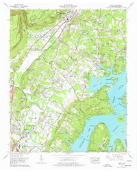 1976 Daisy1977 Print · USGSHamilton County experienced rapid suburban growth in the mid-seventies as new subdivisions spread toward the banks of Chickamauga Lake. Genealogists and historians can trace family landmarks like Harris Cem and Jackson Chapel Cem or locate industrial sites like Greens Mill.2 unique versions available
 - 1979 Map of Chattanooga, 1980 Print
 1979 Chattanooga1980 Print · USGSSoutheast Tennessee in the late seventies reveals a landscape shaped by massive TVA river projects and the industrial strength of the Cumberland Plateau. Genealogists and historians can trace the rail-to-river network through L & N RR junctions, the University of the South, and the Volunteer Army Ammunition Plant.
End of results
Showing maps 1-2 of 2
Top cities near Middle Valley Estates
- Chattanooga historical maps
- East Ridge historical maps
- East Ridge historical maps
- Soddy-Daisy historical maps
- Fort Oglethorpe historical maps
- Collegedale historical maps
See more
Frequently asked questions
- What are the different types of historical maps available for Middle Valley Estates?
- What is the oldest map of Middle Valley Estates?
- Where can I purchase historical maps of Middle Valley Estates for my home or office?
- Where can I download high-res historical maps of Middle Valley Estates?
- Are there historical topographic maps available for Middle Valley Estates?
- Is there historical aerial imagery available for Middle Valley Estates?
- Where are historical maps of Middle Valley Estates sourced from?