Old Maps of Ooltewah, Tennessee for Genealogy
Trace your family roots with 27 historic maps of Ooltewah. These high-res maps reveal old neighborhoods, homesites, landmarks, and streets — helping you uncover where your ancestors lived and how the area evolved over time.
- Explore historic neighborhoods: Identify where your relatives may have lived in the 1800s or 1900s.
- Compare maps over time: Trace the changes in streets, buildings, and landmarks for multi-generational research.
- Perfect for genealogy & ancestry research: Used by family historians and researchers to map out lineage and migration.
These maps are an incredible resource for exploring your personal connection to Ooltewah's past.
Ooltewah, TN maps
(27)- 1888 Map of Chattanooga
 1888 Chattanooga1888 Print · USGSSoutheast Tennessee in the late nineteenth century was a landscape of river ferries and mountain mining. Trace family roots and vanished landmarks near Chattanooga, from the Aetna Mines to historic river crossings like Harrison Ferry.
 - 1893 Map of Chattanooga
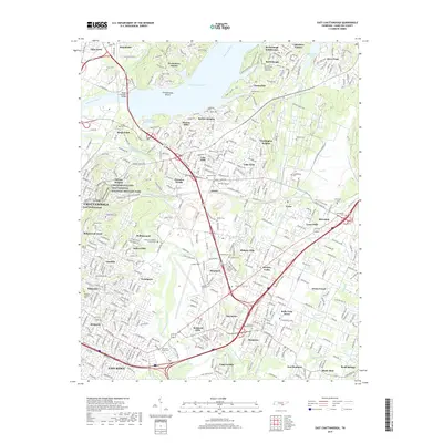
 1893 Chattanooga1893 Print · USGSSoutheast Tennessee is shown here in the 1890s, when river ferries and coal mines defined the landscape around the booming hub of Chattanooga. Genealogists and researchers can trace family lands near Eldridge Landing, the Mc Nabb Mines, or old settlements like Ooltewah.9 unique versions available
 - 1935 Map of East Chattanooga
 1935 East Chattanooga1935 Print · USGSHamilton County is captured during the mid-1930s as the Tennessee Valley Authority begins its massive hydroelectric projects. Researchers can locate family landmarks like Bartlebaugh Cem, the Silverdale community, and the construction site of the Chickamauga Dam.
 - 1935 Map of Ooltewah
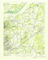
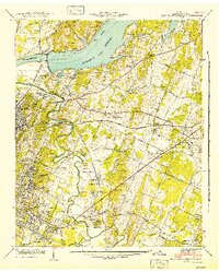
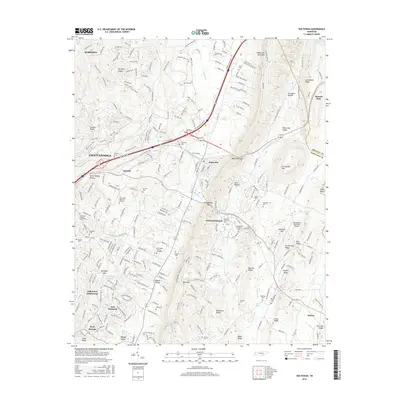
 1935 Ooltewah1935 Print · USGSHamilton County's ridge-and-valley landscape is documented here in the mid-1930s as rural life centered on the rail lines and mountain gaps. Genealogists and historians can trace family roots at Ooltewah Cem, locate the early campus of Southern Junior College, or find the old Rogers Mill.
 - 1940 Map of Ooltewah, 1954 Print
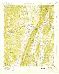
 1940 Ooltewah1954 Print · USGSSoutheast Tennessee is captured here just before the mid-century as a landscape of ridge-and-valley farming and emerging education. Genealogists can trace family names at Sylar Cem and Pollard Cem or locate the early campus of Southern Junior College.
 - 1941 Map of Ooltewah
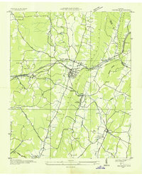
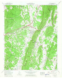
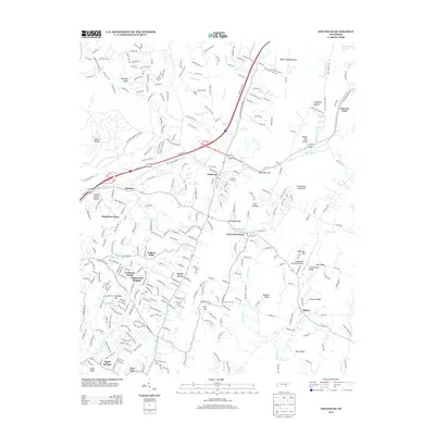
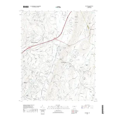
 1941 Ooltewah1941 Print · USGSThe valleys and ridges of Hamilton and Bradley counties are shown here just before the mid-century industrial boom. Genealogists can locate family names and sites like Bell Mill, Mineral Park Chapel, and the campus of Southern Junior College.
 - 1942 Map of East Chattanooga
 1942 East Chattanooga1942 Print · USGSHamilton County's river landscape underwent massive changes during the early Forties as the Tennessee Valley Authority completed the Chickamauga Dam. Genealogists can trace family roots through the Silverdale Confederate Cem, Brainerd Cem, and numerous rural schools like Jersey Sch.2 unique versions available
 - 1953 Map of Chattanooga
 1953 Chattanooga1953 Print · USGSSoutheast Tennessee in the early fifties shows a landscape reshaped by river management and rail power. Trace the rail lines of the Southern Ry through riverside towns or locate the preserved grounds of the Chickamauga and Chattanooga National Military Park.
 - 1957 Map of Chattanooga, 1966 Print
 1957 Chattanooga1966 Print · USGSEast Tennessee in the mid-1960s shows a landscape of massive hydroelectric reservoirs and emerging industrial sites like the Atomic Energy Commission (Oak Ridge Area). Trace the rail networks of the Southern Ry through Chattanooga or locate family-named ridges across the Cumberland Plateau.3 unique versions available
 - 1958 Map of East Chattanooga, 1959 Print
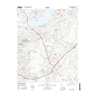
 1958 East Chattanooga1959 Print · USGSEast Chattanooga and its surrounding ridges were undergoing a period of rapid suburban and industrial expansion in the late fifties. Genealogists and historians can trace family burial sites like Varnell Cem or locate early institutions such as Bonny Oaks Sch and the William L Bork Memorial Hospital.2 unique versions available
 - 1959 Map of Chattanooga
 1959 Chattanooga1959 Print · USGSSoutheast Tennessee is shown here during a decade of industrial growth and hydroelectric development. Trace the regional rail networks of the Southern Ry and find landmark sites like Lookout Mountain, Fall Creek Falls State Park, and Chattanooga.
 - 1960 Map of Chattanooga
 1960 Chattanooga1960 Print · USGSSoutheast Tennessee and the southern Appalachians are shown here at the height of the river-management era. You can trace the valley rail lines and locate Lookout Mountain and the expansive waters of Chickamauga Reservoir.
 - 1964 Map of Chattanooga
 1964 Chattanooga1964 Print · USGSSoutheast Tennessee and the western Carolinas appear in the mid-sixties as a powerhouse of river-driven industry and mountain wilderness. Genealogists and historians can trace rail-town lineages along the Southern Ry or locate family landmarks near Watts Bar Lake and Tellico Plains.
 - 1964 Map of Ooltewah, 1966 Print
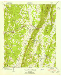
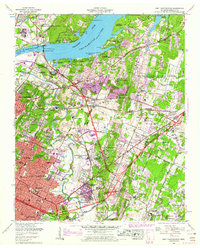
 1964 Ooltewah1966 Print · USGSHamilton County in the mid-sixties reveals a landscape balancing its military history with growing educational and rail hubs. Researchers can trace family-named cemeteries such as Sylar Cemetery and Plowman Cemetery or locate landmarks like Bell Mill and the Southern Missionary College.4 unique versions available
 - 1969 Map of East Chattanooga, 1970 Print
 1969 East Chattanooga1970 Print · USGSHamilton County enters a period of post-war suburban and industrial growth as the Chattanooga city limits expand toward the Tennessee River. Genealogists and historians can trace family locations near Stubblefield Cem, Bonny Oaks Sch, and the Volunteer Army Ammunition Plant.5 unique versions available
 - 1979 Map of Chattanooga, 1980 Print
 1979 Chattanooga1980 Print · USGSSoutheast Tennessee in the late seventies reveals a landscape shaped by massive TVA river projects and the industrial strength of the Cumberland Plateau. Genealogists and historians can trace the rail-to-river network through L & N RR junctions, the University of the South, and the Volunteer Army Ammunition Plant.
 - 1988 Map of Chattanooga, 1991 Print
 1988 Chattanooga1991 Print · USGSSoutheast Tennessee at the end of the 1980s reveals a complex landscape of deep river valleys and high coal-rich plateaus. Researchers can trace the legacy of the L & N RR through Tracy City or locate the sprawling Strip Mines near Whitwell.
 - 2010 Map of Ooltewah, 2010 Print
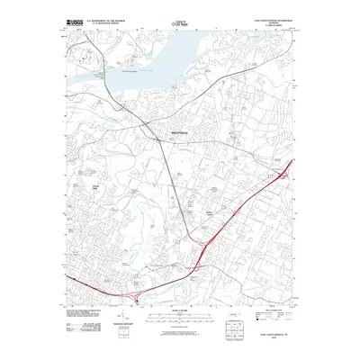
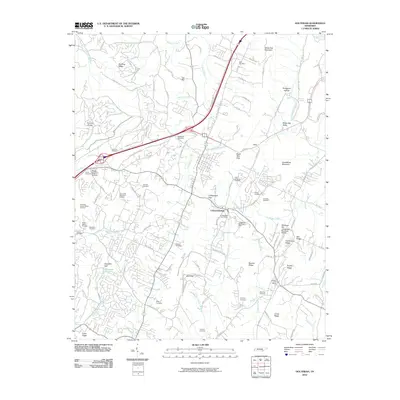 2010 Ooltewah2010 Print · USGSCovers Ooltewah, including Chattanooga, Collegedale, and other nearby areas
 - 2010 Map of East Chattanooga, 2010 Print
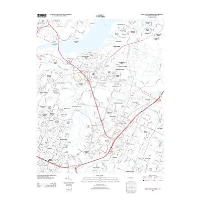
 2010 East Chattanooga2010 Print · USGSCovers Ooltewah, including Chattanooga, East Ridge, and other nearby areas
 - 2013 Map of Ooltewah, 2013 Print
 2013 Ooltewah2013 Print · USGSCovers Ooltewah, including Chattanooga, Collegedale, and other nearby areas
 - 2013 Map of East Chattanooga, 2013 Print
 2013 East Chattanooga2013 Print · USGSCovers Ooltewah, including Chattanooga, East Ridge, and other nearby areas
 - 2016 Map of East Chattanooga, 2016 Print
 2016 East Chattanooga2016 Print · USGSCovers Ooltewah, including Chattanooga, East Ridge, and other nearby areas
 - 2016 Map of Ooltewah, 2016 Print
 2016 Ooltewah2016 Print · USGSCovers Ooltewah, including Chattanooga, Collegedale, and other nearby areas
 - 2019 Map of East Chattanooga, 2019 Print
 2019 East Chattanooga2019 Print · USGSCovers Ooltewah, including Chattanooga, East Ridge, and other nearby areas
 - 2019 Map of Ooltewah, 2019 Print
 2019 Ooltewah2019 Print · USGSCovers Ooltewah, including Chattanooga, Collegedale, and other nearby areas
Showing maps 1-25 of 27
Top cities near Ooltewah
- Chattanooga historical maps
- Cleveland historical maps
- East Ridge historical maps
- East Ridge historical maps
- Soddy-Daisy historical maps
- Fort Oglethorpe historical maps
See more
Top neighborhoods of Ooltewah
Frequently asked questions
- What are the different types of historical maps available for Ooltewah?
- What is the oldest map of Ooltewah?
- Where can I purchase historical maps of Ooltewah for my home or office?
- Where can I download high-res historical maps of Ooltewah?
- Are there historical topographic maps available for Ooltewah?
- Is there historical aerial imagery available for Ooltewah?
- Where are historical maps of Ooltewah sourced from?