2020s Maps of Bolivar, Tennessee
Explore 4 historic maps of Bolivar from the 2020s. These maps offer a rare glimpse into what life looked like during the 2020s — showing old roads, neighborhoods, homes, and landmarks that have changed or disappeared over time.
Whether you're researching your family's past, planning a metal detecting trip, or studying how Bolivar's landscape evolved across the 2020s, these high-resolution maps are a powerful tool for exploring the history of this region.
- Focus on a specific era: All maps on this page are from the 2020s, giving you a focused view of this time period.
- See what’s changed: Compare century-old streets, trails, and buildings to today's modern landscape using overlays and satellite layers.
- Research with precision: Use these maps for genealogy, historical research, land use analysis, or educational projects.
- View, download, or print: Maps are fully viewable online in high resolution, and can be downloaded or printed for your own records.
Start exploring Bolivar's history through authentic maps from the 2020s. This is your window into the past.
Bolivar, TN maps
(4)- 2022 Map of Middleburg, 2022 Print
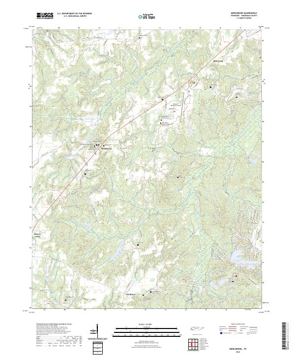 2022 Middleburg2022 Print · USGSHardeman County settlements like Middleburg and Van Buren are documented here in the early twenty-first century. Family history researchers can trace local roots through numerous sites including Spring Hill Cem, Clifft Cem, and Mount Zion Cem.
 - 2022 Map of Bolivar West, 2022 Print
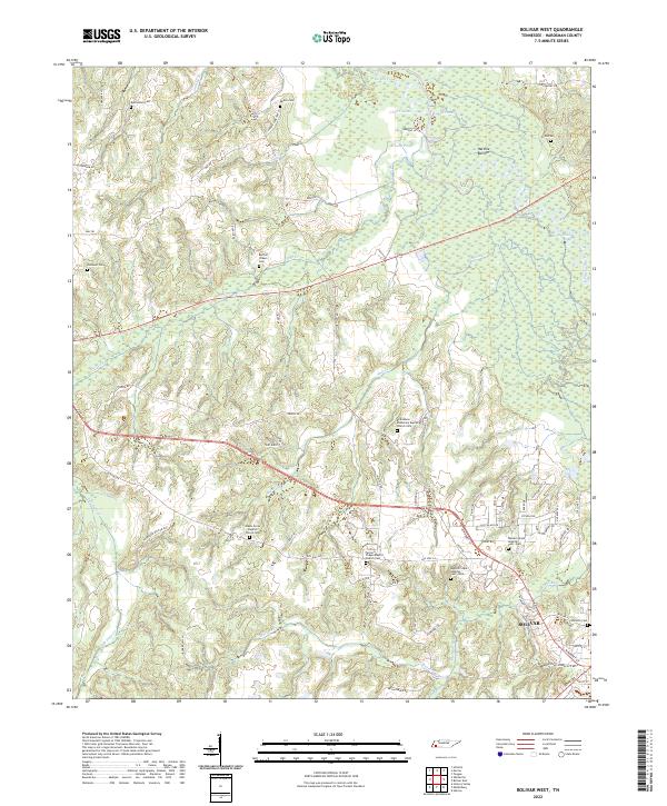 2022 Bolivar West2022 Print · USGSThe rural landscape west of Bolivar is captured here in the early 2020s, showing a region defined by the Hatchie River and its extensive bottoms. Family researchers can locate numerous historic sites, including Pirtle Cem, Norment Cem, and the Green Grove Baptist Church.
 - 2022 Map of Hebron, 2022 Print
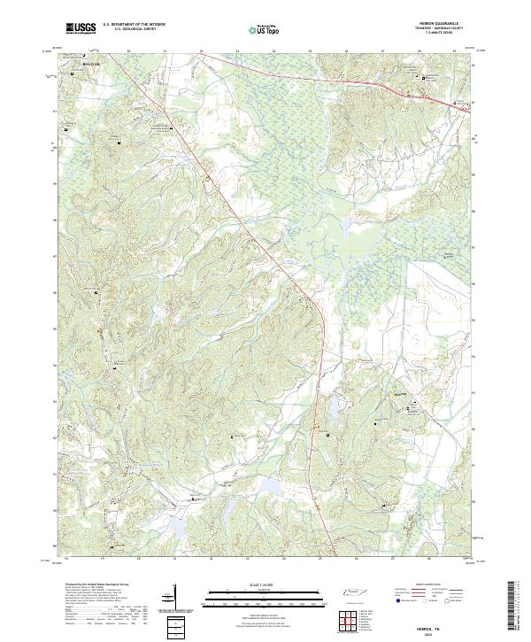 2022 Hebron2022 Print · USGSHardeman County's rural landscape is mapped here in the early 2020s, defined by the winding Hatchie River and its vast bottomlands. Genealogists can locate numerous family-named landmarks including Hazelgrove Cem, Sasser Cem, and the community of Hebron.
 - 2022 Map of Bolivar East, 2022 Print
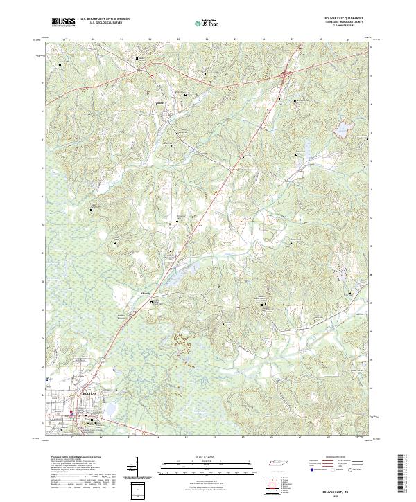 2022 Bolivar East2022 Print · USGSThe Hatchie River floodplain and the community of Bolivar are captured in this recent survey of Hardeman County. Researchers can trace family history through dozens of landmarks like Parker Hill Cem, Toone, and the Hardeman County Courthouse.
End of results
Showing maps 1-4 of 4
Top cities near Bolivar
- Whiteville historical maps
- Middleton historical maps
- Toone historical maps
- Hornsby historical maps
- Medon historical maps
- La Grange historical maps
See more
Top neighborhoods of Bolivar
Frequently asked questions
- What are the different types of historical maps available for Bolivar?
- What is the oldest map of Bolivar?
- Where can I purchase historical maps of Bolivar for my home or office?
- Where can I download high-res historical maps of Bolivar?
- Are there historical topographic maps available for Bolivar?
- Is there historical aerial imagery available for Bolivar?
- Where are historical maps of Bolivar sourced from?