2020s Maps of Houston County, Tennessee
Explore 8 historic maps of Houston County from the 2020s. These maps offer a rare glimpse into what life looked like during the 2020s — showing old roads, neighborhoods, homes, and landmarks that have changed or disappeared over time.
Whether you're researching your family's past, planning a metal detecting trip, or studying how Houston County's landscape evolved across the 2020s, these high-resolution maps are a powerful tool for exploring the history of this region.
- Focus on a specific era: All maps on this page are from the 2020s, giving you a focused view of this time period.
- See what’s changed: Compare century-old streets, trails, and buildings to today's modern landscape using overlays and satellite layers.
- Research with precision: Use these maps for genealogy, historical research, land use analysis, or educational projects.
- View, download, or print: Maps are fully viewable online in high resolution, and can be downloaded or printed for your own records.
Start exploring Houston County's history through authentic maps from the 2020s. This is your window into the past.
Houston County, TN maps
(8)- 2022 Map of Ellis Mills, 2022 Print
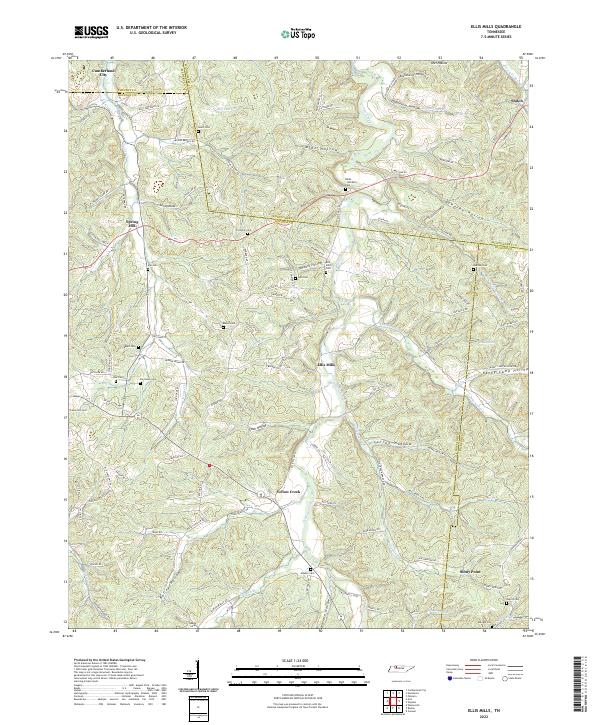 2022 Ellis Mills2022 Print · USGSThe rural borderlands where Houston, Montgomery, and Dickson counties meet are captured here in the early twenty-first century. Researchers can trace numerous family burial sites such as Bibbs - Wimberly Cem and Lyle Cem tucked away near Ellis Mills.
 - 2022 Map of Erin, 2022 Print
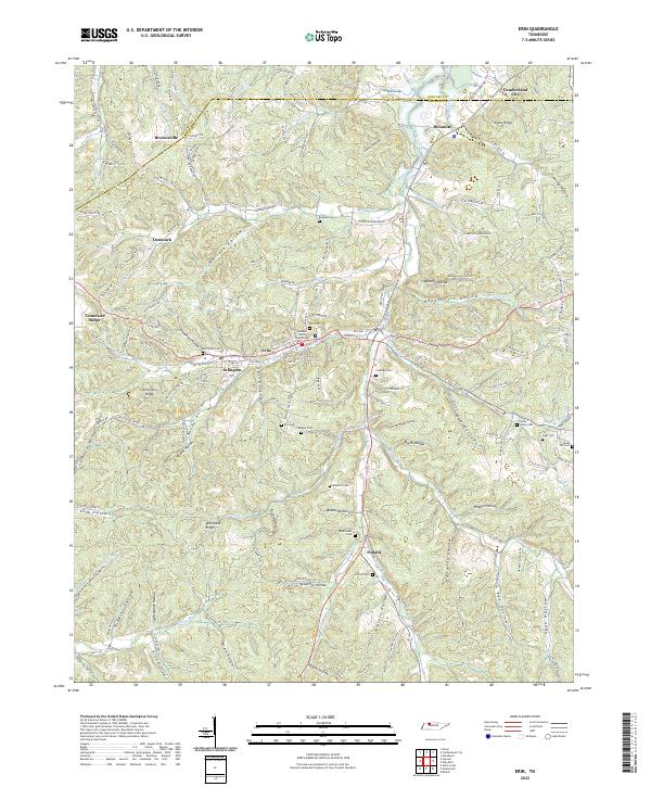 2022 Erin2022 Print · USGSThe steep valleys of Houston County are captured here in the early twenty-first century, centered on the community of Erin. Researchers can locate family landmarks like Alsobrooks Cem, Bratschi Cem, and the Houston County Courthouse.
 - 2022 Map of Halls Creek, 2022 Print
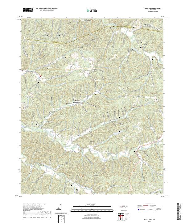 2022 Halls Creek2022 Print · USGSAlong the Houston and Humphreys county line during the early twenty-first century, this landscape remains defined by its deep hollows and family homesteads. Genealogists can trace local roots at McKeel Cem, Knight Cem, and the settlement of Trinity.
 - 2022 Map of Ruskin, 2022 Print
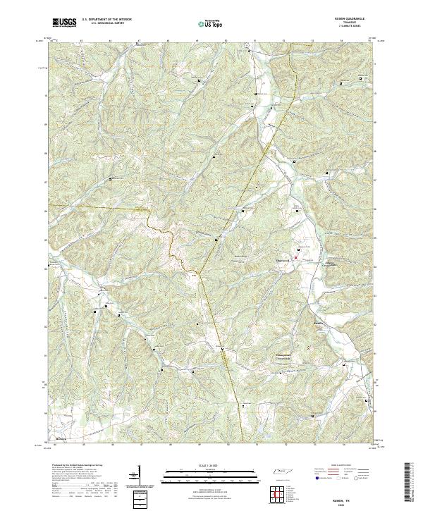 2022 Ruskin2022 Print · USGSThe tri-county border of Houston, Humphreys, and Dickson counties comes to life in this detailed topographic study of Tennessee's hollows. Genealogists can trace family roots through numerous burial sites like Coleman Brown Cem and Adams - Nesbitt Cem or locate old community hubs at Ruskin and Edgewood.
 - 2022 Map of Stewart, 2022 Print
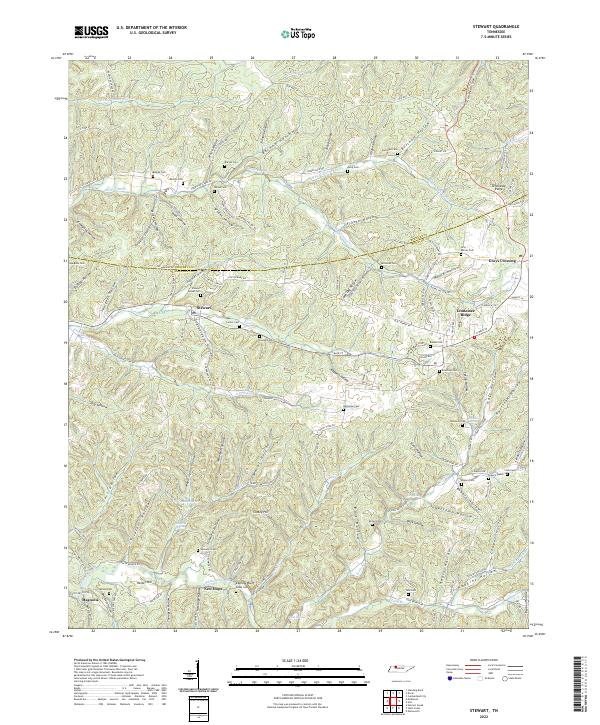 2022 Stewart2022 Print · USGSThe Stewart and Houston County line comes alive in this contemporary record of Tennessee’s hollows and ridges. Researchers can trace family origins through numerous burial sites like Barnes Cem and Beecham Cem or locate old community nodes at Grays Crossing and Stewart.
 - 2022 Map of Woolworth, 2022 Print
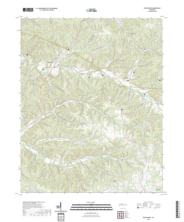 2022 Woolworth2022 Print · USGSThe Tennessee hill country near the Houston and Humphreys county line is revealed here through its intricate system of hollows and family homesteads. Researchers can locate numerous family burial grounds like Sinks Cem and Batson Cem or trace the early paths of Woolworth Road and the high ground of Tennessee Ridge.
 - 2022 Map of Harmon Creek, 2022 Print
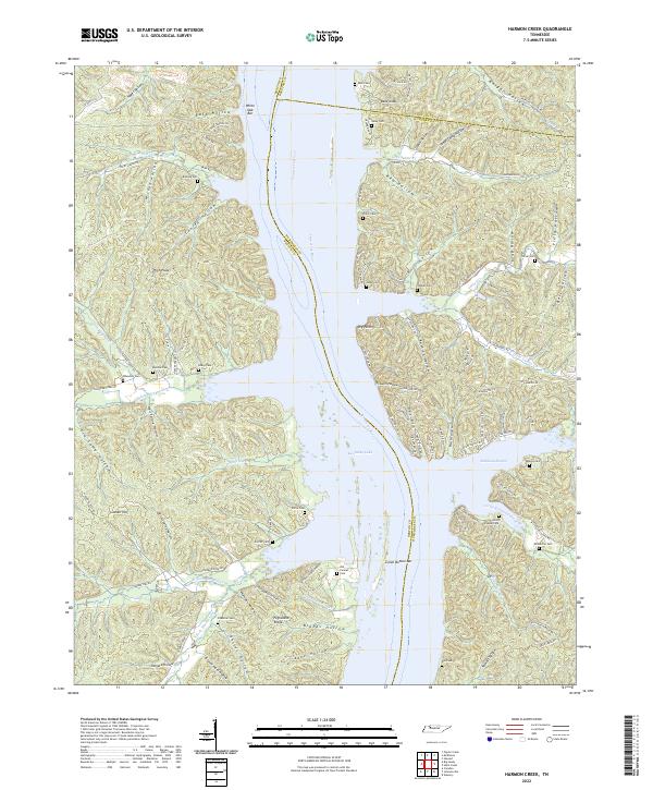 2022 Harmon Creek2022 Print · USGSBenton and Humphreys counties meet along the Tennessee River in this modern survey of Kentucky Lake’s eastern and western shores. Genealogists can trace decades of local history through family burial sites like Si Melton Cem, McMurtrie Cem, and the Union Chapel Cem near Richland Harbor.
 - 2022 Map of McKinnon, 2022 Print
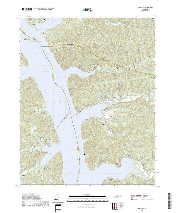 2022 McKinnon2022 Print · USGSThe Tennessee River and Kentucky Lake shoreline are captured here in the early 2020s, revealing a landscape of deep hollows and active ferry crossings. Researchers can trace family names at Martin Cem and Askew Cem or locate the historic crossing at Houston-Benton Ferry.
End of results
Showing maps 1-8 of 8
Top cities of Houston County
Frequently asked questions
- What are the different types of historical maps available for Houston County?
- What is the oldest map of Houston County?
- Where can I purchase historical maps of Houston County for my home or office?
- Where can I download high-res historical maps of Houston County?
- Are there historical topographic maps available for Houston County?
- Is there historical aerial imagery available for Houston County?
- Where are historical maps of Houston County sourced from?