Old Maps of Houston County, Tennessee for Genealogy
Trace your family roots with 59 historic maps of Houston County. These high-res maps reveal old neighborhoods, homesites, landmarks, and streets — helping you uncover where your ancestors lived and how the area evolved over time.
- Explore historic neighborhoods: Identify where your relatives may have lived in the 1800s or 1900s.
- Compare maps over time: Trace the changes in streets, buildings, and landmarks for multi-generational research.
- Perfect for genealogy & ancestry research: Used by family historians and researchers to map out lineage and migration.
These maps are an incredible resource for exploring your personal connection to Houston County's past.
Houston County, TN maps
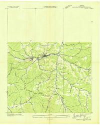
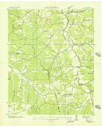
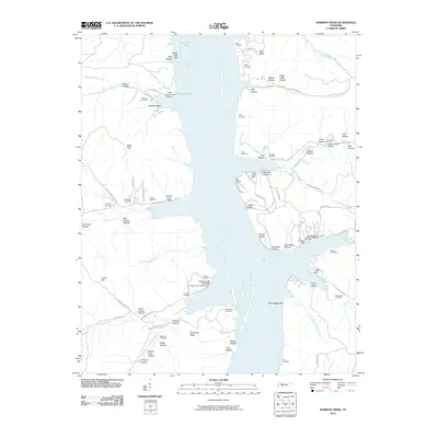
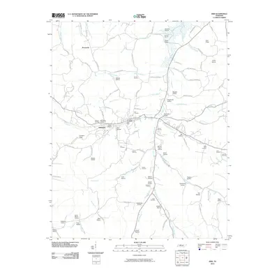
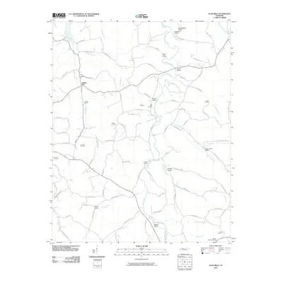
(59)- 1931 Map of Erin
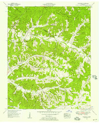
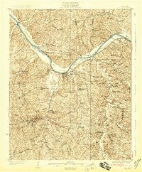 1931 Erin1931 Print · USGSThe Cumberland River corridor and the railroad hub of Erin define this landscape in the late 1920s. Genealogists can trace family footprints through dozens of rural schools and churches, from Blooming Grove Ch to the remote Cave Orchard Sch.
 - 1936 Map of Tantrough Hollow
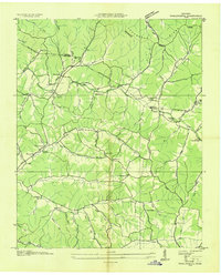
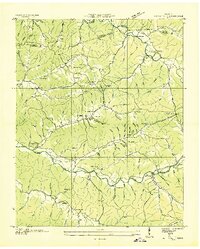
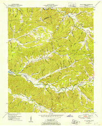
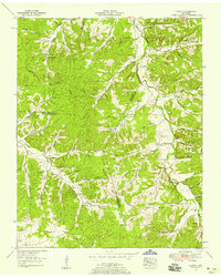
 1936 Tantrough Hollow1936 Print · USGSHouston County at the height of the mid-1930s reveals a landscape of limestone industry and ridge-top settlements. Genealogists can trace family names across Lockhart Cem, locate the Cedar Valley Ch, or find vanished school sites like Bateman Sch.
 - 1936 Map of McKinnon
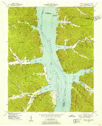
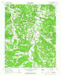
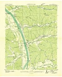 1936 McKinnon1936 Print · USGSThe Tennessee River valley in the 1930s is revealed as a bustling hub of river landings and rail traffic before the landscape was transformed. Researchers can trace the river economy through the Danville Ferry, community ties at Griffin Ch, and the local rail stop at McKinnon.
 - 1936 Map of Woolworth
 1936 Woolworth1936 Print · USGSThe borderlands of Humphreys and Houston counties are captured here in the mid-1930s as the Tennessee Valley Authority began its regional surveys. Researchers can trace rural life through numerous local landmarks, such as Woolworth Sch, Curtis Chapel, and Batson Cem.
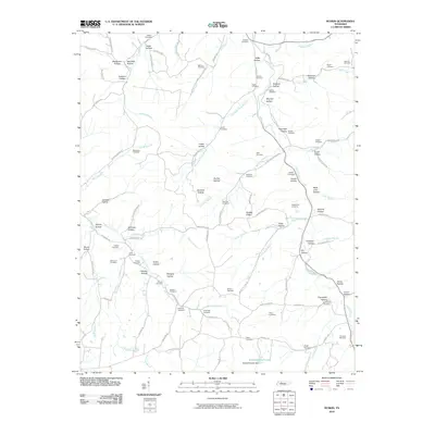
 - 1936 Map of Ruskin
 1936 Ruskin1936 Print · USGSMid-Tennessee's highland rim is captured here in the mid-1930s, showing the intersection of Dickson, Houston, and Humphreys counties. Local researchers can trace family lands near Cave Ruskin, find old rural schoolhouses like Olivet Sch, and locate family burial grounds including Dotson Cem.
 - 1936 Map of Stewart
 1936 Stewart1936 Print · USGSIn the mid-1930s, the rural border of Houston and Stewart counties was defined by the Louisville and Nashville rail line. Genealogists can trace family names through Stewart Cem, Crossroads Ch, and river crossings like Crosswell Ford.
 - 1936 Map of Halls Creek
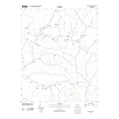
 1936 Halls Creek1936 Print · USGSHumphreys and Houston Counties are mapped here in the mid-1930s as the Tennessee Valley Authority began its regional surveys. Researchers can trace ancestral farmsteads and rural landmarks near Belleview, Trinity, and the Collins Ford water crossing.
 - 1936 Map of Harmon Creek
 1936 Harmon Creek1936 Print · USGSBenton and Humphreys counties are captured here in the mid-1930s, documenting the riverfront landings and valley farms along the Tennessee River. Genealogists can locate family-named landmarks like the Phifer Place, Carter Cem, and the Harmon Creek Sch.
 - 1949 Map of Harmon Creek, 1953 Print
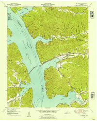
 1949 Harmon Creek1953 Print · USGSThe Tennessee River valley at the junction of Benton and Humphreys counties is shown here shortly after the reservoir's formation. Researchers can locate numerous family burial sites and rural centers like Harmon Creek Church, St John School, and Melton Cem.3 unique versions available
 - 1950 Map of Halls Creek, 1953 Print
 1950 Halls Creek1953 Print · USGSHumphreys and Houston Counties appear here in the early fifties, showing a rural landscape shaped by the new waters of Kentucky Lake. Genealogists can trace family landmarks and schools like Elizabeth Sch or find ancestral sites at Beecham Cem and Shiloh Cem.3 unique versions available
 - 1950 Map of Stewart, 1953 Print
 1950 Stewart1953 Print · USGSThe Tennessee and Kentucky borderlands come alive in this mid-century portrait of the ridge-and-hollow country before modern expansion. Researchers can trace the Louisville and Nashville rail line through old Stewart and locate family burial grounds like McIntosh Cem or the Abandoned limekiln.3 unique versions available
 - 1950 Map of Mc Kinnon, 1954 Print
 1950 Mc Kinnon1954 Print · USGSThe Tennessee River valley is shown shortly after the creation of Kentucky Lake, when the rising waters reshaped local life. Genealogists and historians can trace numerous family burial sites like Wynns Cem and rail-era landmarks such as the Louisville and Nashville line and McKinnon.3 unique versions available
 - 1952 Map of Woolworth, 1957 Print
 1952 Woolworth1957 Print · USGSThe rural Tennessee backcountry along the Houston and Humphreys County line is captured here in the early fifties. Genealogists and researchers can trace family roots through numerous landmarks like Batson Cem, Mt Olivet Hill Sch, and Woolworth.3 unique versions available
 - 1953 Map of Ruskin, 1958 Print
 1953 Ruskin1958 Print · USGSThe rural borders of Dickson, Houston, and Humphreys counties are captured here in the early fifties, showing a landscape defined by deep hollows and high ridges. Family researchers can locate dozens of remote burial sites like Dotson Cem and Yates Cem, alongside crossroads communities like Ruskin and Thompsons Crossroads.3 unique versions available
 - 1956 Map of Nashville, 1971 Print
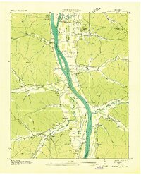
 1956 Nashville1971 Print · USGSThe Tennessee-Kentucky borderlands come into focus in the mid-1960s as major reservoir projects transformed the Cumberland and Tennessee river valleys. Researchers can trace the rail networks of the Louisville and Nashville and visit sites like Fort Campbell and Fort Donelson National Military Park.2 unique versions available
 - 1959 Map of Nashville
 1959 Nashville1959 Print · USGSMiddle Tennessee and Southern Kentucky come into focus during the late fifties, showing the region's transition into a modern transportation and military hub. Researchers can trace the sprawling Fort Campbell Military Reservation or locate historic rail stops along the Tennessee Central Ry and Illinois Central RR.
 - 1965 Map of Erin, 1966 Print
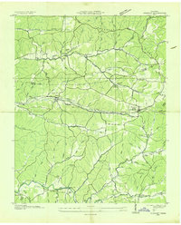
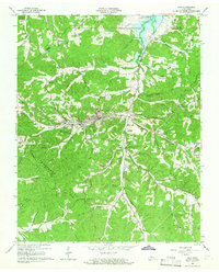 1965 Erin1966 Print · USGSThe Houston County seat of Erin and the surrounding Tennessee hills are shown here in the mid-sixties as Lake Barkley took its final shape. Genealogists and local historians can trace family roots through landmarks like Mt Sinai Ch, Secret Prayer Ch, and the rural community of Haggieville.3 unique versions available
 - 1965 Map of Ellis Mills, 1966 Print
 1965 Ellis Mills1966 Print · USGSHouston and Montgomery counties come together in the mid-1960s among the hollows and creek valleys feeding into the Cumberland River. Researchers can trace rural lineages through sites like Griffin Chapel, Ellis Mills, and the Cedar Hill Cem.3 unique versions available
 - 1985 Map of Dickson
 1985 Dickson1985 Print · USGSMid-Tennessee in the mid-1980s was defined by the intersection of the Cumberland and Tennessee rivers and a massive network of wildlife refuges. Researchers can trace the Seaboard System rail lines connecting Waverly, Dickson, and White Bluff, or locate old landmarks near Fort Donelson National Military Park.
 - 2010 Map of Harmon Creek, 2010 Print
 2010 Harmon Creek2010 Print · USGSCovers Houston County, including Camden, Whiteoak Creek Subdivision, and other nearby areas
 - 2010 Map of Stewart, 2010 Print
 2010 Stewart2010 Print · USGSCovers Houston County, including Cross Roads, Stewart, and other nearby areas
 - 2010 Map of Ruskin, 2010 Print
 2010 Ruskin2010 Print · USGSCovers Houston County, including Spring Valley, Thompsons Crossroads, and other nearby areas
 - 2010 Map of Erin, 2010 Print
 2010 Erin2010 Print · USGSCovers Houston County, including Erin, Cumberland City, and other nearby areas
 - 2010 Map of Woolworth, 2010 Print
 2010 Woolworth2010 Print · USGSCovers Houston County, including Silvertop, Woolworth, and other nearby areas
 - 2010 Map of Ellis Mills, 2010 Print
 2010 Ellis Mills2010 Print · USGSCovers Houston County, including Cumberland City, Ellis Mills, and other nearby areas
Showing maps 1-25 of 59
Top cities of Houston County
Frequently asked questions
- What are the different types of historical maps available for Houston County?
- What is the oldest map of Houston County?
- Where can I purchase historical maps of Houston County for my home or office?
- Where can I download high-res historical maps of Houston County?
- Are there historical topographic maps available for Houston County?
- Is there historical aerial imagery available for Houston County?
- Where are historical maps of Houston County sourced from?