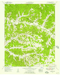
1952 Map of Woolworth
USGS Topo · Published 1957About this map
Woolworth and Silvertop anchor this mid-century survey of the Tennessee hills, where the landscape is defined by an intricate network of hollows and ridges. The border between Houston and Humphreys Counties cuts through the northern portion of the map, a region characterized by numerous small family burial grounds and community focal points. Local history is recorded in the names of Batson, Richardson, and Knight cemeteries, which are interspersed among rural congregations such as New Hope Ch and Cumberland Valley Ch.
Find a feature on this map
84 named features on this map. Tap any name to fly to it.
Don’t see what you’re looking for? This feature index may not catch every label — zoom into the map to look around manually.
Map Details
Editions of this 1952 Woolworth Map
3 editions found
Other maps of this area

1931 · Erin
USGS Topo · 1:62,500

1936 · Gorman
USGS Topo · 1:24,000

1936 · Tantrough Hollow
USGS Topo · 1:24,000

1936 · Woolworth
USGS Topo · 1:24,000

1936 · Ruskin
USGS Topo · 1:24,000

1936 · Stewart
USGS Topo · 1:24,000

1936 · Halls Creek
USGS Topo · 1:24,000

1936 · Waverly
USGS Topo · 1:24,000

1936 · Tennessee City
USGS Topo · 1:24,000

1950 · Halls Creek
USGS Topo · 1:24,000