1960s Maps of Jefferson City, Tennessee
Explore 6 historic maps of Jefferson City from the 1960s. These maps offer a rare glimpse into what life looked like during the 1960s — showing old roads, neighborhoods, homes, and landmarks that have changed or disappeared over time.
Whether you're researching your family's past, planning a metal detecting trip, or studying how Jefferson City's landscape evolved across the 1960s, these high-resolution maps are a powerful tool for exploring the history of this region.
- Focus on a specific era: All maps on this page are from the 1960s, giving you a focused view of this time period.
- See what’s changed: Compare century-old streets, trails, and buildings to today's modern landscape using overlays and satellite layers.
- Research with precision: Use these maps for genealogy, historical research, land use analysis, or educational projects.
- View, download, or print: Maps are fully viewable online in high resolution, and can be downloaded or printed for your own records.
Start exploring Jefferson City's history through authentic maps from the 1960s. This is your window into the past.
Jefferson City, TN maps
(6)- 1960 Map of Johnson City
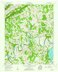
 1960 Johnson City1960 Print · USGSUpper East Tennessee and the surrounding tri-state area are shown in the mid-fifties during the height of the TVA reservoir era. Trace the industrial rail lines of the Southern and Louisville and Nashville between Kingsport and Johnson City.
 - 1960 Map of Talbott, 1963 Print
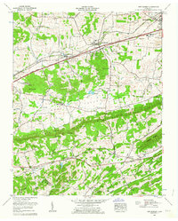
 1960 Talbott1963 Print · USGSEast Tennessee's landscape is shown in the early sixties as the sprawling waters of Cherokee Lake reshaped the tri-county area. Genealogists can locate family names at Bacon Cem or trace the rural routes connecting Talbott and Alpha.
 - 1961 Map of Joppa, 1962 Print
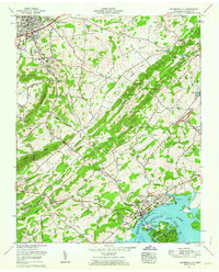
 1961 Joppa1962 Print · USGSGrainger and Jefferson counties in the early sixties reveal a landscape of deep river bends and established family homesteads. Researchers can trace ancestral sites like the Massengill Mill, Fielden Store, and numerous burial sites including Sulphur Spring Cem.3 unique versions available
 - 1961 Map of New Market, 1963 Print
 1961 New Market1963 Print · USGSJefferson County in the early sixties was a landscape of deep-rooted settlements and active industry. Genealogists can locate family landmarks such as French Mill, Wooten Chapel, and numerous cemeteries including Loy Memorial Cem and Piedmont Cem.3 unique versions available
 - 1961 Map of Jefferson City, 1963 Print
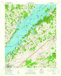
 1961 Jefferson City1963 Print · USGSJefferson and Dandridge are captured here in the early sixties as industrial mining and the rising waters of Douglas Lake reshape the valley. Genealogists can trace family names at Hebron Cem and Wesley Chapel, or locate the Hunnicutt Mill and Coy Mine.3 unique versions available
 - 1963 Map of Johnson City
 1963 Johnson City1963 Print · USGSThe Tri-Cities and the surrounding Appalachian ridges are shown in detail during the early sixties, highlighting the era's vital rail and river networks. Genealogists and historians can trace the routes of the Clinchfield RR and locate settlements from Rogersville to Elizabethton.
End of results
Showing maps 1-6 of 6
Top cities near Jefferson City
- Knoxville historical maps
- Morristown historical maps
- Sevierville historical maps
- Newport historical maps
- Bean Station historical maps
- Dandridge historical maps
See more
Top neighborhoods of Jefferson City
- Keister historical maps
- Flat Gap historical maps
- Rock Town historical maps
- Gravelly Hill historical maps
- Jefferson City Industrial Park historical maps
- Greene Meadows historical maps
Frequently asked questions
- What are the different types of historical maps available for Jefferson City?
- What is the oldest map of Jefferson City?
- Where can I purchase historical maps of Jefferson City for my home or office?
- Where can I download high-res historical maps of Jefferson City?
- Are there historical topographic maps available for Jefferson City?
- Is there historical aerial imagery available for Jefferson City?
- Where are historical maps of Jefferson City sourced from?