2020s Maps of Jefferson City, Tennessee
Explore 4 historic maps of Jefferson City from the 2020s. These maps offer a rare glimpse into what life looked like during the 2020s — showing old roads, neighborhoods, homes, and landmarks that have changed or disappeared over time.
Whether you're researching your family's past, planning a metal detecting trip, or studying how Jefferson City's landscape evolved across the 2020s, these high-resolution maps are a powerful tool for exploring the history of this region.
- Focus on a specific era: All maps on this page are from the 2020s, giving you a focused view of this time period.
- See what’s changed: Compare century-old streets, trails, and buildings to today's modern landscape using overlays and satellite layers.
- Research with precision: Use these maps for genealogy, historical research, land use analysis, or educational projects.
- View, download, or print: Maps are fully viewable online in high resolution, and can be downloaded or printed for your own records.
Start exploring Jefferson City's history through authentic maps from the 2020s. This is your window into the past.
Jefferson City, TN maps
(4)- 2022 Map of New Market, 2022 Print
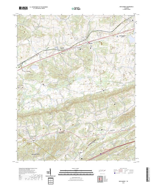 2022 New Market2022 Print · USGSJefferson and Sevier counties are shown here in modern detail, where ridge-and-valley terrain shapes the historic settlements of New Market and Friends Station. Researchers can trace family roots through numerous local sites like McCampbells Chapel Cem and Piedmont.
 - 2022 Map of Talbott, 2022 Print
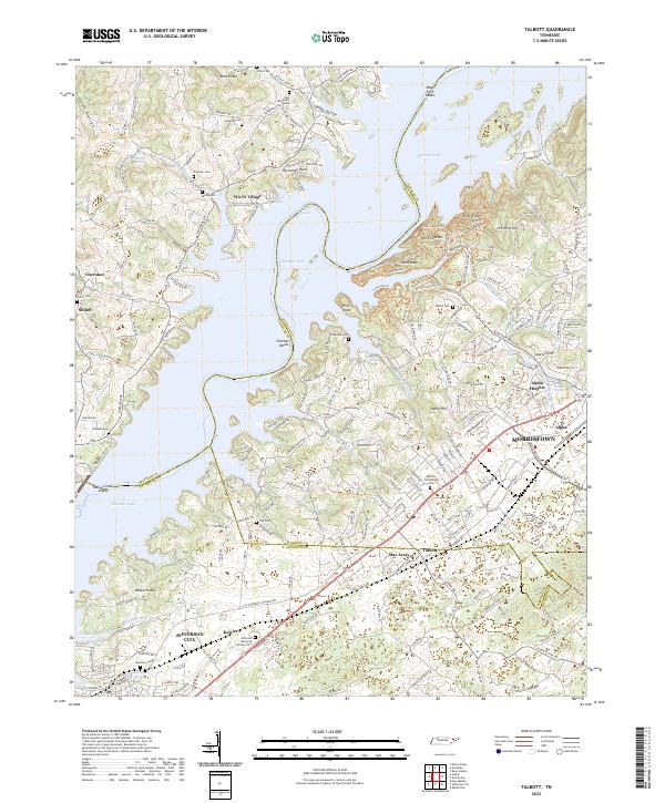 2022 Talbott2022 Print · USGSHamblen and Jefferson counties are captured here in the early 2020s, showing the intersection of lake life and suburban growth. Researchers can trace numerous family burial sites like Martha Sunderland Cem or explore historic industrial roots at Ore Mine Hill.
 - 2022 Map of Joppa, 2022 Print
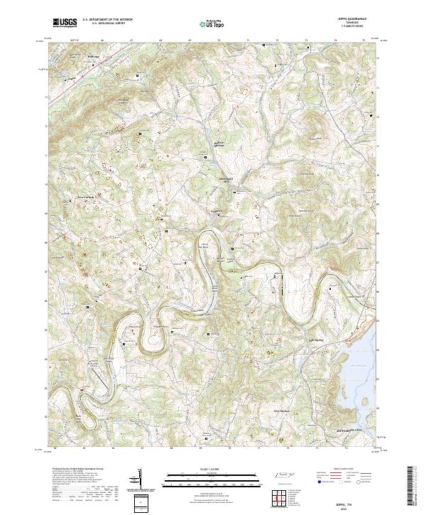 2022 Joppa2022 Print · USGSRichland Valley and the Holston River corridor are captured here during the early twenty-first century. Genealogists and local historians can locate dozens of family-named landmarks and burial sites, including Massengill Mill, Indian Cave, and Good Hope Church.
 - 2022 Map of Jefferson City, 2022 Print
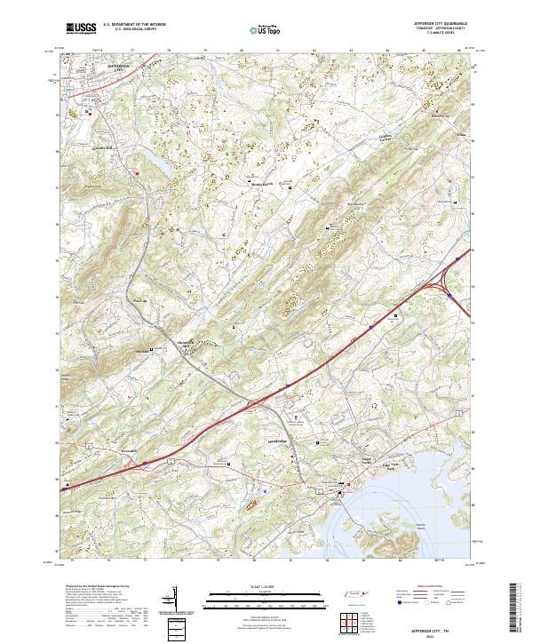 2022 Jefferson City2022 Print · USGSJefferson County, Tennessee, is captured here during the early 2020s, showing the intersection of university life and lakefront development. Researchers can trace family roots at Dandridge Cem and Wesleys Chapel Cem or locate old landmarks like Hunnicutt Mill.
End of results
Showing maps 1-4 of 4
Top cities near Jefferson City
- Knoxville historical maps
- Morristown historical maps
- Sevierville historical maps
- Newport historical maps
- Bean Station historical maps
- Dandridge historical maps
See more
Top neighborhoods of Jefferson City
- Keister historical maps
- Flat Gap historical maps
- Rock Town historical maps
- Gravelly Hill historical maps
- Jefferson City Industrial Park historical maps
- Greene Meadows historical maps
Frequently asked questions
- What are the different types of historical maps available for Jefferson City?
- What is the oldest map of Jefferson City?
- Where can I purchase historical maps of Jefferson City for my home or office?
- Where can I download high-res historical maps of Jefferson City?
- Are there historical topographic maps available for Jefferson City?
- Is there historical aerial imagery available for Jefferson City?
- Where are historical maps of Jefferson City sourced from?