Old Maps of Johnson County, Tennessee for Hiking & Exploration
Hike through history with 119 historic maps of Johnson County. Explore old trails, ghost towns, and forgotten backroads — perfect for outdoor adventurers and local explorers.
- Rediscover forgotten places: Map out old mining camps, roads, and footpaths that no longer exist on modern maps.
- Layer with modern tools: Combine with LiDAR or satellite views to plan hikes through historical terrain.
- Made for exploration: Popular among hikers, overlanders, and local history lovers.
Use these maps to find adventure and explore the hidden past of Johnson County.
Johnson County, TN maps
(119)- 1891 Map of Roan Mountain
 1891 Roan Mountain1891 Print · USGSThe Tennessee-North Carolina border country comes alive in the 1890s, when narrow-gauge railroads and mountain ferries still moved the region's goods. Genealogists and historians can trace early crossings like Shipley's Ferry, industrial sites at Embreeville, and high-country settlements like Cloudland.
 - 1891 Map of Abingdon
 1891 Abingdon1891 Print · USGSSouthwest Virginia in the 1890s reveals a landscape of mountain ridges and thriving valley settlements along the Norfolk and Western R. R. Lineages can be traced through sites like Emory and Henry College, Saltville, and numerous family-named landmarks like Vance's Mill.
 - 1893 Map of Cranberry
 1893 Cranberry1893 Print · USGSThe high country of the Blue Ridge and Appalachians is captured here during the late 1800s, showing the early settlements and crossroads of Watauga and Johnson counties. Genealogists can trace family landmarks and early industry at Rhea Forge, Shulls Mill, and the many hamlets like Vilas and Sutherland.
 - 1894 Map of Roan Mountain
 1894 Roan Mountain1894 Print · USGSNortheast Tennessee and Western North Carolina are mapped here in the late nineteenth century as the rail network expands through the Unaka Range. Trace early industrial footprints and family lands near Elizabethton, Terry Furnace, and the high summit at Cloudland.3 unique versions available
 - 1894 Map of Abingdon, 1896 Print
 1894 Abingdon1896 Print · USGSSouthwest Virginia's valley and ridge country is captured here during the peak of the rail era, centered on the Abingdon and Marion corridors. Local historians can trace the foundations of Emory and Henry College and numerous rural mill sites like Belfast Mills or Vance's Mill.5 unique versions available
 - 1895 Map of Cranberry
 1895 Cranberry1895 Print · USGSThe High Country of North Carolina and Tennessee comes alive in this late nineteenth-century survey. Genealogists and historians can trace the foundations of Mountain City or locate old community centers like Valle Cruces, Banners Elk, and Rhea Forge.
 - 1899 Map of Cranberry
 1899 Cranberry1899 Print · USGSThe high Appalachian borderlands of North Carolina and Tennessee appear here in the late nineteenth century, defined by mountain settlements and early river-powered industry. Researchers can trace the era's geography through landmarks like Rhea Forge, Shills Mill, and the historic Yonhalossee Road.
 - 1902 Map of Cranberry
 1902 Cranberry1902 Print · USGSThe North Carolina and Tennessee borderlands are captured here at the turn of the century as early railroads began penetrating the high ridges. Genealogists can trace family names and old settlements like Mountain City, Shoun Crossroads, and the industry at Rhea Forge.6 unique versions available
 - 1904 Map of Roan Mountain
 1904 Roan Mountain1904 Print · USGSUpper East Tennessee and Western North Carolina are documented here at a time when river fords and narrow-gauge railroads still connected mountain hollows. Trace the paths to Hodge Ore Bank, find old Poplar Ridge Church, or locate river crossings like Yoakley Ferry.4 unique versions available
 - 1909 Map of Abingdon
 1909 Abingdon1909 Print · USGSSouthwest Virginia at the first decade's end shows a valley landscape defined by the iron rail and steep ridges. Genealogists and historians can trace the early layouts of Abingdon and Glade Spring, or locate landmarks like Dove Mills and the County Farm.2 unique versions available
 - 1911 Map of Abingdon
 1911 Abingdon1911 Print · USGSSouthwest Virginia's rugged corridors are captured here during the height of the mountain rail era. Genealogists and historians can trace old homesteads and local landmarks such as Whites Mill, Valley Church, and the County Farm near Abingdon.5 unique versions available
 - 1935 Map of Watauga Valley
 1935 Watauga Valley1935 Print · USGSUpper East Tennessee's river valleys and mountain ridges are documented here during the mid-thirties, centered on the growing industrial hub of Elizabethton. Researchers can locate numerous vanished landmarks, from the Manganese Mine to rural schoolhouses like Caldwell Springs Sch.
 - 1935 Map of Doe
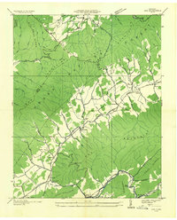 1935 Doe1935 Print · USGSThe Tennessee mountains at the height of the New Deal era reveal a network of high-country hollows and valley settlements. Genealogists can trace the rural communities of Doeville, Pandora, and Doe Valley alongside landmarks like Campbell Cem.
 - 1935 Map of Grayson
 1935 Grayson1935 Print · USGSThe high tri-state ridges of Washington County, Tennessee, and neighboring Virginia are shown here just before the mid-century. Genealogists and hikers can trace old mountain paths through Cut Laurel Gap, find the State Line Sch, and locate the Norfolk and Western rail line near Green Cove.
 - 1935 Map of Baldwin Gap
 1935 Baldwin Gap1935 Print · USGSThe high ridges of the Tennessee and North Carolina border come into focus in the mid-1930s. Genealogists can trace early mountain life through the sites of Snyder Chapel, Curds Sch, and the isolated Wallace Cem.
 - 1935 Map of Carter
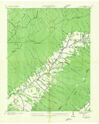 1935 Carter1935 Print · USGSIn the mid-1930s, the Stony Creek valley in Carter County was a landscape of small farms and active mineral extraction. Genealogists and historians can locate community centers like Unaka Sch and Winner alongside industrial sites like the Hodge Ore Bank.
 - 1935 Map of Mount Rogers
 1935 Mount Rogers1935 Print · USGSThe high peaks of Grayson and Smyth Counties are documented here in the mid-1930s as the Appalachian Trail was being established across Mount Rogers. Genealogists and historians can trace the foundations of mountain life at Konnarock, the Iron Mountain Boys Sch, and Taylors Valley.
 - 1935 Map of Doe Mountain
 1935 Doe Mountain1935 Print · USGSMountain City and the Watauga River valley appear here in the mid-1930s, just before major hydroelectric projects transformed the landscape. Researchers can trace the original river towns of Butler and Elk Mills, or locate family landmarks like Shouns Chapel Sch and Doeville P O Doe Sta.2 unique versions available
 - 1935 Map of Sherwood
 1935 Sherwood1935 Print · USGSThe Tennessee and North Carolina high country comes into focus in the mid-1930s, showing a network of mountain coves and river crossings. Researchers can locate remote schools and family burial sites like Glendale Sch, Ivory Ridge Sch, and the Cove Creek Cem.
 - 1935 Map of Butler
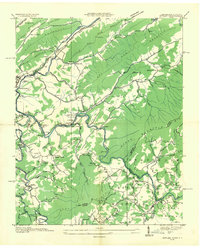 1935 Butler1935 Print · USGSThe Watauga River valley in the mid-1930s is caught here in its original state before TVA projects transformed the region. Genealogists and local historians can pinpoint the original sites of Butler, Watauga Academy, and cemeteries like Green Cem.2 unique versions available
 - 1935 Map of Laurel Bloomery
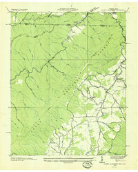 1935 Laurel Bloomery1935 Print · USGSThe Tennessee and Virginia borderlands are shown here in the mid-1930s as federal conservation efforts were taking hold in the mountains. Researchers can locate old CCC camps like Camp McArthur CCC, rural churches such as Wesley Chapel, and the original path of the Appalachian Trail.
 - 1935 Map of River Knobs
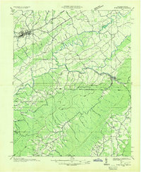 1935 River Knobs1935 Print · USGSThe Virginia and Tennessee borderlands come alive in the mid-1930s, showing a landscape of river forks and mountain ridges. Trace the early Appalachian Trail, locate Great Depression-era sites like CCC Camp Shelby, and find family history at Knotts Cem.
 - 1935 Map of Zionville
 1935 Zionville1935 Print · USGSThe Tennessee and North Carolina borderlands are captured here in the mid-1930s as high-country roads began to improve. Genealogists and hikers can trace old routes through the Gap of Rich Mtn or locate small settlements like Trade and Silverstone.
 - 1935 Map of Fish Springs
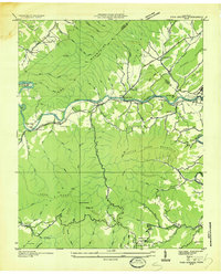 1935 Fish Springs1935 Print · USGSNortheast Tennessee in the mid-1930s was a landscape of steep mountain ridges and river-valley settlements on the eve of significant TVA changes. Researchers can trace the path of the SOUTHERN RAILWAY through Fish Springs, find remote schools like Horseshoe Sch, and locate industrial landmarks such as the LIME KILN.
 - 1935 Map of Shady Valley
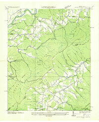 1935 Shady Valley1935 Print · USGSThe mountains of East Tennessee and Southwest Virginia are shown here in the mid-1930s as the New Deal era began. Genealogists can trace family names at Denton Valley Sch, Crandull P O, and the C C C Camp Shelby work site.
Showing maps 1-25 of 119
Top cities of Johnson County
Frequently asked questions
- What are the different types of historical maps available for Johnson County?
- What is the oldest map of Johnson County?
- Where can I purchase historical maps of Johnson County for my home or office?
- Where can I download high-res historical maps of Johnson County?
- Are there historical topographic maps available for Johnson County?
- Is there historical aerial imagery available for Johnson County?
- Where are historical maps of Johnson County sourced from?