1950s Maps of Johnson County, Tennessee
Explore 8 historic maps of Johnson County from the 1950s. These maps offer a rare glimpse into what life looked like during the 1950s — showing old roads, neighborhoods, homes, and landmarks that have changed or disappeared over time.
Whether you're researching your family's past, planning a metal detecting trip, or studying how Johnson County's landscape evolved across the 1950s, these high-resolution maps are a powerful tool for exploring the history of this region.
- Focus on a specific era: All maps on this page are from the 1950s, giving you a focused view of this time period.
- See what’s changed: Compare century-old streets, trails, and buildings to today's modern landscape using overlays and satellite layers.
- Research with precision: Use these maps for genealogy, historical research, land use analysis, or educational projects.
- View, download, or print: Maps are fully viewable online in high resolution, and can be downloaded or printed for your own records.
Start exploring Johnson County's history through authentic maps from the 1950s. This is your window into the past.
Johnson County, TN maps
(8)- 1953 Map of Winston-Salem, 1974 Print
 1953 Winston-Salem1974 Print · USGSThe North Carolina Piedmont and Virginia highlands meet in the mid-1950s, a landscape defined by the tobacco and textile hubs of the Blue Ridge foothills. Researchers can trace the rail-and-river geography connecting Winston-Salem to mountain towns like Mount Airy and Galax.2 unique versions available
 - 1955 Map of Johnson City
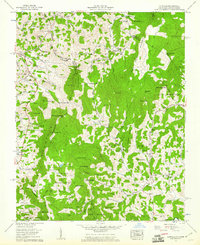
 1955 Johnson City1955 Print · USGSEast Tennessee and the bordering highlands of Virginia and Kentucky appear here during the post-war industrial boom. You can trace the complex network of mountain ridges and new TVA lakes, from Johnson City to the coalfields near Middlesboro and Lynch.
 - 1955 Map of Winston-Salem
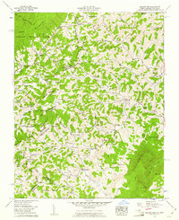
 1955 Winston-Salem1955 Print · USGSThe Central Blue Ridge and Piedmont transition are captured here in the mid-fifties, from the industrial hub of Winston-Salem to the high peaks of Southwest Virginia. Genealogists can trace family landmarks like Richmond Hill Ch, Siloam Ch, and the old rail stops along the Southern Railway.
 - 1957 Map of Johnson City, 1966 Print
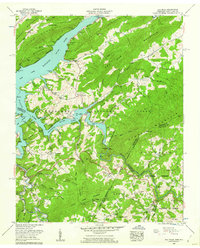
 1957 Johnson City1966 Print · USGSUpper East Tennessee and Southwest Virginia are shown here during the mid-sixties transition of the Appalachians. Researchers can trace the industrial rail hubs of Kingsport, the sprawling waters of Cherokee Lake, and the historic Cumberland Gap.
 - 1959 Map of Zionville, 1961 Print
 1959 Zionville1961 Print · USGSThe borderlands of North Carolina and Tennessee come alive in the late fifties, showing a landscape of high peaks and isolated creek-side settlements. Genealogists can trace old family roots at Winbarger Mill, Pottertown (Tamarack PO), and the Maine Cem.4 unique versions available
 - 1959 Map of Baldwin Gap, 1961 Print
 1959 Baldwin Gap1961 Print · USGSThe high borderlands of the Tennessee-North Carolina line come alive in the late fifties, following the high ridges of Stone Mountain. Genealogists and local historians can trace family burial sites like Graybeal Cem and McEwen Cem or locate the rural Forge Sch.4 unique versions available
 - 1959 Map of Elk Mills, 1962 Print
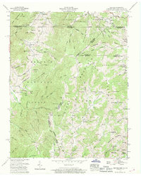
 1959 Elk Mills1962 Print · USGSHigh-country settlements in Johnson and Carter Counties are shown in the late fifties as Watauga Lake reshapes the landscape. Trace family sites like Elk Mills, the Dry Run Sch, and the Crosswhite Cem along the steep mountain ridges.4 unique versions available
 - 1959 Map of Grayson, 1969 Print
 1959 Grayson1969 Print · USGSIn the late 1950s, the mountain borders of Tennessee, Virginia, and North Carolina remained a patchwork of isolated family farmsteads and timbered ridges. Researchers can trace the Norfolk and Western rail corridor and find dozens of small family plots like Rye Cove Cem and Taylor Cem.3 unique versions available
End of results
Showing maps 1-8 of 8
Top cities of Johnson County
Frequently asked questions
- What are the different types of historical maps available for Johnson County?
- What is the oldest map of Johnson County?
- Where can I purchase historical maps of Johnson County for my home or office?
- Where can I download high-res historical maps of Johnson County?
- Are there historical topographic maps available for Johnson County?
- Is there historical aerial imagery available for Johnson County?
- Where are historical maps of Johnson County sourced from?