Old Maps of Crystal Springs, Tennessee for Genealogy
Trace your family roots with 9 historic maps of Crystal Springs. These high-res maps reveal old neighborhoods, homesites, landmarks, and streets — helping you uncover where your ancestors lived and how the area evolved over time.
- Explore historic neighborhoods: Identify where your relatives may have lived in the 1800s or 1900s.
- Compare maps over time: Trace the changes in streets, buildings, and landmarks for multi-generational research.
- Perfect for genealogy & ancestry research: Used by family historians and researchers to map out lineage and migration.
These maps are an incredible resource for exploring your personal connection to Crystal Springs's past.
Crystal Springs, TN maps
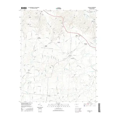
(9)- 1936 Map of Flintville
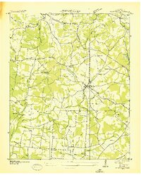 1936 Flintville1936 Print · USGSLincoln County comes alive in the mid-1930s as a landscape of rail-connected hamlets and early TVA electrification efforts. Genealogists can trace family landmarks like Campbell Cem, Brown Chapel, and the rural McCracken Sch along the Flint River.
 - 1947 Map of Flintville, 1948 Print
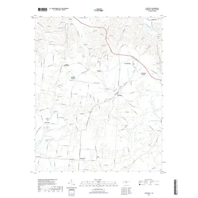
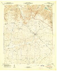 1947 Flintville1948 Print · USGSMid-century Lincoln County comes to life as an active rail and river hub just after the war. Local historians can trace family ties at Stewart Chapel, the State Fish Hatchery, or small settlements like Brighton and Milners Switch.3 unique versions available
 - 1956 Map of Columbia, 1960 Print
 1956 Columbia1960 Print · USGSMiddle Tennessee in the mid-fifties presents a landscape of established river towns and critical rail hubs before the arrival of the modern interstate system. Researchers can trace the routes of the Louisville and Nashville railroad or locate historic landmarks like Stones River National Military Park and the Tennessee National Wildlife Refuge.6 unique versions available
 - 1981 Map of Tullahoma, 1982 Print
 1981 Tullahoma1982 Print · USGSSouthern Tennessee enters the 1980s with a mix of aerospace technology and deep rural roots. Researchers can trace the L & N RR through Shelbyville and Fayetteville or locate family sites like Old Salem Cem and Blanton Chapel near the Cumberland Plateau.
 - 2010 Map of Flintville, 2010 Print
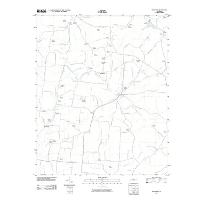 2010 Flintville2010 Print · USGSCovers Crystal Springs, including New Hope, Corder Crossroads, and other nearby areas
 - 2013 Map of Flintville, 2013 Print
 2013 Flintville2013 Print · USGSCovers Crystal Springs, including New Hope, Corder Crossroads, and other nearby areas
 - 2016 Map of Flintville, 2016 Print
 2016 Flintville2016 Print · USGSCovers Crystal Springs, including New Hope, Corder Crossroads, and other nearby areas
 - 2019 Map of Flintville, 2019 Print
 2019 Flintville2019 Print · USGSCovers Crystal Springs, including New Hope, Corder Crossroads, and other nearby areas
 - 2022 Map of Flintville, 2022 Print
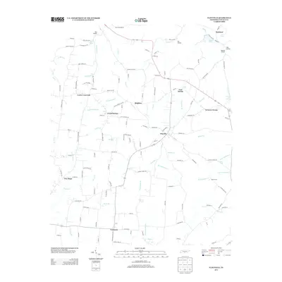
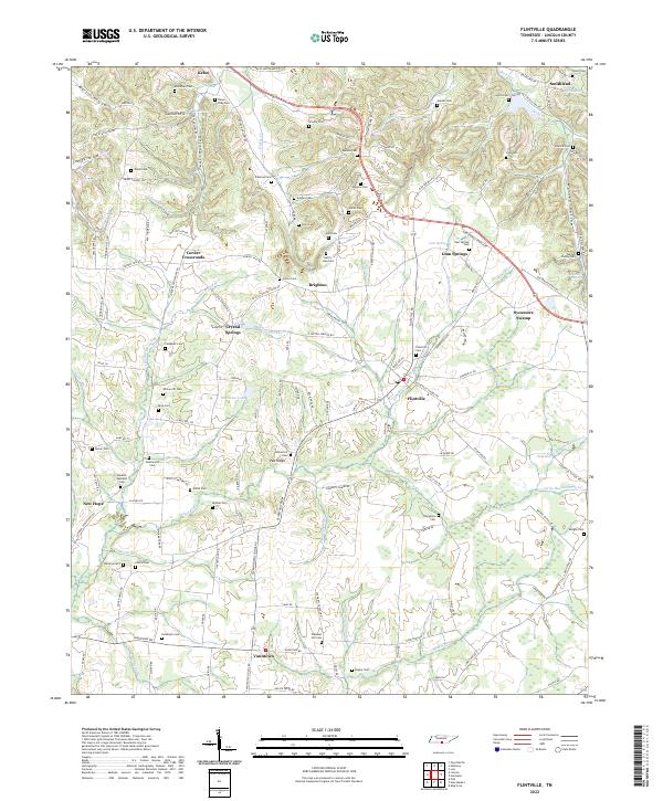 2022 Flintville2022 Print · USGSLincoln County’s rural character is on full display in the early twenty-first century, featuring a landscape shaped by the Flint River and its many branches. Genealogists can trace family names through numerous burial sites like Taylor-Gray Cem, Hopkins-Eastland Cem, and Warren Family Cem.
End of results
Showing maps 1-9 of 9
Top cities near Crystal Springs
- Huntsville historical maps
- Meridianville historical maps
- Fayetteville historical maps
- Hazel Green historical maps
- New Market historical maps
- Huntland historical maps
Frequently asked questions
- What are the different types of historical maps available for Crystal Springs?
- What is the oldest map of Crystal Springs?
- Where can I purchase historical maps of Crystal Springs for my home or office?
- Where can I download high-res historical maps of Crystal Springs?
- Are there historical topographic maps available for Crystal Springs?
- Is there historical aerial imagery available for Crystal Springs?
- Where are historical maps of Crystal Springs sourced from?