1930s Maps of Fayetteville, Tennessee
Explore 3 historic maps of Fayetteville from the 1930s. These maps offer a rare glimpse into what life looked like during the 1930s — showing old roads, neighborhoods, homes, and landmarks that have changed or disappeared over time.
Whether you're researching your family's past, planning a metal detecting trip, or studying how Fayetteville's landscape evolved across the 1930s, these high-resolution maps are a powerful tool for exploring the history of this region.
- Focus on a specific era: All maps on this page are from the 1930s, giving you a focused view of this time period.
- See what’s changed: Compare century-old streets, trails, and buildings to today's modern landscape using overlays and satellite layers.
- Research with precision: Use these maps for genealogy, historical research, land use analysis, or educational projects.
- View, download, or print: Maps are fully viewable online in high resolution, and can be downloaded or printed for your own records.
Start exploring Fayetteville's history through authentic maps from the 1930s. This is your window into the past.
Fayetteville, TN maps
(3)- 1936 Map of Lincoln
 1936 Lincoln1936 Print · USGSLincoln County in the mid-1930s shows a landscape of river-bend settlements and emerging TVA utility lines. Genealogists can trace family locations near Skinem Cem, Rozells Mill, and rural schoolhouses like Quick Sch or Johnson Sch.
 - 1936 Map of Mulberry
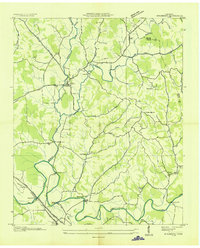 1936 Mulberry1936 Print · USGSMiddle Tennessee's river valleys come alive in the mid-1930s, showing the early reach of the TVA and the local rail network. Trace the paths to Lockes Mill, Lloyd Chapel, and family sites like Cowley Cem or Smith Cem.
 - 1936 Map of Fayetteville
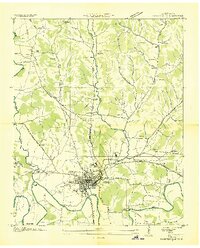 1936 Fayetteville1936 Print · USGSMid-1930s Fayetteville is captured here during the era of TVA expansion and Depression-era public works. Genealogists and researchers can trace local family roots through numerous landmarks like Harris Cem, the Mimosa Sch, and CCC Camp TVA No 33.
End of results
Showing maps 1-3 of 3
Top cities near Fayetteville
Top neighborhoods of Fayetteville
- Creson historical maps
- Elmwood Terrace historical maps
- Madden Homes historical maps
- Mayberry Courts historical maps
- Elk Mill Village historical maps
Frequently asked questions
- What are the different types of historical maps available for Fayetteville?
- What is the oldest map of Fayetteville?
- Where can I purchase historical maps of Fayetteville for my home or office?
- Where can I download high-res historical maps of Fayetteville?
- Are there historical topographic maps available for Fayetteville?
- Is there historical aerial imagery available for Fayetteville?
- Where are historical maps of Fayetteville sourced from?