Old Maps of Yukon, Tennessee for Academic Research
Study the evolution of Yukon with 10 high-resolution historic maps. Whether you're teaching, researching, or modeling changes in land use, these maps provide essential visual documentation of urban, environmental, and geographic change.
- Analyze long-term change: Track patterns in development, transportation, and natural features.
- Ideal for environmental or urban studies: Support academic projects with primary historical map data.
- Use in the classroom or lab: Educators and researchers rely on these maps to bring historical context to life.
These maps are a powerful tool for teaching, research, and visualizing how Yukon has changed over the decades.
Yukon, TN maps
(10)- 1936 Map of Taft
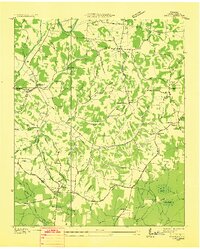 1936 Taft1936 Print · USGSLincoln County at the height of the mid-thirties rural electrification era is captured here in fine detail. Genealogists and local historians can trace family locations near Taft, Coldwater, and Molino, or find markers like Bryant Cem and Smith Chapel.
 - 1949 Map of Taft, 1974 Print
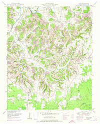 1949 Taft1974 Print · USGSLincoln County comes to life in this mid-century survey of the rugged ridges and river bottoms north of the Alabama line. Genealogists can trace family roots through numerous sites like Marys Grove School, Smith Chapel, and the Milam Cem.2 unique versions available
 - 1951 Map of Taft
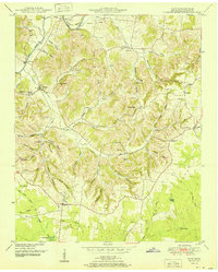 1951 Taft1951 Print · USGSSouthern Lincoln County near the Alabama border is documented here in the early fifties, showing a landscape of upland farms and winding hollows. Genealogists can trace family roots through numerous sites like Smith Chapel, Marys Grove School, and Milam Cem.2 unique versions available
 - 1956 Map of Columbia, 1960 Print
 1956 Columbia1960 Print · USGSMiddle Tennessee in the mid-fifties presents a landscape of established river towns and critical rail hubs before the arrival of the modern interstate system. Researchers can trace the routes of the Louisville and Nashville railroad or locate historic landmarks like Stones River National Military Park and the Tennessee National Wildlife Refuge.6 unique versions available
 - 1981 Map of Tullahoma, 1982 Print
 1981 Tullahoma1982 Print · USGSSouthern Tennessee enters the 1980s with a mix of aerospace technology and deep rural roots. Researchers can trace the L & N RR through Shelbyville and Fayetteville or locate family sites like Old Salem Cem and Blanton Chapel near the Cumberland Plateau.
 - 2010 Map of Taft, 2010 Print
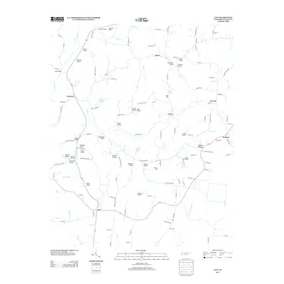
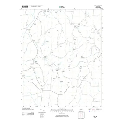 2010 Taft2010 Print · USGSCovers Yukon, including Camargo, Kirkland, and other nearby areas
 - 2013 Map of Taft, 2013 Print
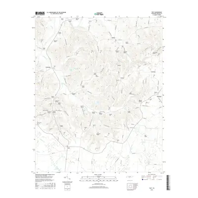
 2013 Taft2013 Print · USGSCovers Yukon, including Camargo, Kirkland, and other nearby areas
 - 2016 Map of Taft, 2016 Print
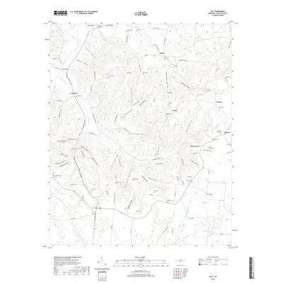
 2016 Taft2016 Print · USGSCovers Yukon, including Camargo, Kirkland, and other nearby areas
 - 2019 Map of Taft, 2019 Print
 2019 Taft2019 Print · USGSCovers Yukon, including Camargo, Kirkland, and other nearby areas
 - 2022 Map of Taft, 2022 Print
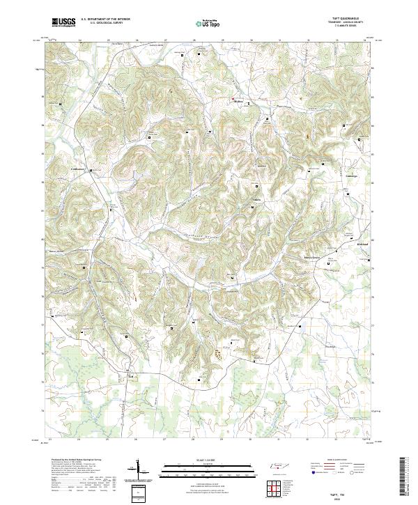 2022 Taft2022 Print · USGSLincoln County, Tennessee, is mapped here in its contemporary rural state, highlighting a landscape carved by hollows and family homesteads. Genealogists can locate family burial plots like Pitts - Dale Cemetery and follow the route of the Old Railroad Bed Road through Taft.
End of results
Showing maps 1-10 of 10
Top cities near Yukon
- Huntsville historical maps
- Meridianville historical maps
- Fayetteville historical maps
- Harvest historical maps
- Hazel Green historical maps
- Ardmore historical maps
See more
Frequently asked questions
- What are the different types of historical maps available for Yukon?
- What is the oldest map of Yukon?
- Where can I purchase historical maps of Yukon for my home or office?
- Where can I download high-res historical maps of Yukon?
- Are there historical topographic maps available for Yukon?
- Is there historical aerial imagery available for Yukon?
- Where are historical maps of Yukon sourced from?