Old Maps of Woodlawn, Tennessee for Academic Research
Study the evolution of Woodlawn with 18 high-resolution historic maps. Whether you're teaching, researching, or modeling changes in land use, these maps provide essential visual documentation of urban, environmental, and geographic change.
- Analyze long-term change: Track patterns in development, transportation, and natural features.
- Ideal for environmental or urban studies: Support academic projects with primary historical map data.
- Use in the classroom or lab: Educators and researchers rely on these maps to bring historical context to life.
These maps are a powerful tool for teaching, research, and visualizing how Woodlawn has changed over the decades.
Woodlawn, TN maps
(18)- 1895 Map of Loudon
 1895 Loudon1895 Print · USGSEastern Tennessee is mapped here during a decade of rail expansion and river-based commerce. Genealogists and historians can trace family-named river crossings and early industry at Huff Ferry, Hiwassee College, and Brick Mill.6 unique versions available
 - 1935 Map of Bethel Valley
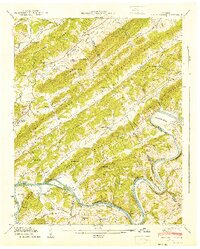
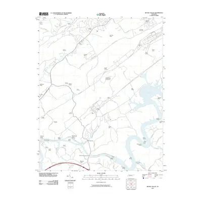
 1935 Bethel Valley1935 Print · USGSEastern Tennessee in the mid-1930s was a landscape of ridge-and-valley farms along the Clinch River. Genealogists and historians can trace the foundations of local life through the George Jones Memorial Ch, Wheat, and the White Wing Ferry.
 - 1941 Map of Bethel Valley
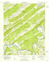
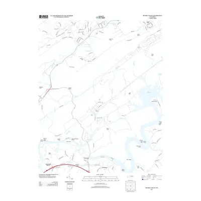
 1941 Bethel Valley1941 Print · USGSBethel Valley and the Clinch River are captured here in the early 1940s, just as the regional landscape began to shift. Genealogists and historians can locate early family landmarks like White Wing Ferry, the Wheat settlement, and the George Jones Memorial Ch.3 unique versions available
 - 1953 Map of Chattanooga
 1953 Chattanooga1953 Print · USGSSoutheast Tennessee in the early fifties shows a landscape reshaped by river management and rail power. Trace the rail lines of the Southern Ry through riverside towns or locate the preserved grounds of the Chickamauga and Chattanooga National Military Park.
 - 1953 Map of Bethel Valley, 1955 Print
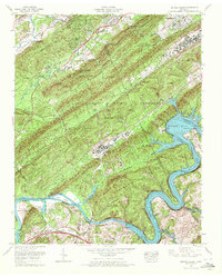
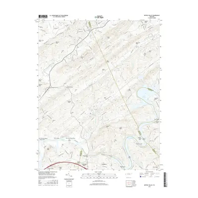
 1953 Bethel Valley1955 Print · USGSMid-century Roane and Anderson counties are captured here as federal activity expands around the Oak Ridge area. Genealogists and local historians can trace family sites like Gallaher Cemetery, the settlement of Wheat, and the early White Wing Bridge (Pontoon).2 unique versions available
 - 1957 Map of Chattanooga, 1966 Print
 1957 Chattanooga1966 Print · USGSEast Tennessee in the mid-1960s shows a landscape of massive hydroelectric reservoirs and emerging industrial sites like the Atomic Energy Commission (Oak Ridge Area). Trace the rail networks of the Southern Ry through Chattanooga or locate family-named ridges across the Cumberland Plateau.3 unique versions available
 - 1959 Map of Chattanooga
 1959 Chattanooga1959 Print · USGSSoutheast Tennessee is shown here during a decade of industrial growth and hydroelectric development. Trace the regional rail networks of the Southern Ry and find landmark sites like Lookout Mountain, Fall Creek Falls State Park, and Chattanooga.
 - 1960 Map of Chattanooga
 1960 Chattanooga1960 Print · USGSSoutheast Tennessee and the southern Appalachians are shown here at the height of the river-management era. You can trace the valley rail lines and locate Lookout Mountain and the expansive waters of Chickamauga Reservoir.
 - 1964 Map of Chattanooga
 1964 Chattanooga1964 Print · USGSSoutheast Tennessee and the western Carolinas appear in the mid-sixties as a powerhouse of river-driven industry and mountain wilderness. Genealogists and historians can trace rail-town lineages along the Southern Ry or locate family landmarks near Watts Bar Lake and Tellico Plains.
 - 1968 Map of Bethel Valley, 1972 Print
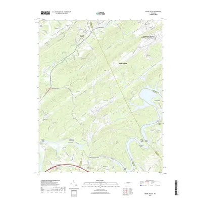
 1968 Bethel Valley1972 Print · USGSOak Ridge and the Clinch River valley are shown during a period of intense atomic research and postwar expansion. Genealogists and historians can trace local landmarks like Bethel Chapel Cem, Bradbury, and the high-security Atomic Energy Commission grounds.
 - 1981 Map of Watts Bar Lake, 1984 Print
 1981 Watts Bar Lake1984 Print · USGSEast Tennessee's river valleys and industrial corridors are captured here during the expansion of the TVA power system in the early eighties. Researchers can trace the legacy of the Southern Railway and the development of Watts Bar Lake and Tellico Lake.2 unique versions available
 - 1989 Map of Bethel Valley, 1990 Print
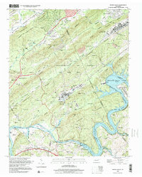
 1989 Bethel Valley1990 Print · USGSBethel Valley and the Oak Ridge area in the late eighties show the complex layering of Department of Energy facilities over a landscape of older family homesteads. Trace ancestral sites like George Jones Memorial Cem, follow the Old Railroad Grade, and locate the Atomic Speedway near the river.
 - 1998 Map of Bethel Valley, 2001 Print
 1998 Bethel Valley2001 Print · USGSRoane County and the Oak Ridge area appear in the late twentieth century as a landscape of energy research, ridge-top development, and river recreation. Researchers can trace family history through dozens of rural burial grounds like Bethel Cem and landmarks like Atomic Speedway or Pinhook Gap.
 - 2010 Map of Bethel Valley, 2010 Print
 2010 Bethel Valley2010 Print · USGSCovers Woodlawn, including Oak Ridge, Lenoir City, and other nearby areas
 - 2013 Map of Bethel Valley, 2013 Print
 2013 Bethel Valley2013 Print · USGSCovers Woodlawn, including Oak Ridge, Lenoir City, and other nearby areas
 - 2016 Map of Bethel Valley, 2016 Print
 2016 Bethel Valley2016 Print · USGSCovers Woodlawn, including Oak Ridge, Lenoir City, and other nearby areas
 - 2019 Map of Bethel Valley, 2019 Print
 2019 Bethel Valley2019 Print · USGSCovers Woodlawn, including Oak Ridge, Lenoir City, and other nearby areas
 - 2022 Map of Bethel Valley, 2022 Print
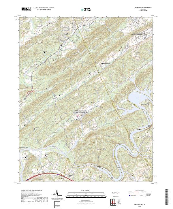 2022 Bethel Valley2022 Print · USGSEastern Tennessee at the edge of the atomic age is revealed here, where high-security federal history overlaps with old valley settlements. Genealogists can trace family landmarks like Douglas Chapel Cem and Gravel Hill Cem near the winding Clinch River.
End of results
Showing maps 1-18 of 18
Top cities near Woodlawn
- Knoxville historical maps
- Maryville historical maps
- Oak Ridge historical maps
- Farragut historical maps
- Clinton historical maps
- Lenoir City historical maps
See more
Frequently asked questions
- What are the different types of historical maps available for Woodlawn?
- What is the oldest map of Woodlawn?
- Where can I purchase historical maps of Woodlawn for my home or office?
- Where can I download high-res historical maps of Woodlawn?
- Are there historical topographic maps available for Woodlawn?
- Is there historical aerial imagery available for Woodlawn?
- Where are historical maps of Woodlawn sourced from?