2020s Maps of Adamsville, Tennessee
Explore 4 historic maps of Adamsville from the 2020s. These maps offer a rare glimpse into what life looked like during the 2020s — showing old roads, neighborhoods, homes, and landmarks that have changed or disappeared over time.
Whether you're researching your family's past, planning a metal detecting trip, or studying how Adamsville's landscape evolved across the 2020s, these high-resolution maps are a powerful tool for exploring the history of this region.
- Focus on a specific era: All maps on this page are from the 2020s, giving you a focused view of this time period.
- See what’s changed: Compare century-old streets, trails, and buildings to today's modern landscape using overlays and satellite layers.
- Research with precision: Use these maps for genealogy, historical research, land use analysis, or educational projects.
- View, download, or print: Maps are fully viewable online in high resolution, and can be downloaded or printed for your own records.
Start exploring Adamsville's history through authentic maps from the 2020s. This is your window into the past.
Adamsville, TN maps
(4)- 2022 Map of Leapwood, 2022 Print
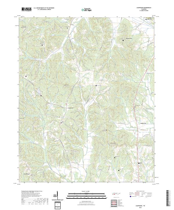 2022 Leapwood2022 Print · USGSMcNairy County's rolling hills and canalized creek bottoms come alive in this detailed look at rural Tennessee. Researchers can trace family history through a dozen burial sites like Mars Hill Cem or locate old community centers at Leapwood and Good Hope.
 - 2022 Map of Pittsburg Landing, 2022 Print
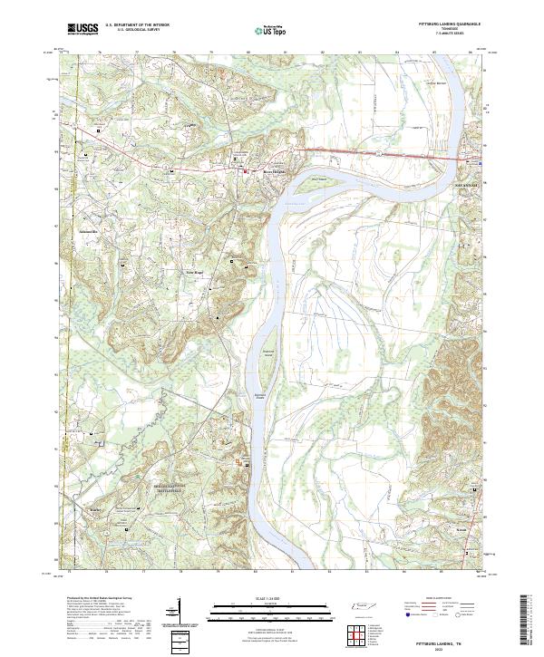 2022 Pittsburg Landing2022 Print · USGSHardin County's riverfront and the hallowed grounds of the Civil War are detailed here in this 2022 survey. Genealogists and historians can trace family names and military positions near Shiloh National Battlefield, Bloody Pond, and the Hardin County Courthouse.
 - 2022 Map of Stantonville, 2022 Print
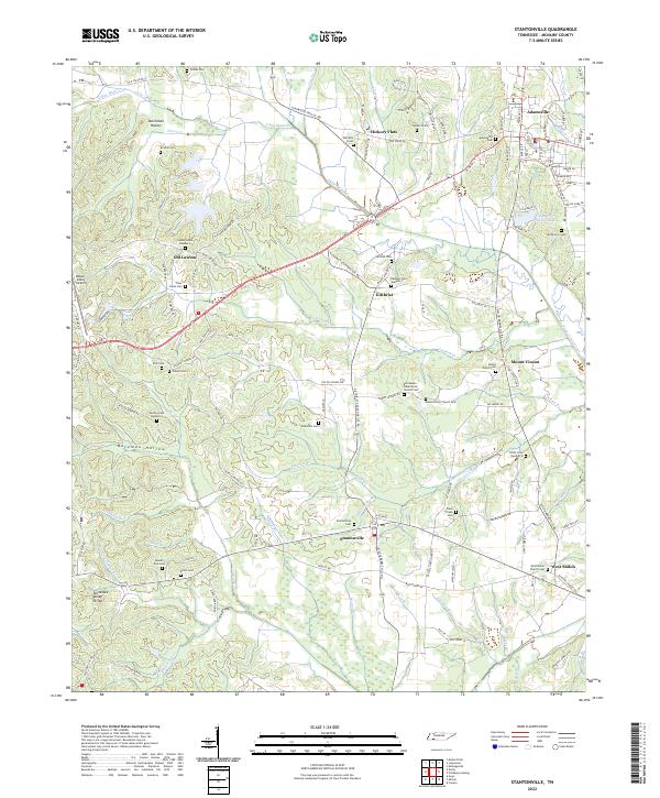 2022 Stantonville2022 Print · USGSStantonville and the McNairy County countryside are shown here in the early 2020s, dominated by the Tennessee Valley Divide. Trace local family roots at Stantonville Cem, Old Lawton, and the West Shiloh Church Cem.
 - 2022 Map of Milledgeville, 2022 Print
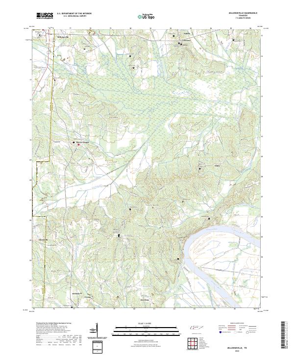 2022 Milledgeville2022 Print · USGSThe Tennessee River and Kentucky Lake shoreline defines this area on the McNairy and Hardin border as it appeared recently. Researchers can trace family roots through numerous landmarks like Old Union Church, Milledgeville Cem, and the Morris Chapel settlement.
End of results
Showing maps 1-4 of 4
Top cities near Adamsville
- Savannah historical maps
- Henderson historical maps
- Selmer historical maps
- Crump historical maps
- Bethel Springs historical maps
- Michie historical maps
See more
Top neighborhoods of Adamsville
Frequently asked questions
- What are the different types of historical maps available for Adamsville?
- What is the oldest map of Adamsville?
- Where can I purchase historical maps of Adamsville for my home or office?
- Where can I download high-res historical maps of Adamsville?
- Are there historical topographic maps available for Adamsville?
- Is there historical aerial imagery available for Adamsville?
- Where are historical maps of Adamsville sourced from?