Old Maps of Oak Ridge, Tennessee for Academic Research
Study the evolution of Oak Ridge with 73 high-resolution historic maps. Whether you're teaching, researching, or modeling changes in land use, these maps provide essential visual documentation of urban, environmental, and geographic change.
- Analyze long-term change: Track patterns in development, transportation, and natural features.
- Ideal for environmental or urban studies: Support academic projects with primary historical map data.
- Use in the classroom or lab: Educators and researchers rely on these maps to bring historical context to life.
These maps are a powerful tool for teaching, research, and visualizing how Oak Ridge has changed over the decades.
Oak Ridge, TN maps
(73)- 1893 Map of Briceville
 1893 Briceville1893 Print · USGSThe northern Tennessee coalfields and valleys come to life in the 1890s, when mining and rail were transforming the ridges of the Cumberland. Local historians can trace the paths of the Knoxville and Ohio R. R. and early settlements like Jacksboro, Coal Creek, and Oliver Springs.
 - 1895 Map of Loudon
 1895 Loudon1895 Print · USGSEastern Tennessee is mapped here during a decade of rail expansion and river-based commerce. Genealogists and historians can trace family-named river crossings and early industry at Huff Ferry, Hiwassee College, and Brick Mill.6 unique versions available
 - 1895 Map of Briceville
 1895 Briceville1895 Print · USGSThe Cumberland Mountains and Powell Valley met a rapidly expanding railroad network in the late nineteenth century. Trace early industrial footprints and family-named hollows from Briceville and Clinton to the coal-rich slopes of Big Mountain.
 - 1896 Map of Briceville
 1896 Briceville1896 Print · USGSEast Tennessee's coal and rail corridors are captured here in the late nineteenth century as the industrial landscape of the Cumberland Plateau matured. Researchers can trace early family homesteads and transport hubs through Briceville, Clinton, and the Southern RR line.6 unique versions available
 - 1935 Map of Lenoir City
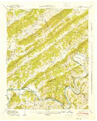
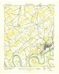 1935 Lenoir City1935 Print · USGSThe Tennessee and Little Tennessee rivers converge here in the mid-1930s, showing a landscape of river bends and ferries. Genealogists can trace family landmarks like Cardwells Chapel, Oral Cem, and the Loudon County Farm.
 - 1935 Map of Elverton
 1935 Elverton1935 Print · USGSMid-1930s Roane County and Morgan County were characterized by river-bottom agriculture and ridgeline settlements before the arrival of the atomic age. Genealogists can trace family landmarks like Gallagher Ferry, Orchard View Sch, and the community of Wheat.
 - 1935 Map of Bethel Valley
 1935 Bethel Valley1935 Print · USGSEastern Tennessee in the mid-1930s was a landscape of ridge-and-valley farms along the Clinch River. Genealogists and historians can trace the foundations of local life through the George Jones Memorial Ch, Wheat, and the White Wing Ferry.
 - 1935 Map of Lovell
 1935 Lovell1935 Print · USGSKnox County was a landscape of river crossings and ridge-top communities in the mid-1930s. Genealogists and local historians can trace family locations through rural landmarks like Gallaher Ferry, Grigsby Chapel, and Grand Caverns.
 - 1936 Map of Windrock
 1936 Windrock1936 Print · USGSAnderson County and its neighbors are captured here in the mid-1930s as industrial rail lines bridged the gap between mountain coal and valley towns. Genealogists can trace family names at Grave Hill Cemetery or locate the old Frost Bottom School.
 - 1936 Map of Norris Dam
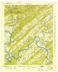
 1936 Norris Dam1936 Print · USGSIn the mid-thirties, the Clinch River valley underwent a total transformation as the new Norris Reservoir reshaped the land. Genealogists can trace family homesteads near Clinton, old burial sites like Leach Cem, and coal towns including Briceville.
 - 1936 Map of Friendship
 1936 Friendship1936 Print · USGSEast Tennessee in the mid-1930s is documented here at a turning point for the river and rail landscape of Knox and Blount counties. Genealogists can trace family names at Mt Zion Ch, Martel Sch, and the riverside settlement of Louisville before the valley landscape was transformed.
 - 1936 Map of Clinton
 1936 Clinton1936 Print · USGSAnderson County settlements and ridge-and-valley farms are captured here in the mid-1930s as the river economy begins to shift. Genealogists can locate family landmarks like Worthington Cem, Spessard Mill, and old congregations at Sulphur Springs Ch.
 - 1940 Map of Lenoir City
 1940 Lenoir City1940 Print · USGSLoudon and Roane counties are captured here just as the Tennessee Valley Authority was reshaping the river landscape. Researchers can trace family-named sites like Brazeale Cem, old schoolhouses such as Oak Grove Sch, and historic river crossings at Bussell Ferry.2 unique versions available
 - 1940 Map of Lovell, 1952 Print
 1940 Lovell1952 Print · USGSKnox and Anderson counties are captured here in the early 1940s, showing a world of river bends and rural ridges. Genealogists and historians can trace the foundations of local life through landmarks like Gallaher Ferry, Grand Caverns, and Estes Cem.
 - 1941 Map of Bethel Valley
 1941 Bethel Valley1941 Print · USGSBethel Valley and the Clinch River are captured here in the early 1940s, just as the regional landscape began to shift. Genealogists and historians can locate early family landmarks like White Wing Ferry, the Wheat settlement, and the George Jones Memorial Ch.3 unique versions available
 - 1941 Map of Lovell
 1941 Lovell1941 Print · USGSThe Clinch River loops and ridge-and-valley topography of Knox County are captured here just before the mid-century. Researchers can trace the routes of the Louisville and Nashville RR and locate rural landmarks like Gallaher Ferry, Bird Chapel, and Scarboro.
 - 1941 Map of Elverton
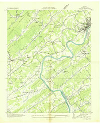
 1941 Elverton1941 Print · USGSThe Clinch and Emory Rivers meet at the dawn of the Tennessee Valley Authority era, just as the Watts Bar Reservoir began to fill. Local historians can trace the foundations of old Roane County through Smallman Mill, Gallaher Ferry, and the County Farm.3 unique versions available
 - 1946 Map of Clinton
 1946 Clinton1946 Print · USGSMid-century Anderson County is captured here just after the war, showing the industrial and rail hub of Clinton and its surrounding agricultural valleys. Researchers can trace family roots through numerous landmarks like Patterson Cem, Sulphur Springs Sch, and Spessard Mill.2 unique versions available
 - 1946 Map of Windrock, 1947 Print
 1946 Windrock1947 Print · USGSThe mining and rail landscape of Anderson County comes into focus in the mid-1940s. Researchers can trace family sites at Robertsville and Frost Bottom, or locate old landmarks like Donovan Sch and the Oliver Springs Cem.2 unique versions available
 - 1952 Map of Windrock, 1954 Print
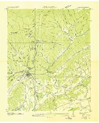
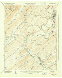
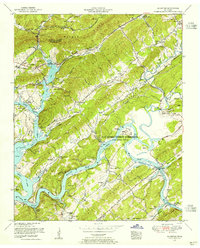
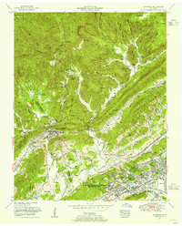 1952 Windrock1954 Print · USGSIn the early fifties, the Anderson County landscape was transforming from a coal-mining region into a center of the atomic age. Genealogists and historians can trace family cemeteries like Grave Hill Cemetery alongside the growth of Oak Ridge and Oliver Springs.2 unique versions available
 - 1952 Map of Clinton, 1956 Print
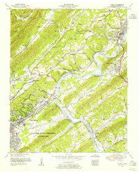 1952 Clinton1956 Print · USGSAnderson County in the early fifties shows a fascinating overlap of traditional rural life and the rise of the secret city. Trace family roots at the Slave cemetery or Sunset Cemetery, and locate old landmarks like Spessard Mill and Jackson Square.2 unique versions available
 - 1953 Map of Chattanooga
 1953 Chattanooga1953 Print · USGSSoutheast Tennessee in the early fifties shows a landscape reshaped by river management and rail power. Trace the rail lines of the Southern Ry through riverside towns or locate the preserved grounds of the Chickamauga and Chattanooga National Military Park.
 - 1953 Map of Lovell, 1954 Print
 1953 Lovell1954 Print · USGSKnox County in the early fifties shows a landscape of strategic importance and rural tradition as the Oak Ridge Area expanded. Genealogists can trace family names through Lebanon Cemetery, Grigsby Chapel, and the settlement at Farragut.2 unique versions available
 - 1953 Map of Lenoir City, 1954 Print
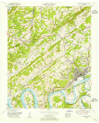 1953 Lenoir City1954 Print · USGSLoudon and Roane counties are shown here in the early fifties, where the winding Tennessee River meets the growing industrial center of Lenoir City. Researchers can trace old family sites and rural infrastructure, from the Browder School and White Wing Church to the river crossings at Huff Ferry.2 unique versions available
 - 1953 Map of Elverton, 1955 Print
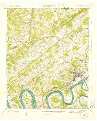
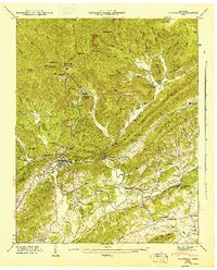
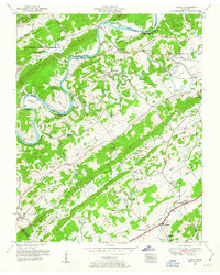
 1953 Elverton1955 Print · USGSThe Roane County hills and the newly formed Watts Bar Lake meet the Oak Ridge Area in the early 1950s. Trace local history through the Slave Cemetery, Coal Hill Church, and family settlements like Elverton.2 unique versions available
Showing maps 1-25 of 73
Top cities near Oak Ridge
- Knoxville historical maps
- Maryville historical maps
- Farragut historical maps
- Clinton historical maps
- Lenoir City historical maps
- Tellico Village historical maps
See more
Top neighborhoods of Oak Ridge
- Emory Valley historical maps
- Jackson Square historical maps
- Emory Heights historical maps
- Emory Hills historical maps
- Scarboro historical maps
- Robertsville historical maps
See more
Frequently asked questions
- What are the different types of historical maps available for Oak Ridge?
- What is the oldest map of Oak Ridge?
- Where can I purchase historical maps of Oak Ridge for my home or office?
- Where can I download high-res historical maps of Oak Ridge?
- Are there historical topographic maps available for Oak Ridge?
- Is there historical aerial imagery available for Oak Ridge?
- Where are historical maps of Oak Ridge sourced from?