2020s Maps of Obion County, Tennessee
Explore 21 historic maps of Obion County from the 2020s. These maps offer a rare glimpse into what life looked like during the 2020s — showing old roads, neighborhoods, homes, and landmarks that have changed or disappeared over time.
Whether you're researching your family's past, planning a metal detecting trip, or studying how Obion County's landscape evolved across the 2020s, these high-resolution maps are a powerful tool for exploring the history of this region.
- Focus on a specific era: All maps on this page are from the 2020s, giving you a focused view of this time period.
- See what’s changed: Compare century-old streets, trails, and buildings to today's modern landscape using overlays and satellite layers.
- Research with precision: Use these maps for genealogy, historical research, land use analysis, or educational projects.
- View, download, or print: Maps are fully viewable online in high resolution, and can be downloaded or printed for your own records.
Start exploring Obion County's history through authentic maps from the 2020s. This is your window into the past.
Obion County, TN maps
(21)- 2022 Map of Rives, 2022 Print
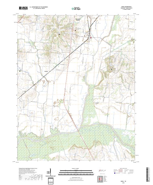 2022 Rives2022 Print · USGSObion County's river bottoms and rural communities are captured here in the early twenty-first century. Researchers can trace family history through local landmarks like Sardis Cem or follow the wetlands surrounding the North Fork Obion River.
 - 2022 Map of Clayton, 2022 Print
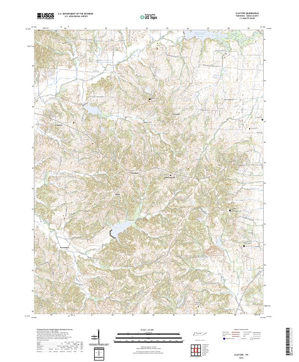 2022 Clayton2022 Print · USGSObion County's rural heartland is captured here in the early twenty-first century, showcasing a landscape of dispersed settlements and historic family lands. Researchers can trace ancestral locations near Old Fremont, Antioch Cem, and Beech Church Cem.
 - 2022 Map of Miston, 2022 Print
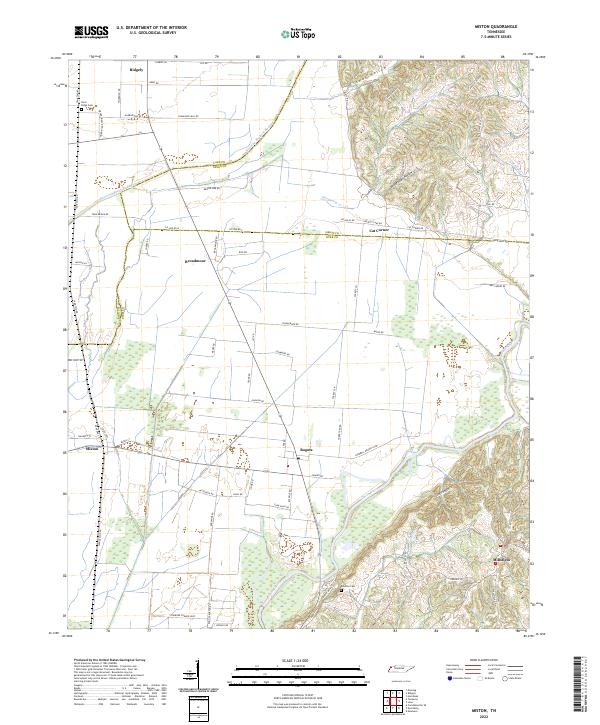 2022 Miston2022 Print · USGSNorthwestern Tennessee at the junction of Lake, Obion, and Dyer Counties reveals a landscape shaped by the Obion River and its floodplain. Trace family roots and local history through Miston, Bogota, and the Horn Ridge Cem.
 - 2022 Map of Rutherford, 2022 Print
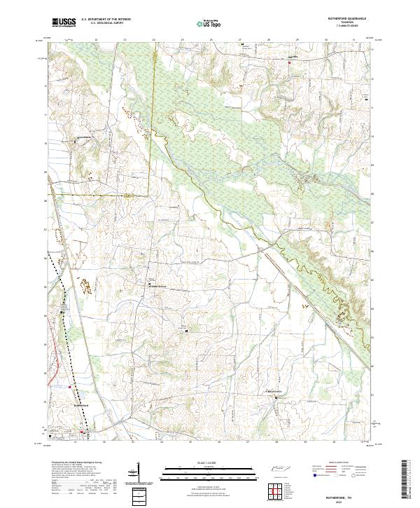 2022 Rutherford2022 Print · USGSWest Tennessee’s river bottomlands and rural communities are captured here in the 2020s. Researchers can locate family landmarks like the Keathley and Peel Family Cem, Beech Grove Cem, and the small settlement of Sidonia.
 - 2022 Map of Obion, 2022 Print
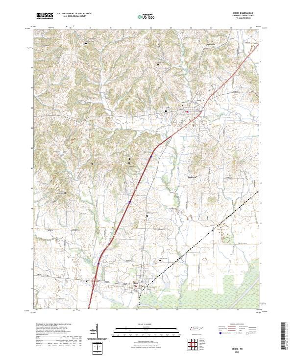 2022 Obion2022 Print · USGSObion County at the start of the 2020s shows a landscape deeply tied to its rural roots and the Obion River bottomlands. Genealogists can trace family heritage through numerous burial sites including Bethlehem Cem, Rose Hill Cem, and Fox Cem.
 - 2022 Map of Gardner, 2022 Print
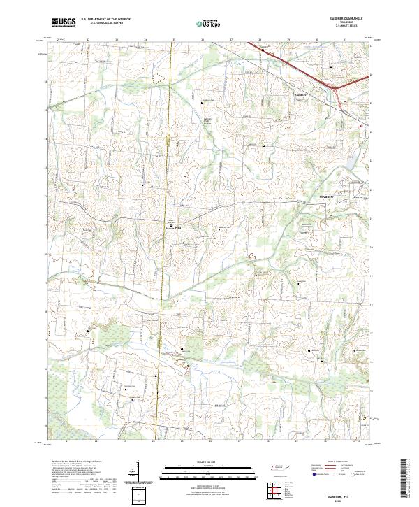 2022 Gardner2022 Print · USGSThe borderlands of Obion and Weakley counties come into focus in this recent survey of rural Tennessee. Genealogists can trace family landmarks through more than a dozen local burial sites such as Callicott Cem, McKinney Cem, and Holland Cem near Mount Pelia.
 - 2022 Map of Lane, 2022 Print
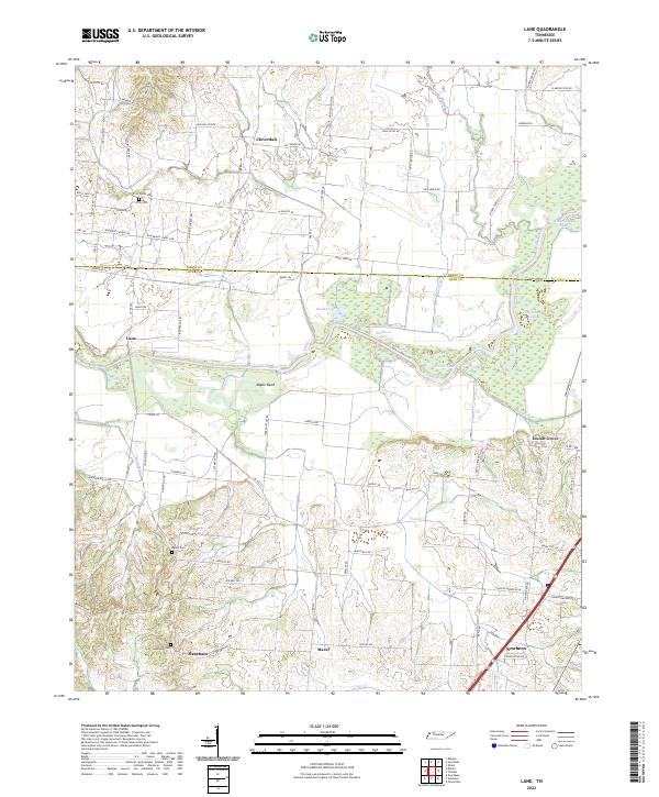 2022 Lane2022 Print · USGSThe Obion River valley and the rural uplands of West Tennessee come into focus in this recent survey. Local historians can trace family roots through several landmarks and burial sites, including Zion Cem, Locust Grove, and the community of Newbern.
 - 2022 Map of McConnell, 2022 Print
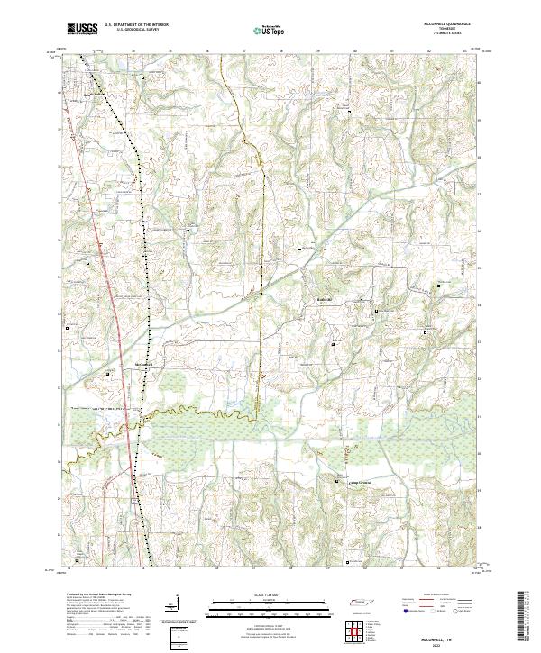 2022 McConnell2022 Print · USGSThis rural corridor of Weakley County and Obion County is shown in 2022 as it surrounds the meandering North Fork Obion River. Researchers can trace local lineage through a dense concentration of burial sites like New Hope Cem, Pate Cem, and Rucker Cem.
 - 2022 Map of Hornbeak, 2022 Print
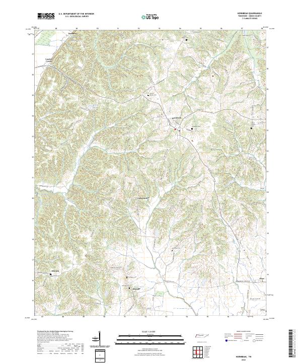 2022 Hornbeak2022 Print · USGSObion County's agricultural heartland is captured in this modern survey of West Tennessee. Genealogists can trace family roots through numerous burial sites like Elbridge Cem and Obion Chapel Cem or explore communities from Hornbeak to Samburg.
 - 2022 Map of Trimble, 2022 Print
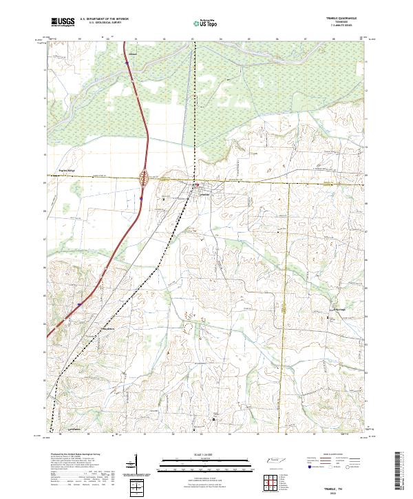 2022 Trimble2022 Print · USGSWest Tennessee’s river bottomlands and rural crossroads are meticulously documented in this recent survey. Genealogists and local historians can trace family-named landmarks and old burial grounds like Jones Cem and Cool Springs Cem near the Obion River.
 - 2022 Map of Cayce, 2022 Print
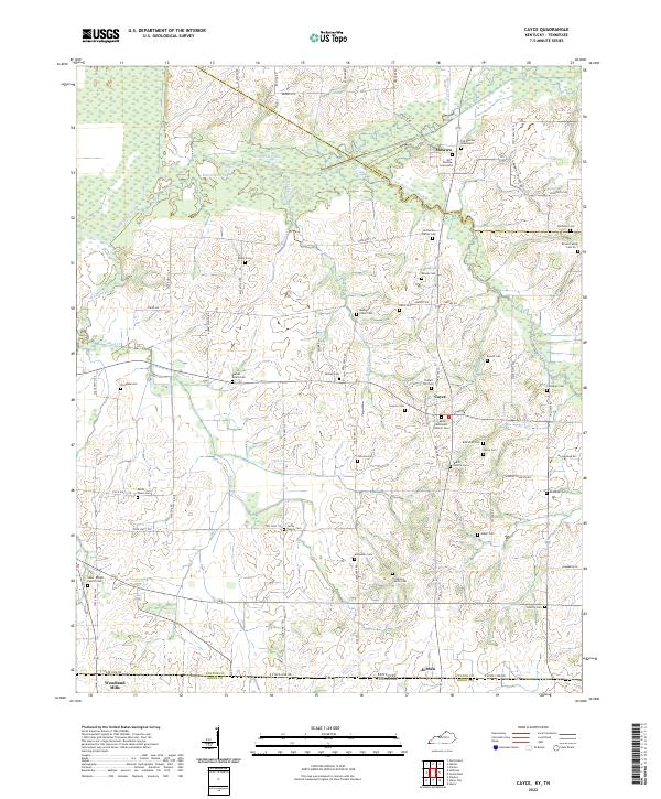 2022 Cayce2022 Print · USGSWestern Kentucky farmland near the Tennessee border shows a complex history of family land ownership and small-town continuity. Genealogists can trace family names through dozens of sites like the Shaw-Knight Family Cem or the Old Moscow Graveyard.
 - 2022 Map of Ridgely, 2022 Print
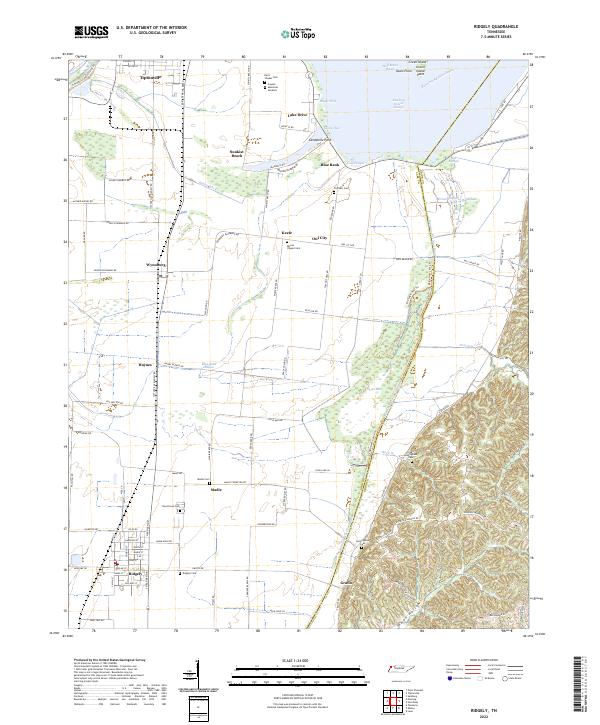 2022 Ridgely2022 Print · USGSLake County's alluvial plains and Reelfoot Lake waterfront are captured here in the early twenty-first century, showing a landscape defined by drainage and levees. Genealogists can locate family burial grounds including Ridgely Cem and Crockett Cem, or trace the path of Running Reelfoot Bayou.
 - 2022 Map of Tiptonville, 2022 Print
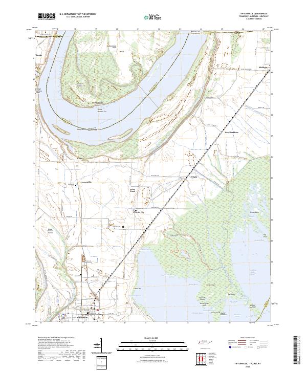 2022 Tiptonville2022 Print · USGSTiptonville and the Mississippi River bottoms of Lake County are captured here in the early twenty-first century as agricultural life continues alongside the shifting river. Researchers can trace ancestral locations near Cronanville and Phillippy, or locate the Lake County Courthouse and Citizen Cem.
 - 2022 Map of Hickman, 2022 Print
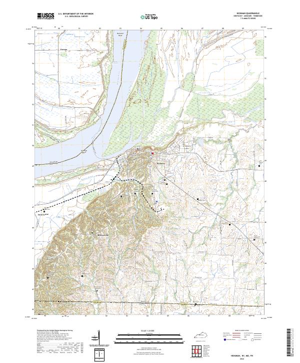 2022 Hickman2022 Print · USGSHickman and the surrounding river bluffs are shown here at the start of the 2020s, highlighting the enduring river-and-road connections of western Kentucky. Researchers can trace ancestral sites like the County Farm Cem and the Dorena-Hickman Ferry.
 - 2022 Map of Union City, 2022 Print
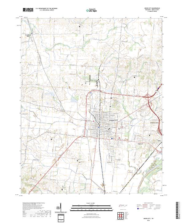 2022 Union City2022 Print · USGSThe county seat of Union City and its surrounding farmsteads are documented here in the early twenty-first century. Researchers can trace historic family lineages through local landmarks such as Unknown Confederate Soldier Cem, Woodland Mills, and the Obion County Courthouse.
 - 2022 Map of Harris, 2022 Print
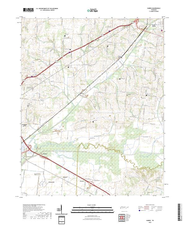 2022 Harris2022 Print · USGSObion County farmland and the Obion River bottomlands are captured here in the early twenty-first century. Researchers can trace ancestral sites through numerous small burial grounds like the Morris Slave Cem and Johnson Grove Cem or locate the quiet crossroads of Pierce Station and Harris.
 - 2022 Map of Bondurant, 2022 Print
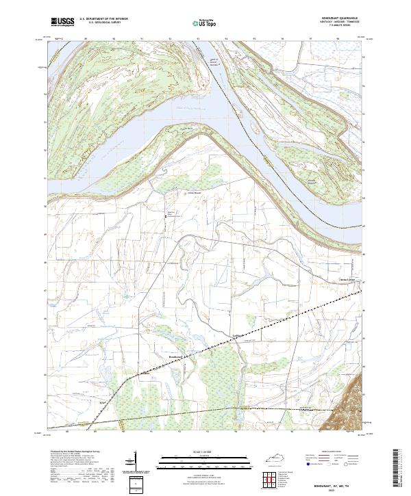 2022 Bondurant2022 Print · USGSThe Mississippi River bottomlands of Kentucky and Tennessee are mapped here during the early 2020s, showing a landscape defined by alluvial plains and flood control. Researchers can trace family roots through the Sassafras Ridge Community Cem or locate the historic sites of Bondurant and Tyler among the winding channels of Hogpen Slough and Willow Pond.
 - 2022 Map of Samburg, 2022 Print
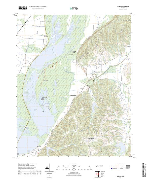 2022 Samburg2022 Print · USGSSamburg and the eastern shores of Reelfoot Lake appear in detail during the early 2020s, showing a landscape defined by complex wetlands and ridge-top settlements. Researchers can trace family names and local landmarks from Roneys Store and Walnut Log to the Crescent Cem on the slopes of Fishgap Hill.
 - 2022 Map of Kenton, 2022 Print
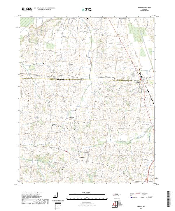 2022 Kenton2022 Print · USGSThe Gibson and Obion county line divides this agricultural landscape as it appeared in recent years. Researchers can trace the layout of rural communities like Mason Hall and Stringtown or locate family burial sites at Bethphage Cem and Sunnyside Cem.
 - 2022 Map of Crutchfield, 2022 Print
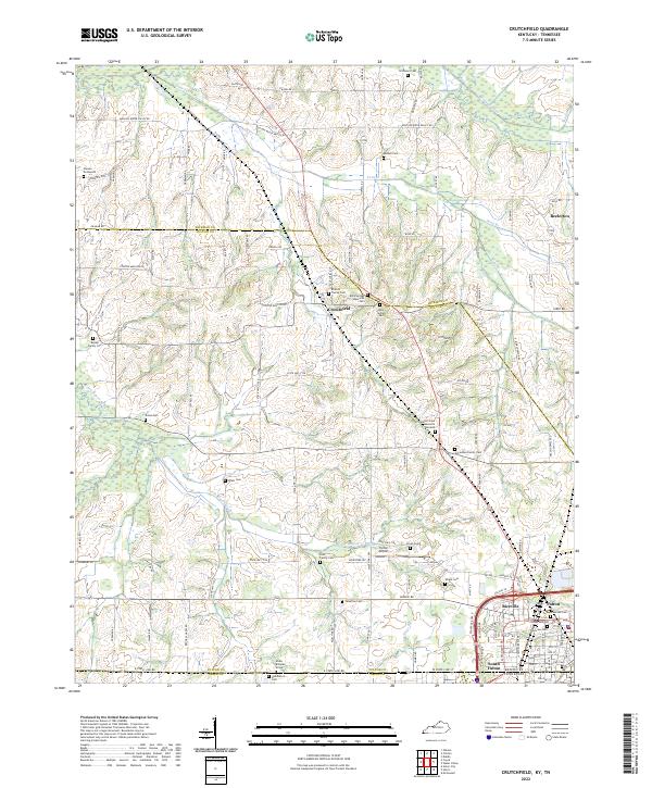 2022 Crutchfield2022 Print · USGSWestern Kentucky and northern Tennessee intersect in this 2020s survey of the rural corridor between Crutchfield and South Fulton. Researchers can trace dozens of family landmarks and cemeteries, including the Isham Browder Grave, Union Cem, and Blair Family Cem.
 - 2022 Map of Water Valley, 2022 Print
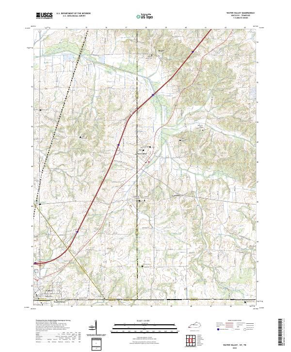 2022 Water Valley2022 Print · USGSThe borderlands of Kentucky and Tennessee come into focus in the early 2020s, centered on the community of Water Valley. Researchers can trace dozens of local burial sites and landmarks including Pleasant Hill Cemetery African American, Camp Beauregard Cemetery, and the historic Feliciana settlement area.
End of results
Showing maps 1-21 of 21
Top cities of Obion County
- Union City historical maps
- South Fulton historical maps
- Troy historical maps
- Obion historical maps
- Hornbeak historical maps
- Rives historical maps
See more
Frequently asked questions
- What are the different types of historical maps available for Obion County?
- What is the oldest map of Obion County?
- Where can I purchase historical maps of Obion County for my home or office?
- Where can I download high-res historical maps of Obion County?
- Are there historical topographic maps available for Obion County?
- Is there historical aerial imagery available for Obion County?
- Where are historical maps of Obion County sourced from?