2000s (21st Century) Maps of Old Patty, Tennessee
Explore 6 historic maps of Old Patty from the 2000s (21st Century). These maps offer a rare glimpse into what life looked like during the 2000s — showing old roads, neighborhoods, homes, and landmarks that have changed or disappeared over time.
Whether you're researching your family's past, planning a metal detecting trip, or studying how Old Patty's landscape evolved across the 2000s, these high-resolution maps are a powerful tool for exploring the history of this region.
- Focus on a specific era: All maps on this page are from the 2000s, giving you a focused view of this time period.
- See what’s changed: Compare century-old streets, trails, and buildings to today's modern landscape using overlays and satellite layers.
- Research with precision: Use these maps for genealogy, historical research, land use analysis, or educational projects.
- View, download, or print: Maps are fully viewable online in high resolution, and can be downloaded or printed for your own records.
Start exploring Old Patty's history through authentic maps from the 2000s. This is your window into the past.
Old Patty, TN maps
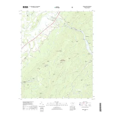
(6)- 2003 Map of Oswald Dome, 2004 Print
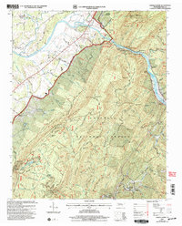 2003 Oswald Dome2004 Print · USGSPolk County, Tennessee, is captured here in the early twenty-first century as a land of deep river gorges and timbered ridges. Researchers can trace rural lineages through sites like Archville, Antioch Cem, and the Hiwassee Union Ch.
 - 2011 Map of Oswald Dome, 2011 Print
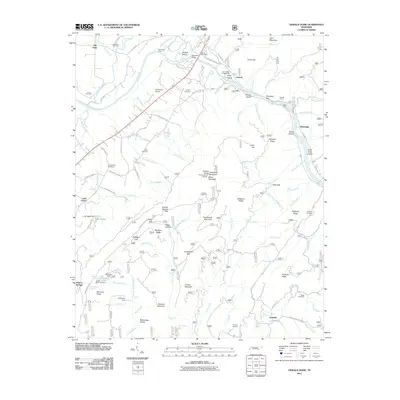 2011 Oswald Dome2011 Print · USGSCovers Old Patty, including Benton Springs, Oak Grove, and other nearby areas
 - 2013 Map of Oswald Dome, 2013 Print
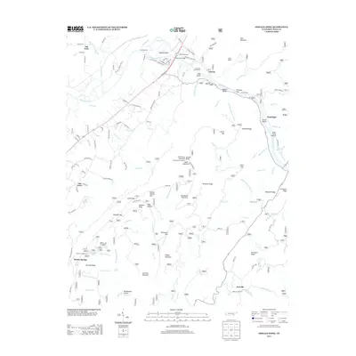 2013 Oswald Dome2013 Print · USGSCovers Old Patty, including Benton Springs, Oak Grove, and other nearby areas
 - 2016 Map of Oswald Dome, 2016 Print
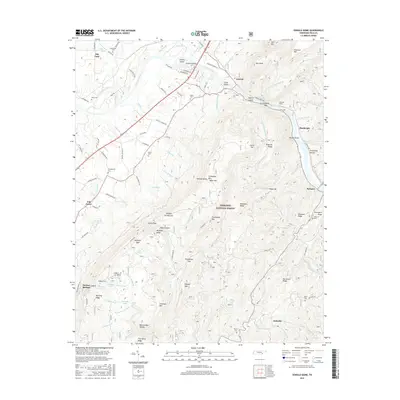 2016 Oswald Dome2016 Print · USGSCovers Old Patty, including Benton Springs, Oak Grove, and other nearby areas
 - 2019 Map of Oswald Dome, 2019 Print
 2019 Oswald Dome2019 Print · USGSCovers Old Patty, including Benton Springs, Oak Grove, and other nearby areas
 - 2022 Map of Oswald Dome, 2022 Print
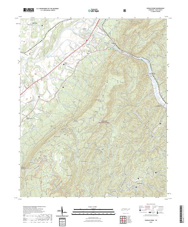 2022 Oswald Dome2022 Print · USGSCovers Old Patty, including Austral, Hambright, and other nearby areas
End of results
Showing maps 1-6 of 6
Top cities near Old Patty
- Cleveland historical maps
- Athens historical maps
- Etowah historical maps
- Englewood historical maps
- Benton historical maps
- Charleston historical maps
See more
Frequently asked questions
- What are the different types of historical maps available for Old Patty?
- What is the oldest map of Old Patty?
- Where can I purchase historical maps of Old Patty for my home or office?
- Where can I download high-res historical maps of Old Patty?
- Are there historical topographic maps available for Old Patty?
- Is there historical aerial imagery available for Old Patty?
- Where are historical maps of Old Patty sourced from?