1960s Maps of Lake-A-Wana, Tennessee
Explore 3 historic maps of Lake-A-Wana from the 1960s. These maps offer a rare glimpse into what life looked like during the 1960s — showing old roads, neighborhoods, homes, and landmarks that have changed or disappeared over time.
Whether you're researching your family's past, planning a metal detecting trip, or studying how Lake-A-Wana's landscape evolved across the 1960s, these high-resolution maps are a powerful tool for exploring the history of this region.
- Focus on a specific era: All maps on this page are from the 1960s, giving you a focused view of this time period.
- See what’s changed: Compare century-old streets, trails, and buildings to today's modern landscape using overlays and satellite layers.
- Research with precision: Use these maps for genealogy, historical research, land use analysis, or educational projects.
- View, download, or print: Maps are fully viewable online in high resolution, and can be downloaded or printed for your own records.
Start exploring Lake-A-Wana's history through authentic maps from the 1960s. This is your window into the past.
Lake-A-Wana, TN maps
(3)- 1960 Map of Chattanooga
 1960 Chattanooga1960 Print · USGSSoutheast Tennessee and the southern Appalachians are shown here at the height of the river-management era. You can trace the valley rail lines and locate Lookout Mountain and the expansive waters of Chickamauga Reservoir.
 - 1964 Map of Chattanooga
 1964 Chattanooga1964 Print · USGSSoutheast Tennessee and the western Carolinas appear in the mid-sixties as a powerhouse of river-driven industry and mountain wilderness. Genealogists and historians can trace rail-town lineages along the Southern Ry or locate family landmarks near Watts Bar Lake and Tellico Plains.
 - 1968 Map of Cave Creek, 1972 Print
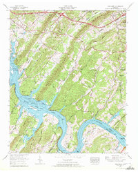 1968 Cave Creek1972 Print · USGSRoane and Loudon Counties are captured here in the late sixties as the Tennessee River's path was managed for conservation and power. Researchers can locate numerous family-named sites like Eblen Cem and Ladd Ch, or trace the winding Hines Creek Road.3 unique versions available
End of results
Showing maps 1-3 of 3
Top cities near Lake-A-Wana
- Oak Ridge historical maps
- Farragut historical maps
- Lenoir City historical maps
- Tellico Village historical maps
- Kingston historical maps
- Harriman historical maps
See more
Frequently asked questions
- What are the different types of historical maps available for Lake-A-Wana?
- What is the oldest map of Lake-A-Wana?
- Where can I purchase historical maps of Lake-A-Wana for my home or office?
- Where can I download high-res historical maps of Lake-A-Wana?
- Are there historical topographic maps available for Lake-A-Wana?
- Is there historical aerial imagery available for Lake-A-Wana?
- Where are historical maps of Lake-A-Wana sourced from?