Old Maps of Scott County, Tennessee for Genealogy
Trace your family roots with 131 historic maps of Scott County. These high-res maps reveal old neighborhoods, homesites, landmarks, and streets — helping you uncover where your ancestors lived and how the area evolved over time.
- Explore historic neighborhoods: Identify where your relatives may have lived in the 1800s or 1900s.
- Compare maps over time: Trace the changes in streets, buildings, and landmarks for multi-generational research.
- Perfect for genealogy & ancestry research: Used by family historians and researchers to map out lineage and migration.
These maps are an incredible resource for exploring your personal connection to Scott County's past.
Scott County, TN maps
(131)- 1890 Map of Williamsburg
 1890 Williamsburg1890 Print · USGSThe Kentucky and Tennessee borderlands come alive in the late nineteenth century as the coal industry and railroads expand. Genealogists can trace family roots in Williamsburgh or locate early industrial sites like Beaver Mines and Steels Mill.2 unique versions available
 - 1893 Map of Briceville
 1893 Briceville1893 Print · USGSThe northern Tennessee coalfields and valleys come to life in the 1890s, when mining and rail were transforming the ridges of the Cumberland. Local historians can trace the paths of the Knoxville and Ohio R. R. and early settlements like Jacksboro, Coal Creek, and Oliver Springs.
 - 1894 Map of Williamsburg
 1894 Williamsburg1894 Print · USGSThe Cumberland River valley and the Kentucky-Tennessee borderlands are captured here during the late nineteenth-century coal and rail expansion. Researchers can trace early industrial sites like Beaver Mines and Kensee Coal Mine or locate family roots in Whitley and Chitwood.5 unique versions available
 - 1895 Map of Wartburg
 1895 Wartburg1895 Print · USGSThe Cumberland Plateau of the late nineteenth century comes to life through this record of high-country towns and rivers. Genealogists can trace early homesteads and rail stops from Oneida down to Wartburg, including the distinct colonies at Rugby and Allardt.
 - 1895 Map of Briceville
 1895 Briceville1895 Print · USGSThe Cumberland Mountains and Powell Valley met a rapidly expanding railroad network in the late nineteenth century. Trace early industrial footprints and family-named hollows from Briceville and Clinton to the coal-rich slopes of Big Mountain.
 - 1896 Map of Wartburg
 1896 Wartburg1896 Print · USGSThe Cumberland Plateau in the late nineteenth century is captured here as railroads began to transform the mountain economy. Trace the development of utopian Rugby, the county seat at Wartburg, and remote crossings like Island Ford or Big Lick Gap.6 unique versions available
 - 1896 Map of Briceville
 1896 Briceville1896 Print · USGSEast Tennessee's coal and rail corridors are captured here in the late nineteenth century as the industrial landscape of the Cumberland Plateau matured. Researchers can trace early family homesteads and transport hubs through Briceville, Clinton, and the Southern RR line.6 unique versions available
 - 1934 Map of Barthell
 1934 Barthell1934 Print · USGSMcCreary County during the late 1920s reveals a landscape of industrial outposts and river-bound settlements at the edge of the Tennessee line. Researchers can trace the Kentucky and Tennessee Railway corridor or find family roots at Kidds Crossing, Cooperative, and Laurel Hill Ch.
 - 1934 Map of Pall Mall
 1934 Pall Mall1934 Print · USGSThe Kentucky-Tennessee borderlands appear in great detail during the late interwar period, showing a landscape of remote mountain hamlets and schools. Genealogists can locate family landmarks such as Edwards Chapel, Slickford, and the Parmley Sch among the cliffs and ridges.
 - 1935 Map of Gobey
 1935 Gobey1935 Print · USGSMorgan County is captured during the mid-1930s when logging and rail lines defined the life of the plateau. Trace the timber economy through the Lumber Company rail spurs and find family landmarks like Elizabeth Sch and Macedonia Ch.
 - 1936 Map of Hogbell Gap
 1936 Hogbell Gap1936 Print · USGSThe Tennessee Cumberland Mountains are captured during the mid-1930s, revealing a landscape of high ridges and critical mountain passes. Researchers can trace the rugged topography of Bird Mountain and locate early landmarks such as Hogbell Gap and The Garden Spot.
 - 1936 Map of Block
 1936 Block1936 Print · USGSCoal and rail define this Campbell County landscape in the mid-thirties as mining operations carved into the ridges of Fork Mountain. Trace the steep industrial Incline paths and rail sidings serving Turley, Hickey, and Block.2 unique versions available
 - 1936 Map of Pioneer
 1936 Pioneer1936 Print · USGSCampbell County’s coal and rail corridor is captured here in the mid-1930s as federal agencies mapped the Tennessee Valley. Researchers can trace the Southern railroad through the mountains and locate sites like the Abandoned Mine and the village of Pioneer.
 - 1936 Map of Duncan Flats
 1936 Duncan Flats1936 Print · USGSUpland Anderson County life is recorded here during the mid-1930s as federal agencies mapped the high ridges. Genealogists can locate the Duncan Flats Sch and trace the proximity of family homes to Duncan Flats and the Incline.
 - 1946 Map of Gobey
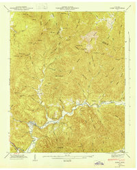 1946 Gobey1946 Print · USGSThe Morgan and Scott County border comes alive in the mid-1940s, showing a region defined by timber transport and mountain hollows. Genealogists can trace family names through Mc Cartt Cem, Elizabeth School, and the winding Emory River Railroad.
 - 1946 Map of Block, 1947 Print
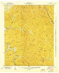 1946 Block1947 Print · USGSThe northern Tennessee coalfields are shown at their mid-century peak, where rail lines and steep inclines carve through the ridges. Genealogists and historians can trace the foundations of Smoky Junction, the Round Rock Sch, and family sites at Jerry Fields.2 unique versions available
 - 1946 Map of Fork Mountain, 1947 Print
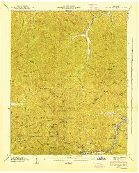 1946 Fork Mountain1947 Print · USGSThe rugged intersections of Scott, Morgan, and Anderson counties are captured here in the mid-1940s, highlighting a remote mountain landscape shaped by the timber and coal industries. Researchers can locate vanished infrastructure like the Lumber Railroad and trace family roots at the Beech Grove Cem and Mooretown.2 unique versions available
 - 1946 Map of Pioneer, 1947 Print
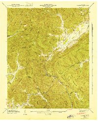 1946 Pioneer1947 Print · USGSThe Cumberland Plateau highlands near the Campbell and Scott county line appear here in the mid-1940s. Genealogists and historians can trace old mountain routes to Pioneer, Valley View Cem, and the industrial Incline.
 - 1947 Map of Duncan Flats
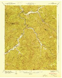 1947 Duncan Flats1947 Print · USGSThe high ridges of the Cumberland Mountains meet the Anderson and Campbell county lines in the late 1940s. Genealogists and hikers can trace remote family sites like Ben Phillips Cem, old mountain schools, and the riverside settlement at Rosedale.
 - 1952 Map of Helenwood, 1953 Print
 1952 Helenwood1953 Print · USGSThe Cumberland Plateau in the early fifties shows a rugged landscape shaped by the New River and the coal industry. Genealogists can trace family names through dozens of sites like the Pike Cem, Tunnel Hill Sch, and Mountain View.4 unique versions available
 - 1952 Map of Honey Creek, 1953 Print
 1952 Honey Creek1953 Print · USGSScott and Fentress counties are documented in the early 1950s, showing a landscape of river-carved ridges and remote homesteads. Genealogists can trace family connections at Blevins Cem or locate the sites of Honey Creek School and Zenith.6 unique versions available
 - 1952 Map of Rugby, 1953 Print
 1952 Rugby1953 Print · USGSThe Morgan and Scott County borderlands appear here in the early fifties as a landscape of timbered hills and railway towns. Researchers can trace family history through numerous burial sites like Rugby Cem and Webb Cem or follow the Southern Railway through Sixteen Tunnel.4 unique versions available
 - 1952 Map of Robbins, 1953 Print
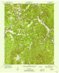 1952 Robbins1953 Print · USGSCoal and rail dominate this Scott County landscape in the early fifties, where mountain ridges are etched with Strip Mines. Researchers can trace rural life at Campground Sch and family roots at Shipard Cem or Black Creek Cem.3 unique versions available
 - 1952 Map of Fork Mountain, 1954 Print
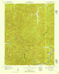 1952 Fork Mountain1954 Print · USGSThe Cumberland Plateau landscape at the start of the fifties reveals a coal-driven economy where mountain hamlets like Mahan Village and Moores Camp line the river valleys. Genealogists can trace family heritage through sites like Beech Grove Church and the Reeves-Daugherty Cemetery.5 unique versions available
 - 1952 Map of Pioneer, 1954 Print
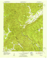 1952 Pioneer1954 Print · USGSUpper East Tennessee's coal and timber country is shown here in the early fifties as the Southern Railway linked mountain gaps and hollows. Genealogists can trace family roots through the Meredith Cemetery and sites like Rockhouse School or New Canaan Church.4 unique versions available
Showing maps 1-25 of 131
Top cities of Scott County
Frequently asked questions
- What are the different types of historical maps available for Scott County?
- What is the oldest map of Scott County?
- Where can I purchase historical maps of Scott County for my home or office?
- Where can I download high-res historical maps of Scott County?
- Are there historical topographic maps available for Scott County?
- Is there historical aerial imagery available for Scott County?
- Where are historical maps of Scott County sourced from?