1940s Maps of Sevierville, Tennessee
Explore 5 historic maps of Sevierville from the 1940s. These maps offer a rare glimpse into what life looked like during the 1940s — showing old roads, neighborhoods, homes, and landmarks that have changed or disappeared over time.
Whether you're researching your family's past, planning a metal detecting trip, or studying how Sevierville's landscape evolved across the 1940s, these high-resolution maps are a powerful tool for exploring the history of this region.
- Focus on a specific era: All maps on this page are from the 1940s, giving you a focused view of this time period.
- See what’s changed: Compare century-old streets, trails, and buildings to today's modern landscape using overlays and satellite layers.
- Research with precision: Use these maps for genealogy, historical research, land use analysis, or educational projects.
- View, download, or print: Maps are fully viewable online in high resolution, and can be downloaded or printed for your own records.
Start exploring Sevierville's history through authentic maps from the 1940s. This is your window into the past.
Sevierville, TN maps
(5)- 1940 Map of New Market
 1940 New Market1940 Print · USGSJefferson County's rural and industrial landscape is captured here in the years before the war, centered on the New Market rail corridor. Genealogists and historians can locate family landmarks like Dinwoody Mill, trace the SOUTHERN railroad line, and find old burial grounds such as Caldwell Cem.2 unique versions available
 - 1940 Map of Pigeon Forge
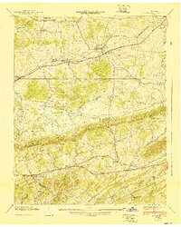
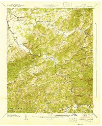
 1940 Pigeon Forge1940 Print · USGSSevier County during the pre-war period shows the early development of Pigeon Forge and the established county seat at Sevierville. Genealogists and historians can trace family locations near Mc Mahan Cem, Henderson Springs, and the Williamsburg Sch.
 - 1940 Map of Boyds Creek
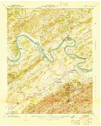 1940 Boyds Creek1940 Print · USGSThe French Broad River valley of East Tennessee comes alive in the pre-war era, showing a landscape defined by river meanders and mountain ridges. Genealogists can trace family footprints at Trundle Cemetery, the John Sevier Monument, and historic river crossings like Huffaker Ferry.3 unique versions available
 - 1940 Map of Kykers Ferry
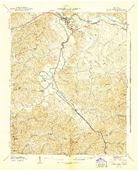
 1940 Kykers Ferry1940 Print · USGSThe river-and-road networks of Sevier and Jefferson counties are preserved here just before the mid-century. Genealogists can trace family landmarks and river crossings like KYKERS FERRY, Kodak (P O), and the Oak Grove Cem.2 unique versions available
 - 1940 Map of Richardson Cove
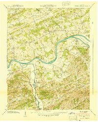
 1940 Richardson Cove1940 Print · USGSSevier County mountain life is captured here in the early 1940s, showing a landscape defined by river-valley settlements and rural academies. Genealogists can trace family footprints through the Smoky Mtn Academy, Boogertown, and the Williams Cem.4 unique versions available
End of results
Showing maps 1-5 of 5
Top cities near Sevierville
- Knoxville historical maps
- Morristown historical maps
- Jefferson City historical maps
- Pigeon Forge historical maps
- Gatlinburg historical maps
- Mascot historical maps
See more
Top neighborhoods of Sevierville
Frequently asked questions
- What are the different types of historical maps available for Sevierville?
- What is the oldest map of Sevierville?
- Where can I purchase historical maps of Sevierville for my home or office?
- Where can I download high-res historical maps of Sevierville?
- Are there historical topographic maps available for Sevierville?
- Is there historical aerial imagery available for Sevierville?
- Where are historical maps of Sevierville sourced from?