Old Maps of Vinegar Hill, Tennessee for Hiking & Exploration
Hike through history with 17 historic maps of Vinegar Hill. Explore old trails, ghost towns, and forgotten backroads — perfect for outdoor adventurers and local explorers.
- Rediscover forgotten places: Map out old mining camps, roads, and footpaths that no longer exist on modern maps.
- Layer with modern tools: Combine with LiDAR or satellite views to plan hikes through historical terrain.
- Made for exploration: Popular among hikers, overlanders, and local history lovers.
Use these maps to find adventure and explore the hidden past of Vinegar Hill.
Vinegar Hill, TN maps
(17)- 1897 Map of Bristol
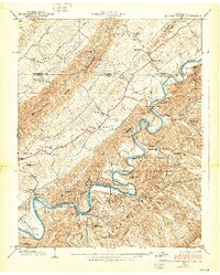
 1897 Bristol1897 Print · USGSThe Tennessee-Virginia borderlands in the late nineteenth century were a landscape of steep ridges and river-dependent commerce. Genealogists can trace family homesteads near Bickley Mill, locate river crossings like Childress Ferry, or find early rail stops along the Norfolk and Western RR.
 - 1902 Map of Bristol
 1902 Bristol1902 Print · USGSThe interstate border region around Bristol appears here at the start of the twentieth century, defined by its deep mountain ridges and river valleys. Researchers can trace the early industrial footprint of the area through numerous landmarks like Bickley Mill, Kings Mill, and the Norfolk and Western RR.6 unique versions available
 - 1934 Map of Holston Valley
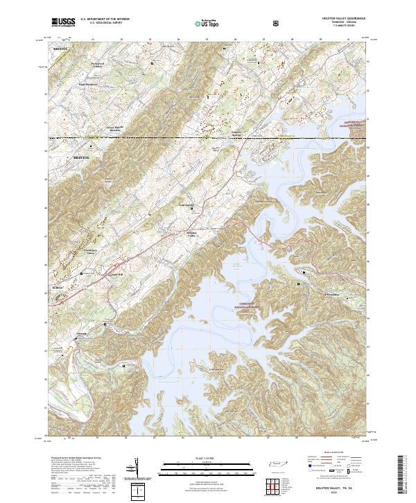
 1934 Holston Valley1934 Print · USGSThe Holston Valley was a landscape of river fords and rural outposts in the mid-1930s. Genealogists and historians can trace family ties through Stuffels Cem, locate old mills like Old Kings Mill, and find river crossings at Shady Ford.
 - 1935 Map of Beaver Creek
 1935 Beaver Creek1935 Print · USGSThe border city of Bristol serves as a bustling rail and highway hub in the mid-1930s. Genealogists and historians can trace family locations near Beidleman Mill, Mountain View Cemetery, and the Twin States Fairgrounds.2 unique versions available
 - 1938 Map of Holston Valley
 1938 Holston Valley1938 Print · USGSThe Holston River valley at the Tennessee-Virginia border in the late 1930s shows a landscape of river fords and mountain ridges. Researchers can trace family history through sites like Stuffels Cem, King Mill, and the Holston Valley Sch before the landscape was altered.2 unique versions available
 - 1955 Map of Johnson City
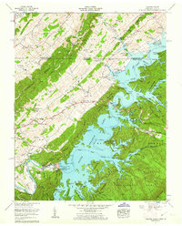
 1955 Johnson City1955 Print · USGSEast Tennessee and the bordering highlands of Virginia and Kentucky appear here during the post-war industrial boom. You can trace the complex network of mountain ridges and new TVA lakes, from Johnson City to the coalfields near Middlesboro and Lynch.
 - 1957 Map of Johnson City, 1966 Print
 1957 Johnson City1966 Print · USGSUpper East Tennessee and Southwest Virginia are shown here during the mid-sixties transition of the Appalachians. Researchers can trace the industrial rail hubs of Kingsport, the sprawling waters of Cherokee Lake, and the historic Cumberland Gap.
 - 1960 Map of Johnson City
 1960 Johnson City1960 Print · USGSUpper East Tennessee and the surrounding tri-state area are shown in the mid-fifties during the height of the TVA reservoir era. Trace the industrial rail lines of the Southern and Louisville and Nashville between Kingsport and Johnson City.
 - 1960 Map of Holston Valley, 1962 Print
 1960 Holston Valley1962 Print · USGSSullivan County and the Virginia borderland are shown here at a moment when the recently completed South Holston Dam had transformed the river valley. Genealogists and historians can locate old landmarks like Scalf Cemetery, Sinking Spring Church, and the Bristol Caverns.4 unique versions available
 - 1963 Map of Johnson City
 1963 Johnson City1963 Print · USGSThe Tri-Cities and the surrounding Appalachian ridges are shown in detail during the early sixties, highlighting the era's vital rail and river networks. Genealogists and historians can trace the routes of the Clinchfield RR and locate settlements from Rogersville to Elizabethton.
 - 1981 Map of Bristol
 1981 Bristol1981 Print · USGSAppalachia and the Tri-Cities region are shown at a peak of industrial and rail development in the early eighties. Researchers can trace the Clinchfield Railroad through the mountains or find local landmarks like King College and the Holston Army Ammunition Plant.2 unique versions available
 - 2003 Map of Holston Valley, 2004 Print
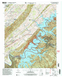 2003 Holston Valley2004 Print · USGSThe South Fork Holston River valley and the expanding suburbs of Bristol are captured here at the turn of the twenty-first century. Genealogists can locate family landmarks like Ketron Cem, Stophel Cem, and the Holston Valley Sch.
 - 2011 Map of Holston Valley, 2011 Print
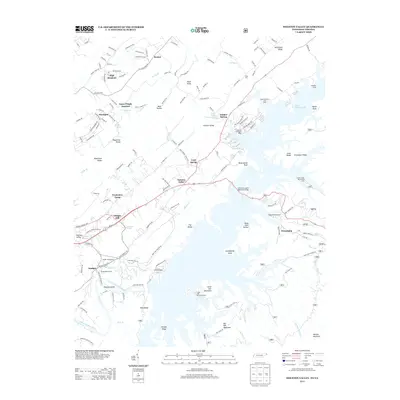
 2011 Holston Valley2011 Print · USGSCovers Vinegar Hill, including Bristol, Goose Pimple Junction, and other nearby areas
 - 2013 Map of Holston Valley, 2013 Print
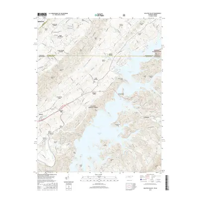
 2013 Holston Valley2013 Print · USGSCovers Vinegar Hill, including Bristol, Goose Pimple Junction, and other nearby areas
 - 2016 Map of Holston Valley, 2016 Print
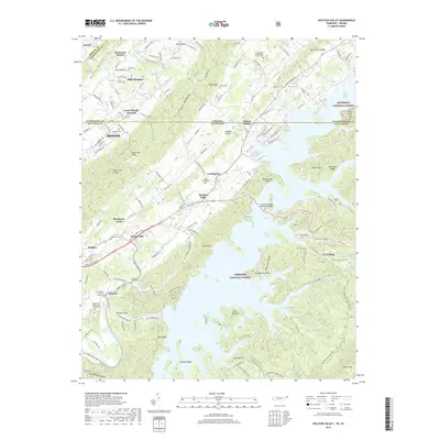
 2016 Holston Valley2016 Print · USGSCovers Vinegar Hill, including Bristol, Goose Pimple Junction, and other nearby areas
 - 2019 Map of Holston Valley, 2019 Print
 2019 Holston Valley2019 Print · USGSCovers Vinegar Hill, including Bristol, Goose Pimple Junction, and other nearby areas
 - 2022 Map of Holston Valley, 2022 Print
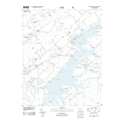
 2022 Holston Valley2022 Print · USGSThe Tennessee-Virginia borderlands appear here in the early twenty-first century as a landscape of managed forests and deep reservoir waters. Genealogists can trace family names at Cleveland Presbyterian Church or burial sites like Sauls Cem and Cowan-Delaney Cem.
End of results
Showing maps 1-17 of 17
Top cities near Vinegar Hill
- Johnson City historical maps
- Bristol historical maps
- Bristol historical maps
- Elizabethton historical maps
- Abingdon historical maps
- Blountville historical maps
See more
Frequently asked questions
- What are the different types of historical maps available for Vinegar Hill?
- What is the oldest map of Vinegar Hill?
- Where can I purchase historical maps of Vinegar Hill for my home or office?
- Where can I download high-res historical maps of Vinegar Hill?
- Are there historical topographic maps available for Vinegar Hill?
- Is there historical aerial imagery available for Vinegar Hill?
- Where are historical maps of Vinegar Hill sourced from?