1930s Maps of Austin Springs, Tennessee
Explore 2 historic maps of Austin Springs from the 1930s. These maps offer a rare glimpse into what life looked like during the 1930s — showing old roads, neighborhoods, homes, and landmarks that have changed or disappeared over time.
Whether you're researching your family's past, planning a metal detecting trip, or studying how Austin Springs's landscape evolved across the 1930s, these high-resolution maps are a powerful tool for exploring the history of this region.
- Focus on a specific era: All maps on this page are from the 1930s, giving you a focused view of this time period.
- See what’s changed: Compare century-old streets, trails, and buildings to today's modern landscape using overlays and satellite layers.
- Research with precision: Use these maps for genealogy, historical research, land use analysis, or educational projects.
- View, download, or print: Maps are fully viewable online in high resolution, and can be downloaded or printed for your own records.
Start exploring Austin Springs's history through authentic maps from the 1930s. This is your window into the past.
Austin Springs, TN maps
(2)- 1935 Map of Bluff City
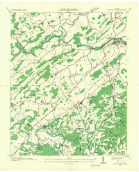 1935 Bluff City1935 Print · USGSBluff City and Piney Flats thrive during the mid-1930s along the rail-and-river corridors of Upper East Tennessee. Genealogists can trace family landmarks like Allison Mill, Poplar Ridge Ch, and the many islands along the Watauga River.2 unique versions available
 - 1939 Map of Bluff City, 1954 Print
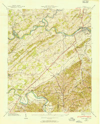 1939 Bluff City1954 Print · USGSSullivan County at the dawn of the 1940s reveals a landscape defined by the winding South Fork Holston and Watauga rivers. You can trace the sites of early industry and education at Shaver Mill, Austin Springs, and the Poplar Ridge Sch.2 unique versions available
End of results
Showing maps 1-2 of 2
Top cities near Austin Springs
- Johnson City historical maps
- Kingsport historical maps
- Bristol historical maps
- Bristol historical maps
- Elizabethton historical maps
- Bloomingdale historical maps
See more
Frequently asked questions
- What are the different types of historical maps available for Austin Springs?
- What is the oldest map of Austin Springs?
- Where can I purchase historical maps of Austin Springs for my home or office?
- Where can I download high-res historical maps of Austin Springs?
- Are there historical topographic maps available for Austin Springs?
- Is there historical aerial imagery available for Austin Springs?
- Where are historical maps of Austin Springs sourced from?