2020s Maps of Wayne County, Tennessee
Explore 18 historic maps of Wayne County from the 2020s. These maps offer a rare glimpse into what life looked like during the 2020s — showing old roads, neighborhoods, homes, and landmarks that have changed or disappeared over time.
Whether you're researching your family's past, planning a metal detecting trip, or studying how Wayne County's landscape evolved across the 2020s, these high-resolution maps are a powerful tool for exploring the history of this region.
- Focus on a specific era: All maps on this page are from the 2020s, giving you a focused view of this time period.
- See what’s changed: Compare century-old streets, trails, and buildings to today's modern landscape using overlays and satellite layers.
- Research with precision: Use these maps for genealogy, historical research, land use analysis, or educational projects.
- View, download, or print: Maps are fully viewable online in high resolution, and can be downloaded or printed for your own records.
Start exploring Wayne County's history through authentic maps from the 2020s. This is your window into the past.
Wayne County, TN maps
(18)- 2022 Map of Martins Mills, 2022 Print
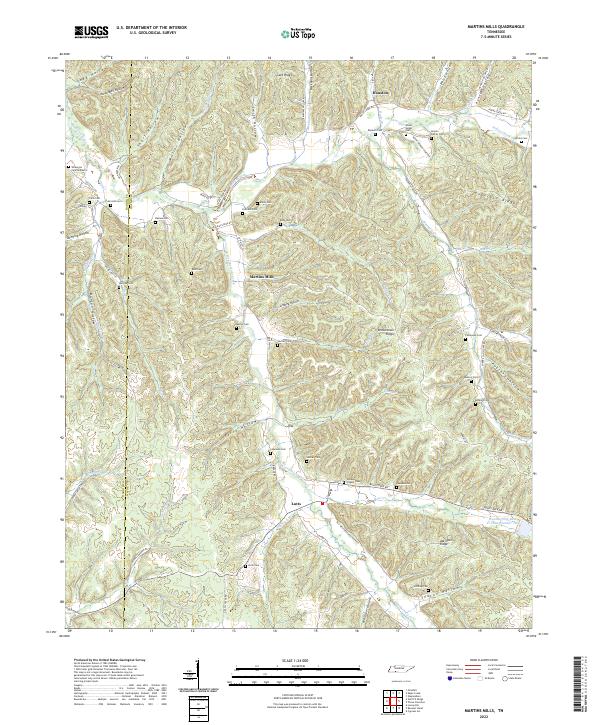 2022 Martins Mills2022 Print · USGSThe Tennessee borderlands of Wayne and Hardin Counties are captured here in a period of enduring rural character. Genealogists can trace family lines through dozens of remote sites like the Nowlin Family Cem, Greeson Chapel Cem, and the community of Lutts.
 - 2022 Map of Eagle Creek, 2022 Print
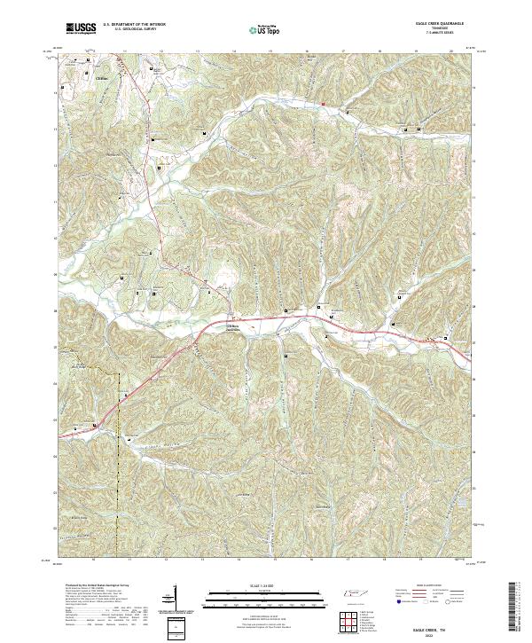 2022 Eagle Creek2022 Print · USGSModern-day Wayne County and Hardin County maintain their rural character across a terrain of ridges and deep hollows. Genealogists can trace family heritage at Evans Chapel Cem, Philadelphia Cem, and along Hardin Cr.
 - 2022 Map of Waynesboro, 2022 Print
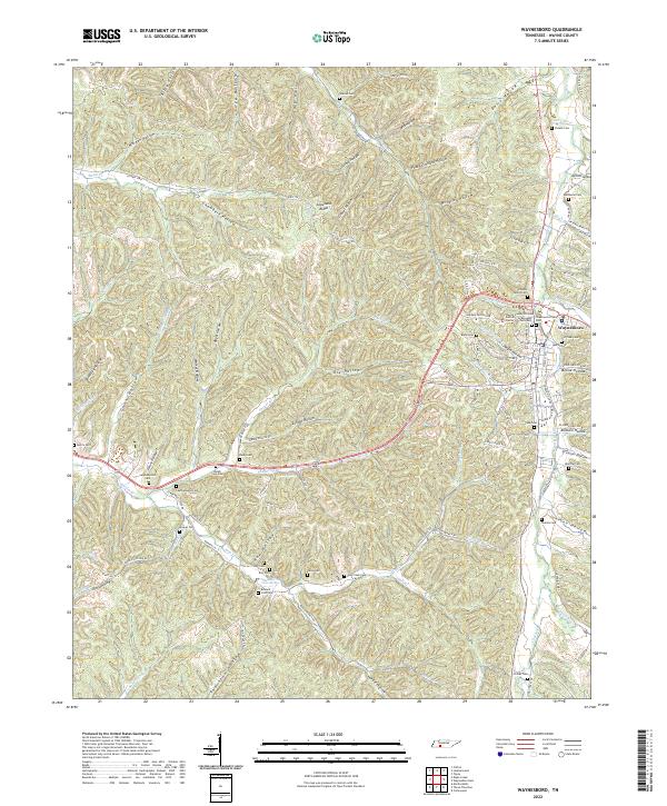 2022 Waynesboro2022 Print · USGSWaynesboro and the surrounding Wayne County hollows are captured here in the early twenty-first century. Genealogists can trace family legacies through numerous rural burial sites including Choate Cem, Leatherwood Cem, and the Greeson Family Cem.
 - 2022 Map of Whitten, 2022 Print
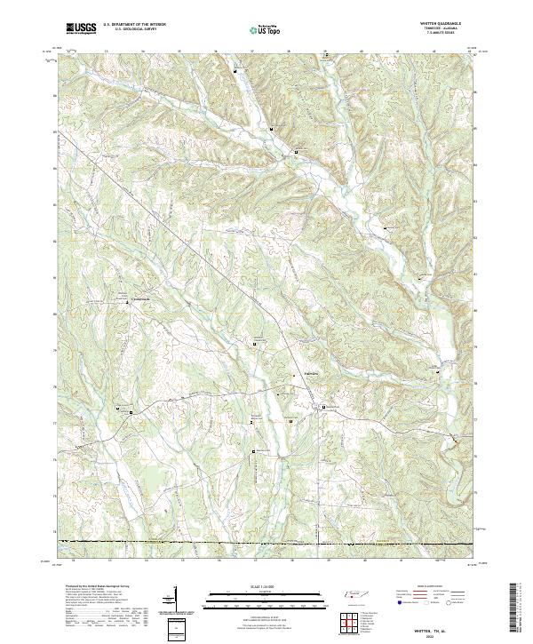 2022 Whitten2022 Print · USGSThe Tennessee-Alabama borderlands come into focus in the early 2020s, showing a landscape defined by high ridges and deep creek bottoms. Genealogists can locate numerous burial sites like Whittens Cross Roads Cem and Railroad Cem near Crossroads.
 - 2022 Map of Riverside, 2022 Print
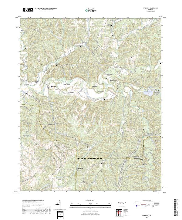 2022 Riverside2022 Print · USGSThe Tennessee backcountry near the Buffalo River is captured here in the early 2020s, showing a landscape of deep hollows and high ridges. Genealogists can trace family names at Mannie Cemetery and Banks Cemetery or locate the old Swiss Colony site.
 - 2022 Map of Topsy, 2022 Print
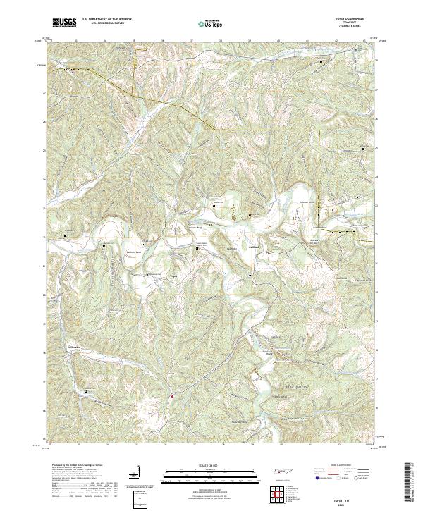 2022 Topsy2022 Print · USGSWayne County's winding river valleys and ridge-top roads are documented here in the early twenty-first century. Genealogists and local historians can trace family locations near Salem Baptist Church Cem, Bachelor Bend, and the settlement of Topsy.
 - 2022 Map of Clifton, 2022 Print
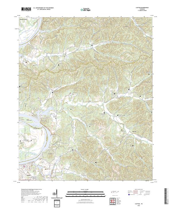 2022 Clifton2022 Print · USGSThe Tennessee River bend at Clifton is captured here in the early twenty-first century, showcasing a landscape of deep hollows and historic riverfront settlements. Researchers can trace numerous family burial sites and landmarks like the Henry Culp Family Plot, Carrollville Hill, and Glenkirk Island.
 - 2022 Map of Waynesboro East, 2022 Print
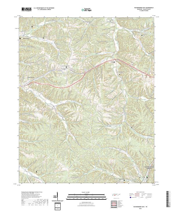 2022 Waynesboro East2022 Print · USGSThe eastern edges of the county seat and the crossing of the historic Natchez Trace Parkway define this recent topographic portrait of middle Tennessee. Genealogists can locate numerous family burial grounds, including Fortyeight Forge Cem and Bedford Cem, among the deep hollows and ridges.
 - 2022 Map of Leatherwood, 2022 Print
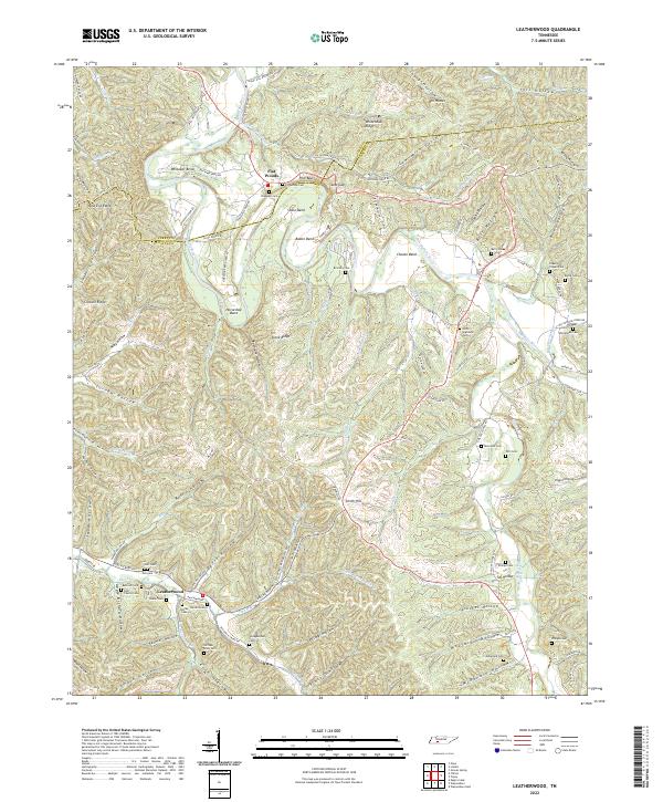 2022 Leatherwood2022 Print · USGSThe Buffalo River valley in Wayne and Perry counties is shown here during the early twenty-first century. Genealogists and local historians can locate numerous family burial grounds including Flatwoods Cem, Holt Cem, and William Riley Cem near the historic Leatherwood settlement.
 - 2022 Map of Three Churches, 2022 Print
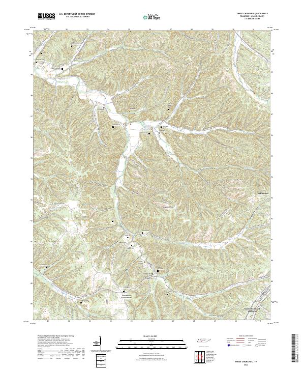 2022 Three Churches2022 Print · USGSWayne County, Tennessee, is mapped here in the modern era, showing a landscape of family-named ridges and deep hollows. Genealogists can trace family burial sites like Cypert-Copeland-Lay Cem and Downing-Byler Cem near the Natchez Trace Parkway.
 - 2022 Map of Collinwood, 2022 Print
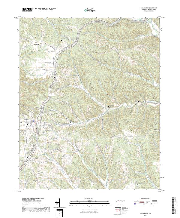 2022 Collinwood2022 Print · USGSWayne County in the early twenty-first century is defined by the historic corridor of the Natchez Trace Parkway and the town of Collinwood. Researchers can trace local lineage through a dozen rural burial grounds, including Shawnette Cem, Daniel Horton Cem, and McGlamery Cem.
 - 2022 Map of Ransom Stand, 2022 Print
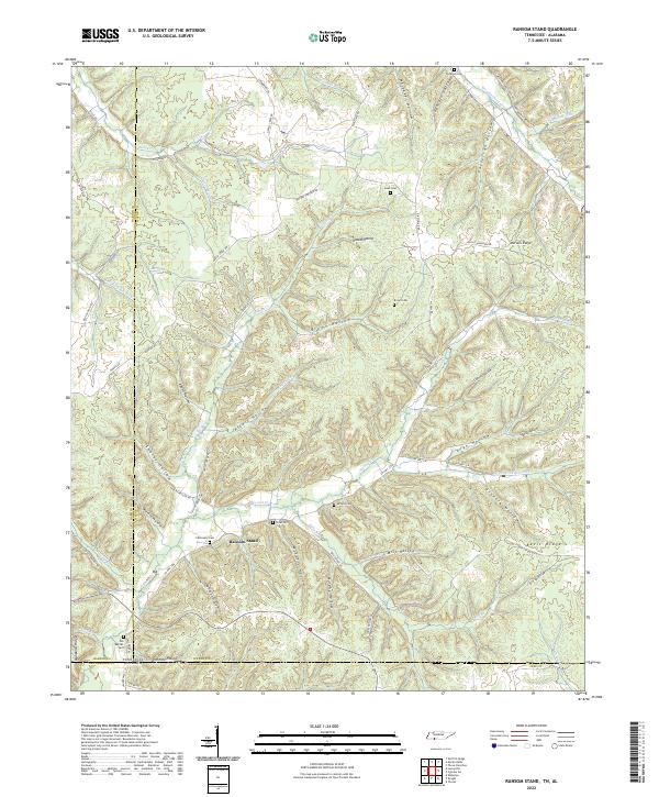 2022 Ransom Stand2022 Print · USGSThe Tennessee and Alabama borderlands are shown here in recent detail, where the settlement of Ransom Stand sits among high ridges. Local historians can trace family burial sites like Stribling Cem and Brown Cem tucked away in drainage hollows like Mill Hollow.
 - 2022 Map of Ovilla, 2022 Print
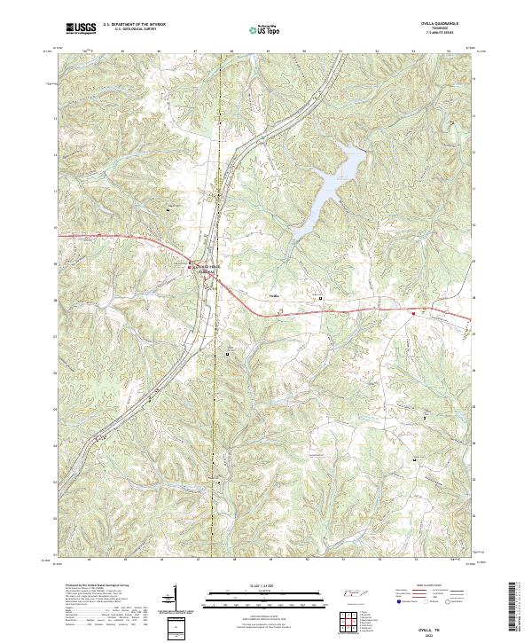 2022 Ovilla2022 Print · USGSThe Lawrence County uplands are documented here in the early twenty-first century, centered on the community of Ovilla. Genealogists can trace numerous family burial sites across the ridges, including Highland Cemetery, Fish Trapp Cemetery, and Owl Hollow Cemetery.
 - 2022 Map of Cypress Inn, 2022 Print
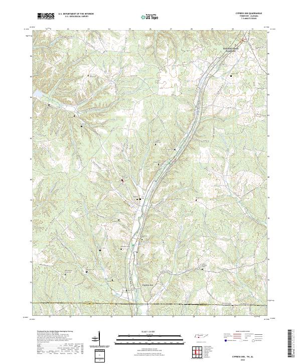 2022 Cypress Inn2022 Print · USGSCypress Inn sits at the Tennessee-Alabama border during the early 2020s, anchoring a landscape of deep-rooted family history. Genealogists can trace lineage across dozens of rural burial sites like Old Chestnut Grove Cem, McAllister Cem, and Susan Moore Cem.
 - 2022 Map of Saint Joseph, 2022 Print
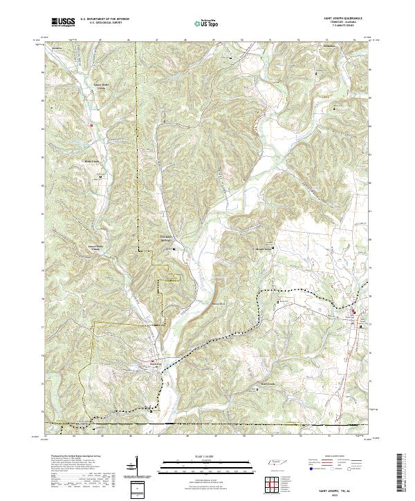 2022 Saint Joseph2022 Print · USGSThe Tennessee and Alabama state line meets in this 2022 survey of the Shoal Creek valley as it appeared in the early twenty-first century. Researchers can trace family history through numerous rural burial sites like Shiloh Cem and the landmarks of Iron City and Wayland Springs.
 - 2022 Map of Westpoint, 2022 Print
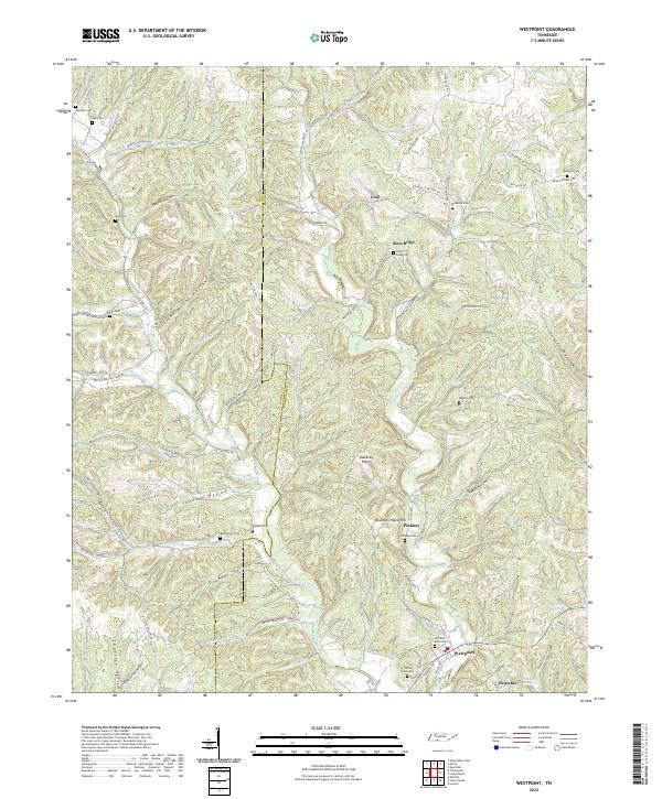 2022 Westpoint2022 Print · USGSWestpoint and the surrounding Tennessee borderlands are mapped here in the early twenty-first century, showing a landscape defined by deep hollows and ridge-top settlements. Genealogists can trace family locations through numerous rural burial sites like Bethlehem Cem, Old West Point Cem, and Wisdom Cem.
 - 2022 Map of Bath Springs, 2022 Print
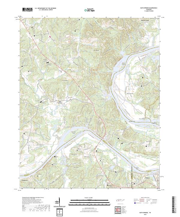 2022 Bath Springs2022 Print · USGSThe Tennessee River valley at the Decatur and Hardin county line comes alive in this 2022 survey. Genealogists can trace family names across dozens of sites including Slater Cem, Lott Landing Cem, and the historic Bath Springs Baptist Church.
 - 2022 Map of Olivehill, 2022 Print
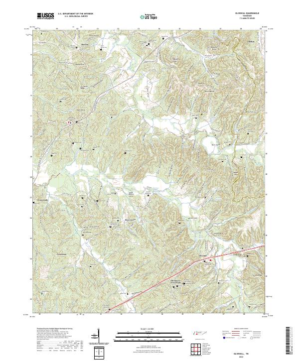 2022 Olivehill2022 Print · USGSEastern Hardin County life is centered around the creek valleys and hollows of Olivehill and Clifton. Genealogists can trace family names through the Dillon Farm Cem, Havana Church, and the Northcutt Elementary school grounds.
End of results
Showing maps 1-18 of 18
Top cities of Wayne County
Frequently asked questions
- What are the different types of historical maps available for Wayne County?
- What is the oldest map of Wayne County?
- Where can I purchase historical maps of Wayne County for my home or office?
- Where can I download high-res historical maps of Wayne County?
- Are there historical topographic maps available for Wayne County?
- Is there historical aerial imagery available for Wayne County?
- Where are historical maps of Wayne County sourced from?