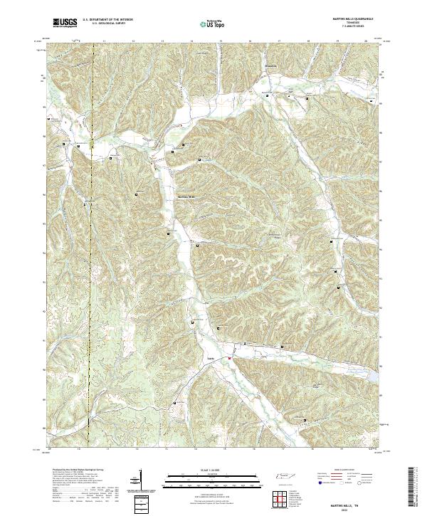
2022 Map of Martins Mills
USGS Topo · Published 2022About this map
Indian Creek and Weatherford Creek carve a deeply dissected landscape across the Hardin Co and Wayne Co border. This area of Tennessee is characterized by an exceptional density of family-named burial grounds and small communities like Lutts, Martins Mills, and Houston. The mapping of cemetery sites such as Nowlin Family Cem, Stribling Cem, and Wilkerson Cem Number 2 provides significant data for genealogical research, pinpointing ancestral locations across numerous hollows and ridges. The topography is defined by prominent high ground like Copeland Ridge and Gant Ridge, while the local transport network follows the winding creek beds and hollows. Notable landmarks include the Lutts Church and the Weatherford-Bear Cr Lake Number Two reservoir, illustrating the rural infrastructure and land use patterns that have long defined this portion of the Highland Rim.
Find a feature on this map
88 named features on this map. Tap any name to fly to it.
Don’t see what you’re looking for? This feature index may not catch every label — zoom into the map to look around manually.
Map Details
Editions of this 2022 Martins Mills Map
This is the sole edition of this map. No revisions or reprints were ever made.
Other maps of this area

1905 · Waynesboro
USGS Topo · 1:125,000

1936 · Wolf Pit Ridge
USGS Topo · 1:24,000

1936 · Eagle Creek
USGS Topo · 1:24,000

1936 · Olivehill
USGS Topo · 1:24,000

1936 · Cypress Inn
USGS Topo · 1:24,000

1936 · Three Churches
USGS Topo · 1:24,000

1936 · Ransom Stand
USGS Topo · 1:24,000

1936 · Lowryville
USGS Topo · 1:24,000

1936 · Waynesboro
USGS Topo · 1:24,000

1936 · Martins Mills
USGS Topo · 1:24,000