Old Maps of Mooney, Tennessee
Explore 11 old maps of Mooney, spanning from 1905 to today. These high-resolution historic maps reveal how streets, neighborhoods, landmarks, and natural features evolved over time — perfect for genealogy, metal detecting, research, and local history exploration.
What you can do with these maps:
- See how Mooney changed over time: Compare historical maps to modern-day views to trace roads, homesites, rail lines & more.
- View detailed metadata: Each map includes creators, publishers, year, scale, and archive source.
- Overlay maps with satellite & LiDAR: Visualize the past alongside modern tools to explore terrain & human change.
- Trusted historical sources: Maps sourced from the USGS, Library of Congress, and other archives.
- Access maps your way: View online, download high-res files, or order prints for personal or research use.
Start exploring old maps of Mooney to uncover forgotten places, hidden landmarks, and the deep history beneath your feet.
Mooney, TN maps
(11)- 1905 Map of Waynesboro
 1905 Waynesboro1905 Print · USGSWayne County and the Tennessee-Alabama borderlands are captured here at the start of the century, showing a network of river landings and old stage stands. Researchers can trace the Nathez Trace and locate historic community hubs like Martins Mills, Whittens Stand, and Clifton.2 unique versions available
 - 1936 Map of Clifton
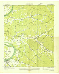 1936 Clifton1936 Print · USGSThe Tennessee River corridor around Clifton was a network of active landings and rural ridge communities during the mid-1930s. Researchers can trace ancestral locations through several family-named cemeteries like Tucker Cem and Prater Cem, or map old river crossings such as Clifton Ferry.
 - 1949 Map of Clifton, 1952 Print
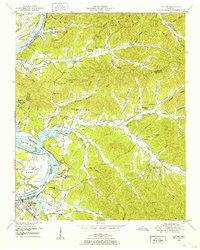 1949 Clifton1952 Print · USGSThe riverfront town of Clifton and its surrounding ridges are captured in the late 1940s as the Tennessee River valley adapted to the impacts of Kentucky Lake. Genealogists can trace family landmarks and community nodes like Peters Landing, New Zion Ch, and the Lone Chestnut Cem.4 unique versions available
 - 1956 Map of Columbia, 1960 Print
 1956 Columbia1960 Print · USGSMiddle Tennessee in the mid-fifties presents a landscape of established river towns and critical rail hubs before the arrival of the modern interstate system. Researchers can trace the routes of the Louisville and Nashville railroad or locate historic landmarks like Stones River National Military Park and the Tennessee National Wildlife Refuge.6 unique versions available
 - 1968 Map of Clifton, 1977 Print
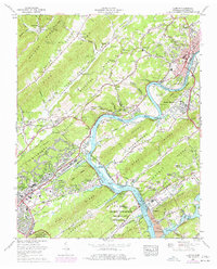 1968 Clifton1977 Print · USGSThe Clinch River corridor and the restricted atomic energy zones of the late sixties reveal a landscape of federal industry and traditional ridge settlements. Trace family roots at Sulphur Spring Cem or explore the mid-century growth of South Clinton and Oak Ridge.
 - 1985 Map of Lawrenceburg
 1985 Lawrenceburg1985 Print · USGSMiddle Tennessee and Northern Alabama are captured in the mid-1980s, showcasing a landscape of high ridges and winding river valleys. Genealogists and historians can trace rail lines like the Seaboard System Railroad or locate community landmarks such as Saint Marys Church and Three Churches.2 unique versions available
 - 2010 Map of Clifton, 2010 Print
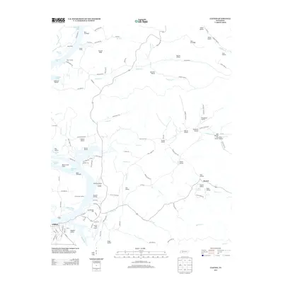
 2010 Clifton2010 Print · USGSCovers Mooney, including Clifton, Wayne County, and other nearby areas
 - 2013 Map of Clifton, 2013 Print
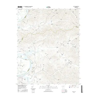
 2013 Clifton2013 Print · USGSCovers Mooney, including Clifton, Wayne County, and other nearby areas
 - 2016 Map of Clifton, 2016 Print
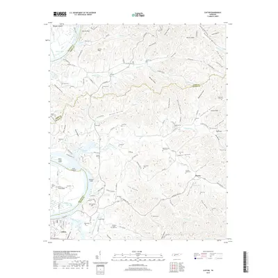
 2016 Clifton2016 Print · USGSCovers Mooney, including Clifton, Wayne County, and other nearby areas
 - 2019 Map of Clifton, 2019 Print
 2019 Clifton2019 Print · USGSCovers Mooney, including Clifton, Wayne County, and other nearby areas
 - 2022 Map of Clifton, 2022 Print
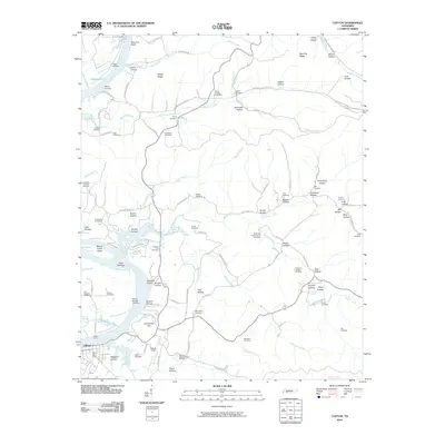
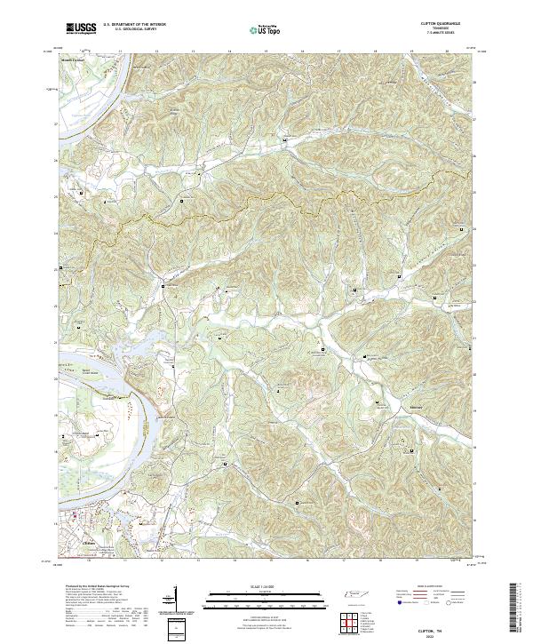 2022 Clifton2022 Print · USGSThe Tennessee River bend at Clifton is captured here in the early twenty-first century, showcasing a landscape of deep hollows and historic riverfront settlements. Researchers can trace numerous family burial sites and landmarks like the Henry Culp Family Plot, Carrollville Hill, and Glenkirk Island.
End of results
Showing maps 1-11 of 11
Top cities near Mooney
- Clifton historical maps
- Parsons historical maps
- Waynesboro historical maps
- Collinwood historical maps
- Linden historical maps
- Decaturville historical maps
Frequently asked questions
- What are the different types of historical maps available for Mooney?
- What is the oldest map of Mooney?
- Where can I purchase historical maps of Mooney for my home or office?
- Where can I download high-res historical maps of Mooney?
- Are there historical topographic maps available for Mooney?
- Is there historical aerial imagery available for Mooney?
- Where are historical maps of Mooney sourced from?