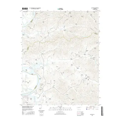
2016 Map of Clifton
USGS Topo · Published 2016About this map
Clifton serves as the focal point for this survey along the Tennessee River, where the waterway expands into Kentucky Lake. The landscape is defined by the significant river-bend geography of Clifton Bend, with prominent river features like Glenkirk Island, Beech Creek Island, and Russ Towhead dotting the channel. On the heights above the river, Carrollville Hill overlooks the surrounding valley, a region characterized by numerous hollows and ridges such as Kittrell Ridge and New Era Ridge.
Find a feature on this map
139 named features on this map. Tap any name to fly to it.
Don’t see what you’re looking for? This feature index may not catch every label — zoom into the map to look around manually.
Map Details
Editions of this 2016 Clifton Map
This is the sole edition of this map. No revisions or reprints were ever made.
Other maps of this area

1905 · Waynesboro
USGS Topo · 1:125,000

1936 · Eagle Creek
USGS Topo · 1:24,000

1936 · Olivehill
USGS Topo · 1:24,000

1936 · Bath Springs
USGS Topo · 1:24,000

1936 · Linden
USGS Topo · 1:24,000

1936 · Leatherwood
USGS Topo · 1:24,000

1936 · Clifton
USGS Topo · 1:24,000

1936 · Perryville
USGS Topo · 1:24,000

1936 · Waynesboro
USGS Topo · 1:24,000

1936 · Pope
USGS Topo · 1:24,000