1930s Maps of Fairview, Tennessee
Explore 3 historic maps of Fairview from the 1930s. These maps offer a rare glimpse into what life looked like during the 1930s — showing old roads, neighborhoods, homes, and landmarks that have changed or disappeared over time.
Whether you're researching your family's past, planning a metal detecting trip, or studying how Fairview's landscape evolved across the 1930s, these high-resolution maps are a powerful tool for exploring the history of this region.
- Focus on a specific era: All maps on this page are from the 1930s, giving you a focused view of this time period.
- See what’s changed: Compare century-old streets, trails, and buildings to today's modern landscape using overlays and satellite layers.
- Research with precision: Use these maps for genealogy, historical research, land use analysis, or educational projects.
- View, download, or print: Maps are fully viewable online in high resolution, and can be downloaded or printed for your own records.
Start exploring Fairview's history through authentic maps from the 1930s. This is your window into the past.
Fairview, TN maps
(3)- 1930 Map of White Bluff, 1953 Print
 1930 White Bluff1953 Print · USGSMiddle Tennessee in the 1930s is defined by the serpentine bends of the Harpeth River and the steam-era dominance of the Nashville Chattanooga and St Louis RR. Genealogists and historians can locate vanished country schools like Opossum Sch and trace early road networks including the Dickson Turnpike.
 - 1933 Map of White Bluff
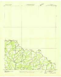
 1933 White Bluff1933 Print · USGSThe Tennessee river country in the early thirties is defined here by the winding loops of the Harpeth River and the rail line through White Bluff. Genealogists and researchers can trace rural life through landmarks like Mound Bottom, Frog Pond Ch, and Opossum Sch.
 - 1936 Map of Craigfield
 1936 Craigfield1936 Print · USGSThe Hickman and Williamson county border comes alive in the mid-1930s, showing a rural Tennessee landscape defined by narrow creek valleys and the Basin Divide. Genealogists can locate family-named sites like McCord Cem, Tidwell Sch, and Shady Grove Ch.
End of results
Showing maps 1-3 of 3
Top cities near Fairview
- Nashville historical maps
- Franklin historical maps
- Spring Hill historical maps
- Dickson historical maps
- Ashland City historical maps
- White Bluff historical maps
See more
Top neighborhoods of Fairview
- New Hope historical maps
- Fairview Heights historical maps
- Glenhaven historical maps
- Green Valley historical maps
- Hallview Meadows historical maps
- Kenny Brook historical maps
See more
Frequently asked questions
- What are the different types of historical maps available for Fairview?
- What is the oldest map of Fairview?
- Where can I purchase historical maps of Fairview for my home or office?
- Where can I download high-res historical maps of Fairview?
- Are there historical topographic maps available for Fairview?
- Is there historical aerial imagery available for Fairview?
- Where are historical maps of Fairview sourced from?