1900s (20th Century) Maps of Franklin, Tennessee
Explore 18 historic maps of Franklin from the 1900s (20th Century). These maps offer a rare glimpse into what life looked like during the 1900s — showing old roads, neighborhoods, homes, and landmarks that have changed or disappeared over time.
Whether you're researching your family's past, planning a metal detecting trip, or studying how Franklin's landscape evolved across the 1900s, these high-resolution maps are a powerful tool for exploring the history of this region.
- Focus on a specific era: All maps on this page are from the 1900s, giving you a focused view of this time period.
- See what’s changed: Compare century-old streets, trails, and buildings to today's modern landscape using overlays and satellite layers.
- Research with precision: Use these maps for genealogy, historical research, land use analysis, or educational projects.
- View, download, or print: Maps are fully viewable online in high resolution, and can be downloaded or printed for your own records.
Start exploring Franklin's history through authentic maps from the 1900s. This is your window into the past.
Franklin, TN maps
(18)- 1909 Map of Franklin
 1909 Franklin1909 Print · USGSWilliamson County at the start of the twentieth century remains a landscape of historic pikes and rail-side villages. Genealogists can locate family homesteads near landmarks like Thompsons Station, Leipers Fork, and the Boiling Spring Academy.2 unique versions available
 - 1936 Map of Spring Hill
 1936 Spring Hill1936 Print · USGSThe Tennessee and Maury county line area is captured here in the mid-1930s as a landscape of rural schoolhouses and family cemeteries. Local historians can trace the Louisville and Nashville RR corridor and find landmarks like Spring Hill Sta, New Town Cem, and Mt Lavergne Sch.
 - 1936 Map of Bethesda, 1969 Print
 1936 Bethesda1969 Print · USGSSouthern Williamson County in the mid-thirties remains a landscape of tightly knit rural settlements and family homesteads. Genealogists can trace ancestral land near Bethesda through numerous small burial grounds like Pointer Cem and Evans Cem.2 unique versions available
 - 1942 Map of Lebanon, 1944 Print
 1942 Lebanon1944 Print · USGSMiddle Tennessee at the start of the war years reveals a landscape of historic homesteads and burgeoning military infrastructure. Genealogists and historians can trace family locations near The Hermitage, follow the Tennessee Central rail lines, or locate the newly established Smyrna Air Base.
 - 1946 Map of Leipers Fork, 1966 Print
 1946 Leipers Fork1966 Print · USGSPost-war Williamson County comes into focus in this mid-century survey of the river valleys and ridges west of Franklin. Genealogists can locate family-named sites like Smith Cem and Perkins Cem or trace the rural crossroads of Leipers Fork and Southall.2 unique versions available
 - 1946 Map of Bethesda, 1974 Print
 1946 Bethesda1974 Print · USGSWilliamson County's rural heartland is captured here in the mid-1940s, showing a landscape defined by the Tennessee River Valley Divide. Researchers can trace dozens of family burial sites like Hardeman Cem and old schoolhouses including Westwood Sch.
 - 1946 Map of Spring Hill, 1975 Print
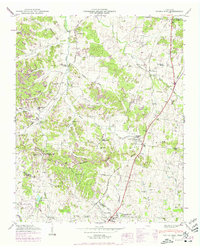 1946 Spring Hill1975 Print · USGSMid-century Middle Tennessee comes into focus as the Louisville and Nashville railroad tracks cut through the hills of Maury and Williamson Counties. Genealogists and historians can trace family plots like Harrison Cem and Patton Cem alongside landmarks such as Thompsons Station and the Mt Laverne School.3 unique versions available
 - 1949 Map of Leipers Fork
 1949 Leipers Fork1949 Print · USGSWilliamson County in the late 1940s reveals a landscape of tight-knit valley communities and historic river crossings. Genealogists and researchers can locate family sites like Hogeye Ch, Hillsboro Sch, and the Smith Cem along the Harpeth River.
 - 1949 Map of Franklin
 1949 Franklin1949 Print · USGSMid-century Williamson County centers on the thriving town of Franklin and the winding Harpeth River valley before the era of modern subdivision. Genealogists can trace family heritage through dozens of sites like Confederate Cem, Mallory Sch, and the Rest Haven Cem.3 unique versions available
 - 1949 Map of Bethesda
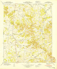 1949 Bethesda1949 Print · USGSSouthern Williamson County appears here in the late 1940s, showing a landscape defined by the Tennessee Duck River Valley Divide. Genealogists can trace family roots through dozens of local sites like Sprott Cem, Bethesda Sch, and the community of Peytonsville.3 unique versions available
 - 1949 Map of Spring Hill
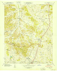 1949 Spring Hill1949 Print · USGSSpring Hill and Thompsons Station are shown here in the late 1940s as central hubs for the local rail and road networks. Genealogists can trace family-named sites such as Harrison Cem, West Harpeth School, and McCormack Crossing along the old pike.
 - 1956 Map of Columbia, 1960 Print
 1956 Columbia1960 Print · USGSMiddle Tennessee in the mid-fifties presents a landscape of established river towns and critical rail hubs before the arrival of the modern interstate system. Researchers can trace the routes of the Louisville and Nashville railroad or locate historic landmarks like Stones River National Military Park and the Tennessee National Wildlife Refuge.6 unique versions available
 - 1957 Map of Nolensville, 1958 Print
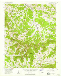 1957 Nolensville1958 Print · USGSMid-century Williamson and Davidson Counties reveal a landscape of family farms and rural churches before modern development. Genealogists can trace ancestral ties through Battle Cem, Pettus Cem, and community centers like Nolensville School.4 unique versions available
 - 1981 Map of Franklin
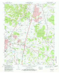 1981 Franklin1981 Print · USGSFranklin and Brentwood appear during a transformative era of growth south of Nashville in the early eighties. Family historians can trace numerous pioneer burial sites such as Primm Cem and McConnico Cem alongside landmarks like Ropers Knob.2 unique versions available
 - 1981 Map of Leipers Fork, 1982 Print
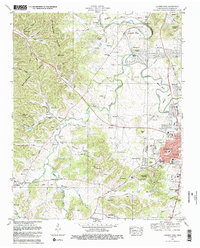 1981 Leipers Fork1982 Print · USGSFranklin and the rural stretches of the West Harpeth River valley are captured in the early eighties as residential growth began to meet historic farmsteads. Genealogists and local historians can trace legacy sites from the Indian Mound and Slave Cem to the Battle Ground Academy.3 unique versions available
 - 1982 Map of Bethesda, 1983 Print
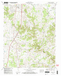 1982 Bethesda1983 Print · USGSThe rolling hills and hollows of Williamson County are captured here in the early 1980s, documenting a landscape of deep-rooted family farms and rural communities. Genealogists can trace hundreds of family names across Hardeman Cem, Peytonsville, and Bethesda.2 unique versions available
 - 1985 Map of Murfreesboro, 1986 Print
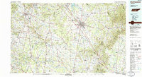 1985 Murfreesboro1986 Print · USGSMiddle Tennessee in the mid-1980s shows a landscape of growing towns and deep-rooted rural outposts. Local researchers can trace old family lines near Bell Buckle, locate landmarks like Donnel Chapel, or explore the grounds of Henry Horton State Park and Hoovers Gap.
 - 1997 Map of Franklin, 2002 Print
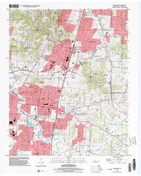 1997 Franklin2002 Print · USGSFranklin and Brentwood underwent significant growth in the late nineties as residential estates expanded across the Tennessee hills. Genealogists can trace family heritage through numerous burial grounds including Owen Cem, Crockett Cem, and the Confederate Cem.
End of results
Showing maps 1-18 of 18
Top cities near Franklin
- Nashville historical maps
- Smyrna historical maps
- Brentwood historical maps
- Columbia historical maps
- Spring Hill historical maps
- La Vergne historical maps
See more
Top neighborhoods of Franklin
- Westfield Estates historical maps
- Boyd Mill Estates historical maps
- Orleans Estates historical maps
- Charlton Green historical maps
- Country Roads historical maps
- Spencer Creek Place historical maps
See more
Frequently asked questions
- What are the different types of historical maps available for Franklin?
- What is the oldest map of Franklin?
- Where can I purchase historical maps of Franklin for my home or office?
- Where can I download high-res historical maps of Franklin?
- Are there historical topographic maps available for Franklin?
- Is there historical aerial imagery available for Franklin?
- Where are historical maps of Franklin sourced from?