Old Maps of Nancy, Texas
Explore 15 old maps of Nancy, spanning from 1928 to today. These high-resolution historic maps reveal how streets, neighborhoods, landmarks, and natural features evolved over time — perfect for genealogy, metal detecting, research, and local history exploration.
What you can do with these maps:
- See how Nancy changed over time: Compare historical maps to modern-day views to trace roads, homesites, rail lines & more.
- View detailed metadata: Each map includes creators, publishers, year, scale, and archive source.
- Overlay maps with satellite & LiDAR: Visualize the past alongside modern tools to explore terrain & human change.
- Trusted historical sources: Maps sourced from the USGS, Library of Congress, and other archives.
- Access maps your way: View online, download high-res files, or order prints for personal or research use.
Start exploring old maps of Nancy to uncover forgotten places, hidden landmarks, and the deep history beneath your feet.
Nancy, TX maps
(15)- 1928 Map of Zavalla 3-c
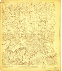 1928 Zavalla 3-c1928 Print · USGSThe timber-driven landscape of East Texas is captured here in the late twenties along the winding Neches River. Researchers can trace the paths of old logging lines like the Lumber RR Switch and find rural community hubs like Rockland, Nancy, and the Saron Sch.
 - 1931 Map of Zavalla
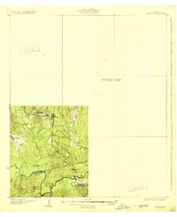 1931 Zavalla1931 Print · USGSEast Texas river life and rail expansion meet in the late 1920s at the junction of the Neches River and the Beaumont Southern Pacific. Researchers can trace old river crossings like Rockland Ferry and Rock Ford or locate vanished school sites like Saron Sch.2 unique versions available
 - 1953 Map of Palestine, 1964 Print
 1953 Palestine1964 Print · USGSEast Texas was defined by its deep pine forests and burgeoning energy sector in the mid-1950s. Genealogists and historians can trace the rail-and-river economy through settlements like Tennessee Colony and Pollok or explore the early footprints of the Cayuga Oil Field and Davy Crockett National Forest.2 unique versions available
 - 1957 Map of Palestine
 1957 Palestine1957 Print · USGSEast Texas in the mid-fifties reveals a landscape of deep pine forests and winding river valleys before the era of massive reservoir construction. Researchers can trace the legacy of the timber and rail industries through labels for the Missouri Pacific RR, Davy Crockett National Forest, and Nacogdoches.
 - 1958 Map of Zavalla, 1959 Print
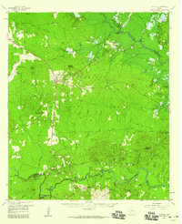 1958 Zavalla1959 Print · USGSEast Texas piney woods and the Neches River valley are captured here just before the landscape-altering creation of the Sam Rayburn Reservoir. Genealogists can trace family-named sites like Dunkin Cem, the Barium Mill, and the site of Fort Teran.3 unique versions available
 - 1984 Map of Rockland
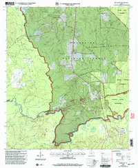
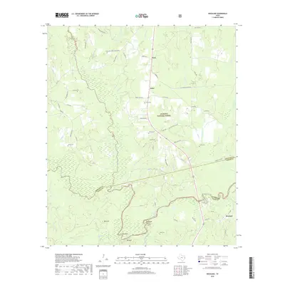
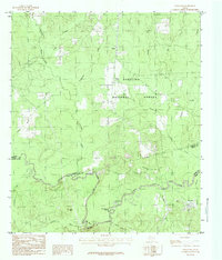 1984 Rockland1984 Print · USGSThe Piney Woods of East Texas are captured here in the mid-1980s as the river-riven timberlands of the Angelina National Forest. Researchers can trace the bends of the Neches River past Big Bluff and find the small settlements of Rockland and Nancy.
 - 1984 Map of Palestine
 1984 Palestine1984 Print · USGSEast Texas in the mid-eighties reveals a landscape of massive reservoirs and protected timberlands between Palestine and Nacogdoches. Researchers can trace old routes like the Missouri Pacific RR and locate rural communities such as Tennessee Colony, Latexo, and Etoile.3 unique versions available
 - 1986 Map of Lufkin
 1986 Lufkin1986 Print · USGSDeep in the Piney Woods during the mid-eighties, this map documents a landscape shaped by vast national forests and the waters of the Sam Rayburn Reservoir. Researchers can trace the legacy of timber and rail through settlements like Diboll, Herty, and Ewing alongside the St Louis Southwestern railroad.
 - 1992 Map of Lufkin
 1992 Lufkin1992 Print · USGSThe Piney Woods of East Texas are captured here in the early nineties, centered on the growing industrial hub of Lufkin. Local researchers can trace the rail networks of the Angelina & Neches River RR and locate rural landmarks like Shady Grove Ch and Manning.
 - 2003 Map of Rockland, 2004 Print
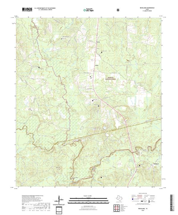
 2003 Rockland2004 Print · USGSDeep in the Piney Woods during the early 2000s, this area traces the historic Neches River corridor. Genealogists can locate family burial grounds like Barge Cem and Kitchen Cem, while historians can find the Site of Fort Teran.
 - 2010 Map of Rockland, 2010 Print
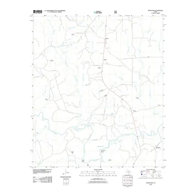 2010 Rockland2010 Print · USGSCovers Nancy, including Rockland, Martin, and other nearby areas
 - 2013 Map of Rockland, 2013 Print
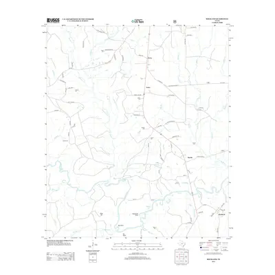 2013 Rockland2013 Print · USGSCovers Nancy, including Rockland, Martin, and other nearby areas
 - 2016 Map of Rockland, 2016 Print
 2016 Rockland2016 Print · USGSCovers Nancy, including Rockland, Martin, and other nearby areas
 - 2019 Map of Rockland, 2019 Print
 2019 Rockland2019 Print · USGSCovers Nancy, including Rockland, Martin, and other nearby areas
 - 2022 Map of Rockland, 2022 Print
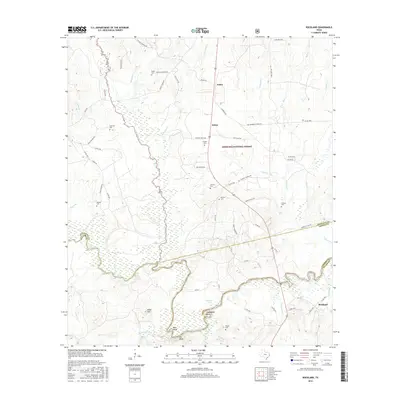
 2022 Rockland2022 Print · USGSAngelina and Tyler counties are captured here at the Neches River crossing near the turn of the twenty-first century. Genealogists can trace family roots at Rockland Cem, Sturrock Cem, and the riverfront community of Best Bend.
End of results
Showing maps 1-15 of 15
Top cities near Nancy
- Huntington historical maps
- Zavalla historical maps
- Colmesneil historical maps
- Chester historical maps
- Broaddus historical maps
Frequently asked questions
- What are the different types of historical maps available for Nancy?
- What is the oldest map of Nancy?
- Where can I purchase historical maps of Nancy for my home or office?
- Where can I download high-res historical maps of Nancy?
- Are there historical topographic maps available for Nancy?
- Is there historical aerial imagery available for Nancy?
- Where are historical maps of Nancy sourced from?