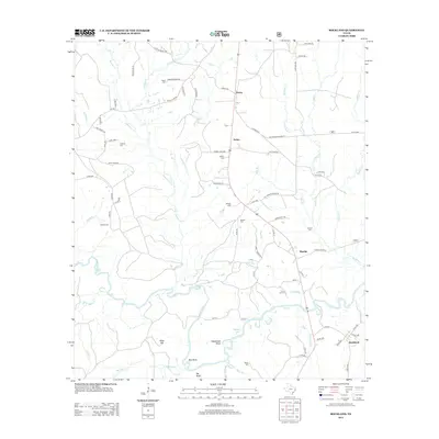
2013 Map of Rockland
USGS Topo · Published 2013About this map
The Neches River winds through the southern portion of this region, creating a complex series of oxbows and landforms including Sheephead Bend, Best Bend, and the prominent Big Bluff. In the early 21st century, this landscape in the Piney Woods remains defined by its watercourses and a network of rural settlements like Nancy, Dolan, and Rockland. The map is particularly rich for genealogical research, documenting numerous family-named burial sites such as Havard Cem, Dunkin Cem, and Kitchen Cem scattered across the countryside. Near the confluence of several creeks, Alligator Lake and Weeks Br mark the low-lying drainage patterns that have historically shaped local land use and road placement, such as Jasper Co Line Rd and Cotton Rd.
Find a feature on this map
81 named features on this map. Tap any name to fly to it.
Don’t see what you’re looking for? This feature index may not catch every label — zoom into the map to look around manually.
Map Details
Editions of this 2013 Rockland Map
This is the sole edition of this map. No revisions or reprints were ever made.
Other maps of this area

1928 · Zavalla 3-c
USGS Topo · 1:24,000

1928 · Lufkin 4-d
USGS Topo · 1:24,000

1931 · Zavalla
USGS Topo · 1:62,500

1932 · Manning
USGS Topo · 1:62,500

1953 · Palestine
USGS Topo · 1:250,000

1954 · Beaumont
USGS Topo · 1:250,000

1955 · Woodville
USGS Topo · 1:62,500

1955 · Camden
USGS Topo · 1:62,500

1957 · Beaumont
USGS Topo · 1:250,000

1957 · Palestine
USGS Topo · 1:250,000