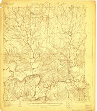
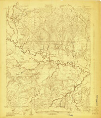
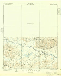
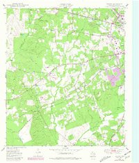
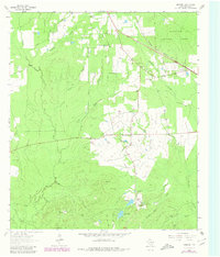
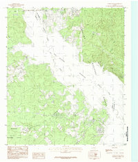
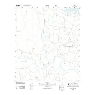
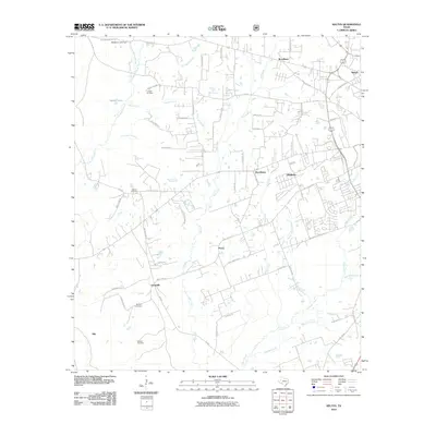
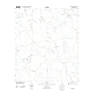
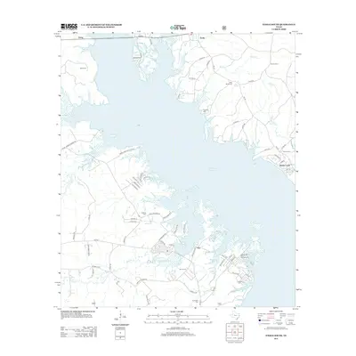
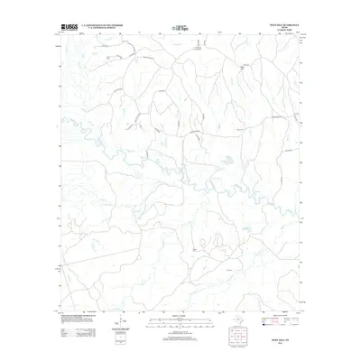
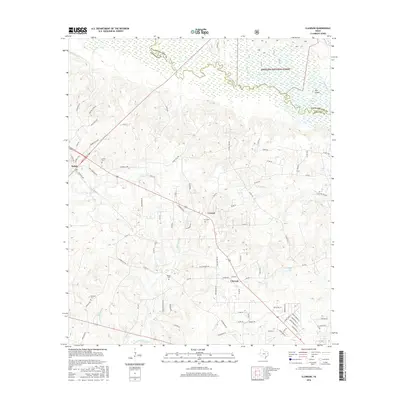
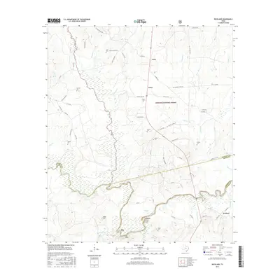
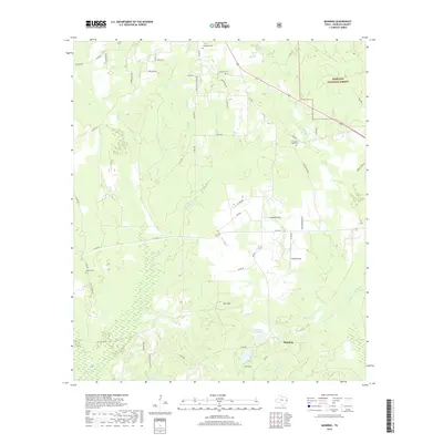
1928 Map of Zavalla 3-c
USGS Topo · Published 1928About this map
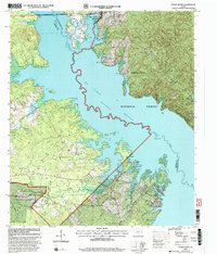
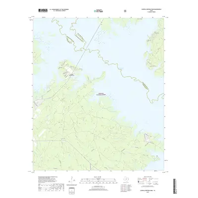
The Neches River winds through this 1928 survey, defining the boundaries where Angelina, Jasper, and Tyler counties meet. The landscape is heavily marked by the region's timber industry, featuring a network of rail lines including the Southern Pacific and the Beaumont Lufkin and Northern Railway (Abandoned). These industrial arteries supported settlements like Nancy, Dolan, and the logging outpost at Wilson Camp. Along the river's edge, the Rockland Ferry provided a vital crossing near the town of Rockland, while local education was centered at rural landmarks like Sulphur Spring Sch and Johnson Sch. The intricate topography around Bess Bend and The Big Bluff reveals the challenging terrain that dictated the paths of numerous creeks like Turpentine Creek and Cypress Creek. This map captures a transition as older Timber RR (Abandoned) spurs were already being left behind for new transportation routes.
Find a feature on this map
35 named features on this map. Tap any name to fly to it.
Don’t see what you’re looking for? This feature index may not catch every label — zoom into the map to look around manually.
Map Details
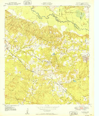
Editions of this 1928 Zavalla 3-c Map
This is the sole edition of this map. No revisions or reprints were ever made.
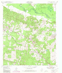
Historical Maps of Dolan Through Time
64 maps found
1928 Lufkin 4-d
Angelina County, TX
1928 Zavalla 3-c
Angelina County, TX
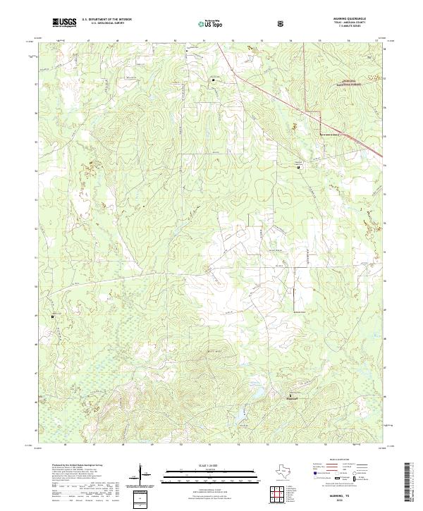
1932 Manning
Angelina County, TX
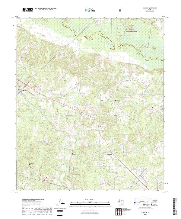
1949 Clawson
Angelina County, TX
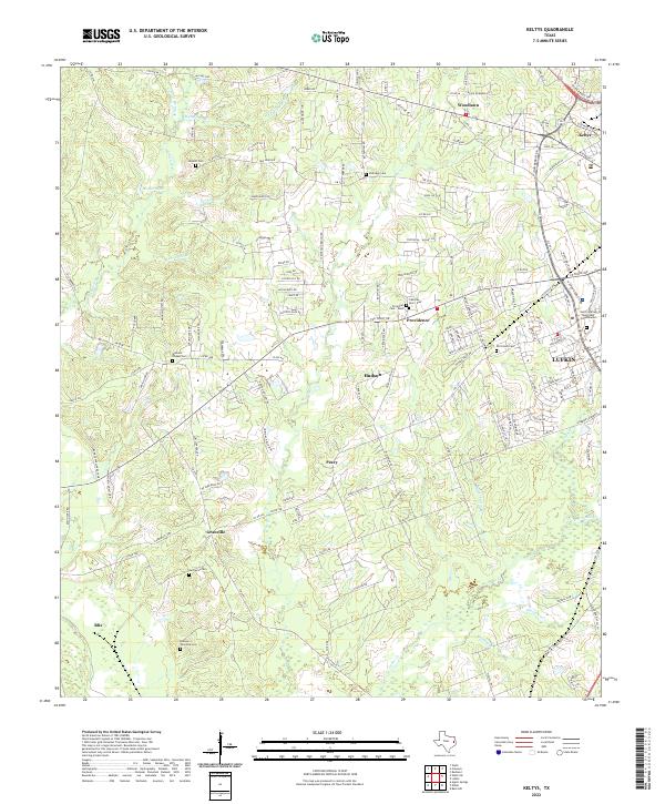
1949 Keltys
Angelina County, TX
1950 Clawson
Angelina County, TX
1950 Keltys
Angelina County, TX
1963 Bald Hill
Angelina County, TX
1963 Manning
Angelina County, TX
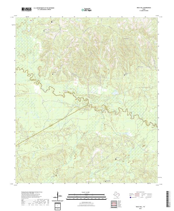
1963 Wolf Hill
Angelina County, TX
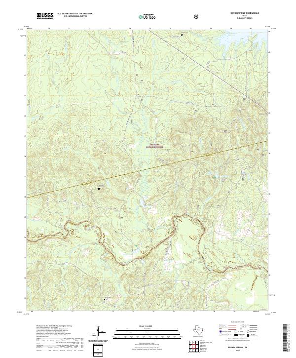
1984 Boykin Spring
Angelina County, TX
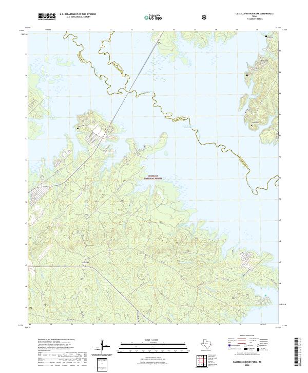
1984 Cassells-Boykin Park
Angelina County, TX
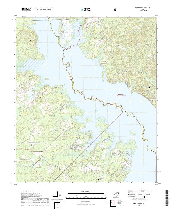
1984 Etoile South
Angelina County, TX
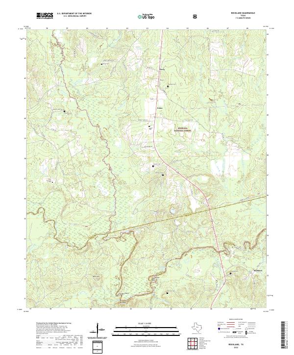
1984 Rockland
Angelina County, TX
2003 Cassells-Boykin Park
Angelina County, TX
2003 Clawson
Angelina County, TX
2003 Etoile South
Angelina County, TX
2003 Manning
Angelina County, TX
2003 Rockland
Angelina County, TX
2010 Bald Hill
Angelina County, TX
2010 Boykin Spring
Angelina County, TX
2010 Cassells-Boykin Park
Angelina County, TX
2010 Clawson
Angelina County, TX
2010 Etoile South
Angelina County, TX
2010 Keltys
Angelina County, TX
2010 Manning
Angelina County, TX
2010 Rockland
Angelina County, TX
2010 Wolf Hill
Angelina County, TX
2013 Bald Hill
Angelina County, TX
2013 Boykin Spring
Angelina County, TX
2013 Cassells-Boykin Park
Angelina County, TX
2013 Clawson
Angelina County, TX
2013 Etoile South
Angelina County, TX
2013 Keltys
Angelina County, TX
2013 Manning
Angelina County, TX
2013 Rockland
Angelina County, TX
2013 Wolf Hill
Angelina County, TX
2016 Bald Hill
Angelina County, TX
2016 Boykin Spring
Angelina County, TX
2016 Cassells-Boykin Park
Angelina County, TX
2016 Clawson
Angelina County, TX
2016 Etoile South
Angelina County, TX
2016 Keltys
Angelina County, TX
2016 Manning
Angelina County, TX
2016 Rockland
Angelina County, TX
2016 Wolf Hill
Angelina County, TX
2019 Bald Hill
Angelina County, TX
2019 Boykin Spring
Angelina County, TX
2019 Cassells-Boykin Park
Angelina County, TX
2019 Clawson
Angelina County, TX
2019 Etoile South
Angelina County, TX
2019 Keltys
Angelina County, TX
2019 Manning
Angelina County, TX
2019 Rockland
Angelina County, TX
2019 Wolf Hill
Angelina County, TX
2022 Bald Hill
Angelina County, TX
2022 Boykin Spring
Angelina County, TX
2022 Cassells-Boykin Park
Angelina County, TX
2022 Clawson
Angelina County, TX
2022 Etoile South
Angelina County, TX
2022 Keltys
Angelina County, TX
2022 Manning
Angelina County, TX
2022 Rockland
Angelina County, TX
2022 Wolf Hill
Angelina County, TX