
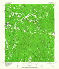
1955 Map of Camden
USGS Topo · Published 1956About this map
The timber-rich borderlands of Polk and Tyler Counties are captured here following a 1952 aerial survey. The settlement at Camden serves as a hub for the region, anchored by its Grade Sch and connected to smaller surrounding communities like Lily Island and Barnes. The landscape is etched with the evidence of industry, featuring an extensive network of Tram lines and an Old Railroad Grade that speaks to the historical movement of lumber through the East Texas pines.
Find a feature on this map
88 named features on this map. Tap any name to fly to it.
Don’t see what you’re looking for? This feature index may not catch every label — zoom into the map to look around manually.
Map Details
Editions of this 1955 Camden Map
2 editions found
Other maps of this area

1927 · Lufkin 4-c
USGS Topo · 1:24,000

1928 · Zavalla 3-c
USGS Topo · 1:24,000

1928 · Lufkin 4-d
USGS Topo · 1:24,000

1931 · Zavalla
USGS Topo · 1:62,500

1932 · Manning
USGS Topo · 1:62,500

1953 · Palestine
USGS Topo · 1:250,000

1954 · Beaumont
USGS Topo · 1:250,000

1955 · Woodville
USGS Topo · 1:62,500

1955 · New Willard
USGS Topo · 1:62,500

1957 · Beaumont
USGS Topo · 1:250,000