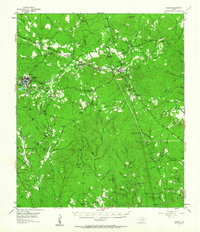
1955 Map of Camden
USGS Topo · Published 1963About this map
Camden anchors this mid-century view of the Deep East Texas timberlands, situated along the MC & Sa railroad line near the Camden Post Office. The landscape is a network of creek drainages and small communities, from the established settlement of Chester to the historical area of Peach Tree Village. Genealogists will find a wealth of family-named landmarks and rural burial grounds, including the Darden Cem, Pullen Cem, and Caney Creek Ch Cem.
Find a feature on this map
88 named features on this map. Tap any name to fly to it.
Don’t see what you’re looking for? This feature index may not catch every label — zoom into the map to look around manually.
Map Details
Editions of this 1955 Camden Map
2 editions found
Other maps of this area

1927 · Lufkin 4-c
USGS Topo · 1:24,000

1928 · Zavalla 3-c
USGS Topo · 1:24,000

1928 · Lufkin 4-d
USGS Topo · 1:24,000

1931 · Zavalla
USGS Topo · 1:62,500

1932 · Manning
USGS Topo · 1:62,500

1953 · Palestine
USGS Topo · 1:250,000

1954 · Beaumont
USGS Topo · 1:250,000

1955 · Woodville
USGS Topo · 1:62,500

1955 · Camden
USGS Topo · 1:62,500

1955 · New Willard
USGS Topo · 1:62,500