
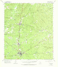
1955 Map of Woodville
USGS Topo · Published 1956About this map
The Southern Pacific rail line serves as the central artery through the East Texas piney woods in the mid-1950s, connecting the lumber-rich corridor of Woodville, Doucette, and Colmesneil. This landscape is deeply etched by a network of family-named creeks and branches, including Theunissen Creek, Pamplin Creek, and Drunkards Creek, which defined the boundaries of rural life. Beyond the larger towns, the map reveals a decentralized community structure anchored by small country churches and family burial grounds like Egypt Ch, Antioch Cem, and Moss Hill Cem.
Find a feature on this map
64 named features on this map. Tap any name to fly to it.
Don’t see what you’re looking for? This feature index may not catch every label — zoom into the map to look around manually.
Map Details
Editions of this 1955 Woodville Map
2 editions found
Other maps of this area

1928 · Zavalla 3-c
USGS Topo · 1:24,000

1928 · Lufkin 4-d
USGS Topo · 1:24,000

1931 · Zavalla
USGS Topo · 1:62,500

1932 · Manning
USGS Topo · 1:62,500

1953 · Palestine
USGS Topo · 1:250,000

1954 · Beaumont
USGS Topo · 1:250,000

1955 · Camden
USGS Topo · 1:62,500

1955 · Curtis
USGS Topo · 1:62,500

1957 · Beaumont
USGS Topo · 1:250,000

1957 · Palestine
USGS Topo · 1:250,000