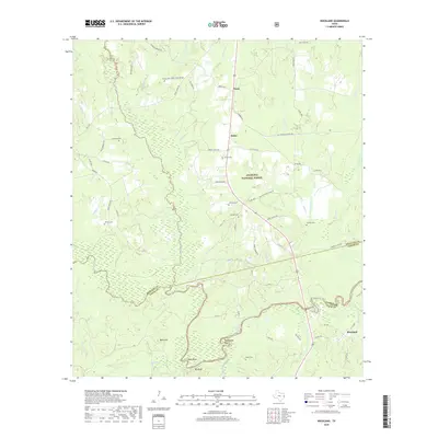
2019 Map of Rockland
USGS Topo · Published 2019About this map
Angelina National Forest dominates this East Texas landscape, where the confluence of the Neches River and various tributaries defines the local geography. The settlement of Rockland sits at the southeastern edge of the map, serving as a focal point for the region's transport and river access. The terrain is marked by significant river features like Sheephead Bend, Best Bend, and the prominent Big Bluff along the Neches, which forms the winding border between Angelina, Tyler, and Jasper counties.
Find a feature on this map
77 named features on this map. Tap any name to fly to it.
Don’t see what you’re looking for? This feature index may not catch every label — zoom into the map to look around manually.
Map Details
Editions of this 2019 Rockland Map
This is the sole edition of this map. No revisions or reprints were ever made.
Other maps of this area

1928 · Zavalla 3-c
USGS Topo · 1:24,000

1928 · Lufkin 4-d
USGS Topo · 1:24,000

1931 · Zavalla
USGS Topo · 1:62,500

1932 · Manning
USGS Topo · 1:62,500

1953 · Palestine
USGS Topo · 1:250,000

1954 · Beaumont
USGS Topo · 1:250,000

1955 · Woodville
USGS Topo · 1:62,500

1955 · Camden
USGS Topo · 1:62,500

1957 · Beaumont
USGS Topo · 1:250,000

1957 · Palestine
USGS Topo · 1:250,000