1960s Maps of Blanco County, Texas
Explore 19 historic maps of Blanco County from the 1960s. These maps offer a rare glimpse into what life looked like during the 1960s — showing old roads, neighborhoods, homes, and landmarks that have changed or disappeared over time.
Whether you're researching your family's past, planning a metal detecting trip, or studying how Blanco County's landscape evolved across the 1960s, these high-resolution maps are a powerful tool for exploring the history of this region.
- Focus on a specific era: All maps on this page are from the 1960s, giving you a focused view of this time period.
- See what’s changed: Compare century-old streets, trails, and buildings to today's modern landscape using overlays and satellite layers.
- Research with precision: Use these maps for genealogy, historical research, land use analysis, or educational projects.
- View, download, or print: Maps are fully viewable online in high resolution, and can be downloaded or printed for your own records.
Start exploring Blanco County's history through authentic maps from the 1960s. This is your window into the past.
Blanco County, TX maps
(19)- 1961 Map of Hye, 1962 Print
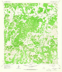
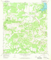
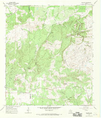
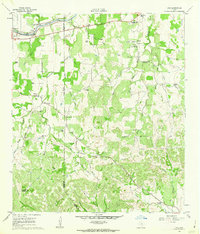 1961 Hye1962 Print · USGSThe Pedernales River valley in the early sixties remains a landscape of sprawling family ranches and rural schoolhouses. Genealogists and historians can trace local legacies at the LBJ Ranch, the Johnson Cem, and early centers like Albert and Hye.3 unique versions available
 - 1961 Map of Rocky Creek, 1962 Print
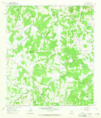
 1961 Rocky Creek1962 Print · USGSThe Texas Hill Country at the start of the 1960s reveals a quiet landscape of riverside quarries and family-named landmarks. Genealogists and local historians can trace the Post Oak Cem or locate the various water sources like Smith Spring and the Pedernales River.2 unique versions available
 - 1961 Map of Johnson City, 1962 Print
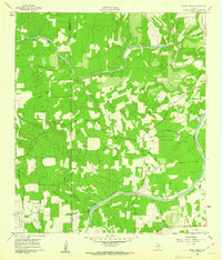
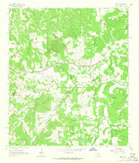
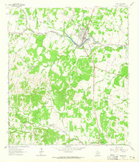
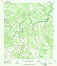
 1961 Johnson City1962 Print · USGSThe Blanco County seat of Johnson City is shown in detail during the early sixties, alongside the winding Pedernales River. Researchers can locate family landmarks like the Sandy Cem, Waller Airfield, and the Happy Old Folks Home.3 unique versions available
 - 1963 Map of Yeager Creek, 1965 Print
 1963 Yeager Creek1965 Print · USGSBlanco County in the early sixties is shown here as a landscape of interconnected ranchlands and winding waterways. Researchers can trace historical property boundaries along Miller Creek, Yeager Creek, and the headwaters of Onion Creek.2 unique versions available
 - 1963 Map of Crabapple Creek, 1965 Print
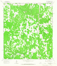
 1963 Crabapple Creek1965 Print · USGSThe rural Hill Country landscape of Kendall and Blanco Counties comes into focus in this mid-century survey. Genealogists and local historians can trace the area's social fabric through landmarks like the Lindendale Community Hall and the settlement of Kendalia.2 unique versions available
 - 1963 Map of Henly, 1965 Print
 1963 Henly1965 Print · USGSHays County during the early sixties is captured here as a landscape of small family cemeteries and winding creek branches. Genealogists can locate several family plots including Middlebrooks Cem and Moore Cem near the community of Henly.4 unique versions available
 - 1963 Map of Payton, 1965 Print
 1963 Payton1965 Print · USGSIn the early sixties, the Texas Hill Country around the Blanco River remained a landscape of quiet rural communities and perennial springs. Researchers can trace the civic heart of Payton through its Payton Sch, Payton Cem, and the unique topography of The Narrows.3 unique versions available
 - 1963 Map of Monument Hill, 1965 Print
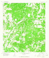
 1963 Monument Hill1965 Print · USGSThis Blanco County survey captures the rugged Texas Hill Country during the early sixties, showing a landscape defined by seasonal creeks and limestone ridges. Genealogists can trace family-named landmarks such as Martin Mountain, McCall Creek, and Miller Road.2 unique versions available
 - 1963 Map of Blanco, 1965 Print
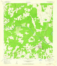
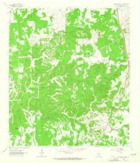
 1963 Blanco1965 Print · USGSThe Texas Hill Country comes alive in the mid-sixties, centered on the riverfront town of Blanco. Genealogists and historians can trace family ranching lines at Hereford Hills Ranch and the Wegner Cem, or explore the rural settlement of Twin Sisters.
 - 1963 Map of Fischer, 1967 Print
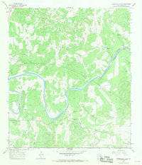
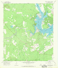
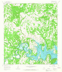 1963 Fischer1967 Print · USGSComal County's river-cut landscape was undergoing a major transformation in the early sixties as the Guadalupe valley began to fill with water. Researchers can trace family sites like Bremer Cem and early settlements at Fischer and Cranes Mill before the lake reshaped the region.2 unique versions available
 - 1964 Map of Spring Branch, 1967 Print
 1964 Spring Branch1967 Print · USGSTexas hill country life in the mid-1960s is centered here on the Guadalupe River and the settlement of Spring Branch. You can trace rural landmarks from the Spring Branch PO to the Twin Sisters peaks and the small community of Knibbe.2 unique versions available
 - 1967 Map of Round Mountain, 1969 Print
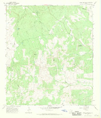
 1967 Round Mountain1969 Print · USGSThe Texas Hill Country at the end of the 1960s comes into focus at the intersection of Blanco, Burnet, and Llano counties. Researchers can trace land boundaries and rural development near Round Mountain, the Round Mountain Cem, and Cypress Mill.2 unique versions available
 - 1967 Map of Spicewood, 1969 Print
 1967 Spicewood1969 Print · USGSThe Blanco and Burnet county line is shown here in the late sixties as the rising waters of the Colorado River reshaped the land. Trace family history at Holloway Cem or follow the old paths near Spicewood and Cypress Mill.4 unique versions available
 - 1967 Map of Howell Mountain, 1969 Print
 1967 Howell Mountain1969 Print · USGSThe Texas Hill Country at the Blanco and Llano county line in the late sixties reveals a landscape of ranching and remote peaks. Trace local history through family-named landmarks like Porter Gap, Walnut Hill Ch, and the A W Ranch Landing Strip.2 unique versions available
 - 1967 Map of Pedernales Falls, 1969 Print
 1967 Pedernales Falls1969 Print · USGSBlanco County ranching country is documented here in the late sixties, showing a landscape of winding river bends and private airfields. Researchers can locate family landmarks like the Voyles Lazy V Ranch, Robinson Community Hall, and the Hill Ranch Landing Strip.4 unique versions available
 - 1967 Map of Click, 1970 Print
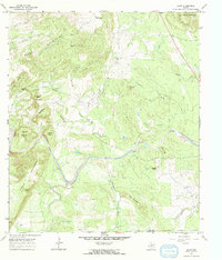 1967 Click1970 Print · USGSThe settlement of Click and the surrounding Llano County ranch lands are caught in detail during the late sixties. Genealogists and local historians can trace family landmarks like the Martin Cem or explore the rugged drainage of Sandy Creek and Comanche Creek.
 - 1967 Map of Blowout, 1970 Print
 1967 Blowout1970 Print · USGSThe ranchlands of the Texas Hill Country are documented here in the late sixties along the Gillespie and Blanco county lines. Researchers can trace historic family burial sites at Comanche Cemetery and Davis Cemetery or locate landmarks like Blowout Cave and Blackjack Spring.
 - 1967 Map of Hammetts Crossing, 1970 Print
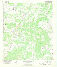
 1967 Hammetts Crossing1970 Print · USGSTexas Hill Country life centers on the river in the late sixties, where Blanco, Hays, and Travis counties meet. Researchers can trace historic river access at Hammetts Crossing, Dead Mans Ford, and the natural landmark at Hamilton Pool.2 unique versions available
 - 1967 Map of Dunman Mountain, 1970 Print
 1967 Dunman Mountain1970 Print · USGSThe Texas Hill Country shoreline transitions from ranching to recreation in the late sixties as Lake Lyndon B Johnson takes shape. Researchers can trace family history at Wolf Crossing Cem or explore the early layout of Sherwood Shores.2 unique versions available
End of results
Showing maps 1-19 of 19
Top cities of Blanco County
- Johnson City historical maps
- Blanco historical maps
- Round Mountain historical maps
- Hye historical maps
- Cypress Mill historical maps
- Flugrath historical maps
Frequently asked questions
- What are the different types of historical maps available for Blanco County?
- What is the oldest map of Blanco County?
- Where can I purchase historical maps of Blanco County for my home or office?
- Where can I download high-res historical maps of Blanco County?
- Are there historical topographic maps available for Blanco County?
- Is there historical aerial imagery available for Blanco County?
- Where are historical maps of Blanco County sourced from?