1960s Maps of Blanco, Texas
Explore 2 historic maps of Blanco from the 1960s. These maps offer a rare glimpse into what life looked like during the 1960s — showing old roads, neighborhoods, homes, and landmarks that have changed or disappeared over time.
Whether you're researching your family's past, planning a metal detecting trip, or studying how Blanco's landscape evolved across the 1960s, these high-resolution maps are a powerful tool for exploring the history of this region.
- Focus on a specific era: All maps on this page are from the 1960s, giving you a focused view of this time period.
- See what’s changed: Compare century-old streets, trails, and buildings to today's modern landscape using overlays and satellite layers.
- Research with precision: Use these maps for genealogy, historical research, land use analysis, or educational projects.
- View, download, or print: Maps are fully viewable online in high resolution, and can be downloaded or printed for your own records.
Start exploring Blanco's history through authentic maps from the 1960s. This is your window into the past.
Blanco, TX maps
(2)- 1963 Map of Monument Hill, 1965 Print
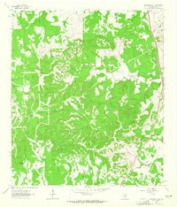 1963 Monument Hill1965 Print · USGSThis Blanco County survey captures the rugged Texas Hill Country during the early sixties, showing a landscape defined by seasonal creeks and limestone ridges. Genealogists can trace family-named landmarks such as Martin Mountain, McCall Creek, and Miller Road.2 unique versions available
 - 1963 Map of Blanco, 1965 Print
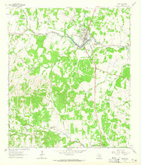 1963 Blanco1965 Print · USGSThe Texas Hill Country comes alive in the mid-sixties, centered on the riverfront town of Blanco. Genealogists and historians can trace family ranching lines at Hereford Hills Ranch and the Wegner Cem, or explore the rural settlement of Twin Sisters.
End of results
Showing maps 1-2 of 2
Top cities near Blanco
Frequently asked questions
- What are the different types of historical maps available for Blanco?
- What is the oldest map of Blanco?
- Where can I purchase historical maps of Blanco for my home or office?
- Where can I download high-res historical maps of Blanco?
- Are there historical topographic maps available for Blanco?
- Is there historical aerial imagery available for Blanco?
- Where are historical maps of Blanco sourced from?