Old Maps of Iredell, Texas
Explore 18 old maps of Iredell, spanning from 1888 to today. These high-resolution historic maps reveal how streets, neighborhoods, landmarks, and natural features evolved over time — perfect for genealogy, metal detecting, research, and local history exploration.
What you can do with these maps:
- See how Iredell changed over time: Compare historical maps to modern-day views to trace roads, homesites, rail lines & more.
- View detailed metadata: Each map includes creators, publishers, year, scale, and archive source.
- Overlay maps with satellite & LiDAR: Visualize the past alongside modern tools to explore terrain & human change.
- Trusted historical sources: Maps sourced from the USGS, Library of Congress, and other archives.
- Access maps your way: View online, download high-res files, or order prints for personal or research use.
Start exploring old maps of Iredell to uncover forgotten places, hidden landmarks, and the deep history beneath your feet.
Iredell, TX maps
(18)- 1888 Map of Meridian
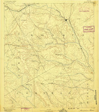 1888 Meridian1888 Print · USGSBosque and Coryell counties are shown here in the 1880s as the rail lines began to redefine the frontier landscape. Genealogists can locate early settlements like Turnersville, Cranfills Gap, and the rail junction at Meridian.
 - 1894 Map of Meridian
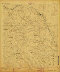 1894 Meridian1894 Print · USGSBosque and Coryell counties are shown in the late nineteenth century as the railroads began to reshape the cattle frontier. Genealogists and local historians can trace early settlements and community landmarks like Norse, Cranfills Gap, and Turnersville.3 unique versions available
 - 1954 Map of Waco, 1964 Print
 1954 Waco1964 Print · USGSCentral Texas during the mid-fifties shows a landscape defined by the expansion of Fort Hood Military Reservation and the Brazos river system. Trace the rail lines and early airfields like James Connally Air Force Base and settlements like Temple or McGregor.2 unique versions available
 - 1955 Map of Waco
 1955 Waco1955 Print · USGSCentral Texas at the peak of the Cold War reveals a landscape defined by military expansion and major water projects. Researchers can trace the footprints of Fort Hood, the waters of Lake Waco, and regional hubs like Temple or Mexia.
 - 1956 Map of Spring Creek Gap, 1957 Print
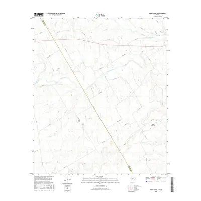
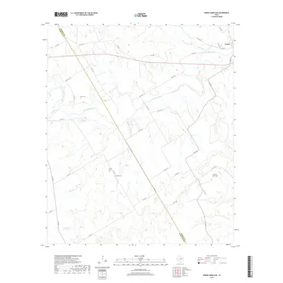
 1956 Spring Creek Gap1957 Print · USGSCrossing the Bosque River valley in the mid-1950s, this area of Central Texas shows a landscape of rail-connected settlements and family cemeteries. Genealogists can trace local heritage at Iredell, Stanley Graves, and rural landmarks like Barbee Cem.2 unique versions available
 - 1956 Map of Iredell, 1957 Print
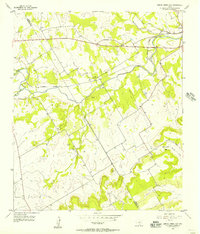
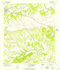
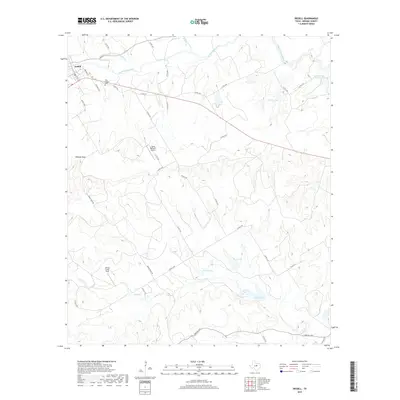
 1956 Iredell1957 Print · USGSThe Bosque County hills in the mid-fifties were defined by small-town railroad hubs and a patchwork of family-owned ranch land. Genealogists can trace rural landmarks from The Rock Ch and Roberts School to the Missouri Kansas Texas line through Iredell.
 - 1956 Map of Iredell, 1957 Print
 1956 Iredell1957 Print · USGSIredell and the surrounding Bosque County countryside are captured here in the mid-1950s as a quiet rail-and-river community. Genealogists and local historians can trace family roots at the New Iredell Cem, locate the Spring Creek Ch, or follow the path of the Missouri Kansas Texas railroad.2 unique versions available
 - 1985 Map of Waco
 1985 Waco1985 Print · USGSCentral Texas in the mid-eighties shows a landscape of river-fed lakes and bustling transit hubs as the region expanded. Genealogists and historians can trace rail lines like the Missouri Kansas Texas or locate sites such as Rosemound Cem and Meridian State Park.2 unique versions available
 - 2010 Map of Iredell, 2010 Print
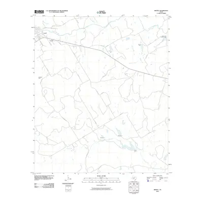 2010 Iredell2010 Print · USGSCovers Iredell, including Bosque County, United States, and other nearby areas
 - 2010 Map of Spring Creek Gap, 2010 Print
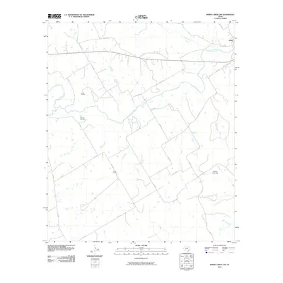 2010 Spring Creek Gap2010 Print · USGSCovers Iredell, including Bosque County, Hamilton County, and other nearby areas
 - 2012 Map of Iredell, 2012 Print
 2012 Iredell2012 Print · USGSCovers Iredell, including Bosque County, United States, and other nearby areas
 - 2012 Map of Spring Creek Gap, 2012 Print
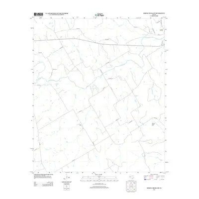 2012 Spring Creek Gap2012 Print · USGSCovers Iredell, including Bosque County, Hamilton County, and other nearby areas
 - 2016 Map of Spring Creek Gap, 2016 Print
 2016 Spring Creek Gap2016 Print · USGSCovers Iredell, including Bosque County, Hamilton County, and other nearby areas
 - 2016 Map of Iredell, 2016 Print
 2016 Iredell2016 Print · USGSCovers Iredell, including Bosque County, United States, and other nearby areas
 - 2019 Map of Spring Creek Gap, 2019 Print
 2019 Spring Creek Gap2019 Print · USGSCovers Iredell, including Bosque County, Hamilton County, and other nearby areas
 - 2019 Map of Iredell, 2019 Print
 2019 Iredell2019 Print · USGSCovers Iredell, including Bosque County, United States, and other nearby areas
 - 2022 Map of Spring Creek Gap, 2022 Print
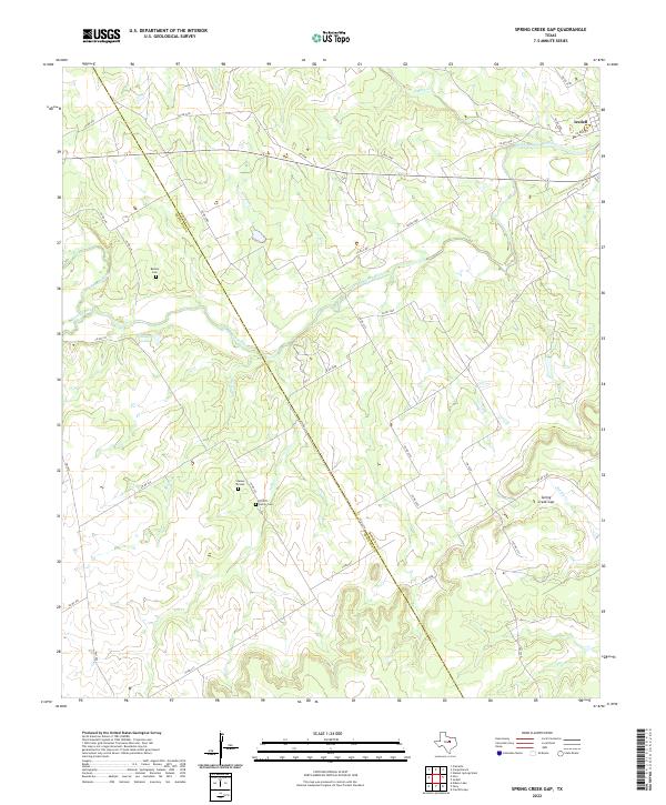 2022 Spring Creek Gap2022 Print · USGSThe ranchlands of Bosque and Hamilton counties are centered on the river valley as they appeared in the early 2020s. Genealogists can locate family landmarks like the Proffitt Family Cemetery and the passage through Spring Creek Gap.
 - 2022 Map of Iredell, 2022 Print
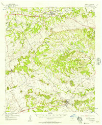
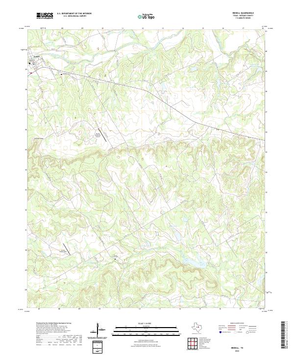 2022 Iredell2022 Print · USGSIredell and the surrounding Bosque County hills are captured here in the early twenty-first century, showing a landscape shaped by the North Bosque River. Researchers can locate several family and community landmarks, including Riverside Cem, Mitchell Cem, and the prominent Johnson Peak.
End of results
Showing maps 1-18 of 18
Top cities near Iredell
- Meridian historical maps
- Hico historical maps
- Walnut Springs historical maps
- Cranfills Gap historical maps
Frequently asked questions
- What are the different types of historical maps available for Iredell?
- What is the oldest map of Iredell?
- Where can I purchase historical maps of Iredell for my home or office?
- Where can I download high-res historical maps of Iredell?
- Are there historical topographic maps available for Iredell?
- Is there historical aerial imagery available for Iredell?
- Where are historical maps of Iredell sourced from?