Old Maps of Bosque County, Texas for Metal Detecting
Plan your next treasure hunt with 204 historic maps of Bosque County. Find old homesites, ghost towns, trails, and gathering spots that may be lost to time — perfect for identifying promising metal detecting locations.
- Locate forgotten sites: Uncover places like long-lost settlements, abandoned rail lines, or gathering spots.
- Plan better hunts: Use map overlays combined with LiDAR or satellite views to narrow in on historically rich areas.
- Made for detectorists: Thousands of hobbyists use these maps to discover relics, coins, and hidden history.
Use these historic maps to boost your research and find new opportunities beneath the surface of Bosque County.
Bosque County, TX maps
(204)- 1888 Map of Meridian
 1888 Meridian1888 Print · USGSBosque and Coryell counties are shown here in the 1880s as the rail lines began to redefine the frontier landscape. Genealogists can locate early settlements like Turnersville, Cranfills Gap, and the rail junction at Meridian.
 - 1889 Map of Granbury
 1889 Granbury1889 Print · USGSIn the late 1880s, the Brazos River dictated the life and travel of North Texas, carving deep bends through Hood and Somervell counties. Genealogists and historians can trace early settlements like Fort Spunky and Glenrose or the routes of the Texas Central Railroad.6 unique versions available
 - 1890 Map of Stephenville
 1890 Stephenville1890 Print · USGSErath County at the close of the frontier era centers on the rising trade hub of Stephenville and its surrounding hill country. Researchers can trace the original Texas Central Railroad corridor through Dublin and find vanished locales like Duffau Wells.5 unique versions available
 - 1891 Map of Cleburne
 1891 Cleburne1891 Print · USGSNorth Texas in the late nineteenth century was a land transformed by new iron rails and established river crossings. Genealogists and researchers can trace the early footprints of Cleburne and Hillsboro alongside vanished stops like Port Graham and Files Valley.
 - 1892 Map of Waco
 1892 Waco1892 Print · USGSCentral Texas was rapidly expanding during the 1890s as a rail and river commerce hub. Genealogists and researchers can trace the early footprints of Waco and its surrounding communities like China Springs, Valley Mills, and West along five distinct railway lines.6 unique versions available
 - 1894 Map of Meridian
 1894 Meridian1894 Print · USGSBosque and Coryell counties are shown in the late nineteenth century as the railroads began to reshape the cattle frontier. Genealogists and local historians can trace early settlements and community landmarks like Norse, Cranfills Gap, and Turnersville.3 unique versions available
 - 1894 Map of Cleburne
 1894 Cleburne1894 Print · USGSNorth Central Texas was a burgeoning rail and cattle hub in the late nineteenth century. Genealogists and historians can trace the growth of Cleburne and Hillsboro alongside vanished river landings like Fort Graham and Kimball on the Brazos River.5 unique versions available
 - 1920 Map of Waco
 1920 Waco1920 Print · USGSWaco and its surrounding rail corridors are captured in high detail shortly after the first World War. Researchers can trace the legacy of Rifle Range Camp MacArthur and vanished river crossings like Greenwoods Ferry and Old Towash.
 - 1920 Map of Stephenville
 1920 Stephenville1920 Print · USGSErath County thrived at the intersection of three major railroads during the early twentieth century. Genealogists and historians can trace the foundations of Stephenville and Dublin, alongside rural landmarks like Morgan Mill and Tanner School.
 - 1924 Map of Cleburne 3-B
 1924 Cleburne 3-B1924 Print · USGSNorth of the Brazos River in the mid-1920s, this area shows a landscape of rural schools and winding creek hollows. Genealogists and historians can trace the early rail influence through Rio Vista and Blum or find family-named landmarks like Klondike Ranch and Plain View School.
 - 1924 Map of Waco 2-b
 1924 Waco 2-b1924 Print · USGSBosque and Hill Counties appear here in the mid-twenties, centered on the winding Brazos River before later landscape changes. Researchers can trace rural life through numerous sites like Towash, Crackerbox School, and the White Ranch.
 - 1924 Map of Cleburne 3-C
 1924 Cleburne 3-C1924 Print · USGSThe Brazos River valley at the Bosque and Hill County line is shown here in the mid-1920s when river crossings still defined local travel. Researchers can locate the site of Fort Graham, the Steiner Valley School, and family landmarks like the Heath Cem.
 - 1924 Map of Granbury 4-a
 1924 Granbury 4-a1924 Print · USGSThe Brazos River landscape in the mid-1920s reveals a rural Texas community defined by its winding waterways and local schoolhouses. Genealogists can locate family landmarks like the Rohme Ranch, New Hope Church, and the Frog Hollow School.
 - 1927 Map of Blum
 1927 Blum1927 Print · USGSThe Brazos River valley and the rail towns of Hill and Bosque Counties are captured here in the mid-twenties. Genealogists can trace rural landmarks like Plainview School, Heath Cem, and historic river fords like Ft Graham Crossing.2 unique versions available
 - 1931 Map of Whitney
 1931 Whitney1931 Print · USGSCentral Texas river life in the early twenties centers on the winding Brazos River before the era of modern dams. Genealogists can trace local school districts like Crackerbox Sch and river crossings such as Greenwade Bridge.2 unique versions available
 - 1931 Map of Valley Mills
 1931 Valley Mills1931 Print · USGSCentral Texas river valleys define the landscape in the mid-1920s, showing a rural network of farm-to-market crossings. Genealogists can trace family footprints near Speegleville or old meeting spots like Shiloh Ch and Caldwell Crossing.2 unique versions available
 - 1931 Map of Morgan
 1931 Morgan1931 Print · USGSThe Brazos River's dramatic winding oxbows define this rural Texas landscape in the 1920s where Somervell, Johnson, and Bosque Counties meet. Genealogists and local historians can trace family roots at Brazos Point or find old school sites like Frog Hollow Sch and Highland Sch.2 unique versions available
 - 1954 Map of Dallas, 1963 Print
 1954 Dallas1963 Print · USGSNorth Texas in the mid-fifties and early sixties reveals a landscape of rapid urban growth and water management. Genealogists and historians can trace the evolution of the metroplex through landmarks like Hensley Field, Boles Orphan Home, and the Texas & Pacific RR.4 unique versions available
 - 1954 Map of Waco, 1964 Print
 1954 Waco1964 Print · USGSCentral Texas during the mid-fifties shows a landscape defined by the expansion of Fort Hood Military Reservation and the Brazos river system. Trace the rail lines and early airfields like James Connally Air Force Base and settlements like Temple or McGregor.2 unique versions available
 - 1954 Map of Abilene, 1966 Print
 1954 Abilene1966 Print · USGSThe Texas Big Country comes into focus in the mid-1950s as petroleum and new water projects reshape the landscape. Local historians can trace the Butterfield Trail, find the Fort Phantom Hill Ruins, and locate numerous small communities along the Texas & Pacific line.2 unique versions available
 - 1955 Map of Waco
 1955 Waco1955 Print · USGSCentral Texas at the peak of the Cold War reveals a landscape defined by military expansion and major water projects. Researchers can trace the footprints of Fort Hood, the waters of Lake Waco, and regional hubs like Temple or Mexia.
 - 1955 Map of Clifton, 1956 Print
 1955 Clifton1956 Print · USGSMid-century Bosque County is centered on the riverfront town of Clifton as it appeared in the mid-fifties. Genealogists and historians can locate family sites like Oswald Cem, trace the Gulf Colorado and Santa Fe rail line, or find local landmarks like Womack Hall.2 unique versions available
 - 1955 Map of Turnersville, 1956 Print
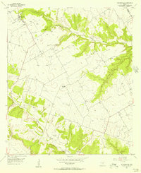 1955 Turnersville1956 Print · USGSTexas ranching country along the Bosque and Coryell county line is documented here during the mid-fifties. Researchers can locate the rural hubs of Turnersville and Whitehall, as well as local landmarks like Pickens Pool, Liberty Ch, and the Turnersville Cem.2 unique versions available
 - 1955 Map of Meridian, 1956 Print
 1955 Meridian1956 Print · USGSMeridian and the Bosque River valley are captured here in the mid-1950s, showing the town at a crossroads of rail and road. Researchers can locate the Hanna Cem, trace the Gulf Colorado and Santa Fe line, and explore the early layout of Meridian State Park.3 unique versions available
 - 1955 Map of Pilot Knob, 1956 Print
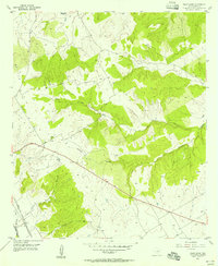 1955 Pilot Knob1956 Print · USGSCentral Texas hills and creek bottoms are captured here in the mid-1950s, showing the rural landscape before modern development. Genealogists can locate Cedron Cem and Oswald or trace the Gulf Colorado and Santa Fe railroad line.2 unique versions available
Showing maps 1-25 of 204
Top cities of Bosque County
- Clifton historical maps
- Meridian historical maps
- Valley Mills historical maps
- Walnut Springs historical maps
- Morgan historical maps
- Iredell historical maps
See more
Frequently asked questions
- What are the different types of historical maps available for Bosque County?
- What is the oldest map of Bosque County?
- Where can I purchase historical maps of Bosque County for my home or office?
- Where can I download high-res historical maps of Bosque County?
- Are there historical topographic maps available for Bosque County?
- Is there historical aerial imagery available for Bosque County?
- Where are historical maps of Bosque County sourced from?