Old Maps of Bowie County, Texas for Hiking & Exploration
Hike through history with 167 historic maps of Bowie County. Explore old trails, ghost towns, and forgotten backroads — perfect for outdoor adventurers and local explorers.
- Rediscover forgotten places: Map out old mining camps, roads, and footpaths that no longer exist on modern maps.
- Layer with modern tools: Combine with LiDAR or satellite views to plan hikes through historical terrain.
- Made for exploration: Popular among hikers, overlanders, and local history lovers.
Use these maps to find adventure and explore the hidden past of Bowie County.
Bowie County, TX maps
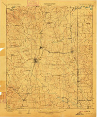
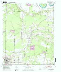
(167)- 1907 Map of Atlanta, 1954 Print
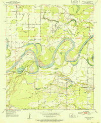
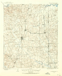 1907 Atlanta1954 Print · USGSNorthwest Louisiana and Northeast Texas meet in this early century survey of the rail-and-timber corridor surrounding Atlanta. Researchers can trace the heritage of rural communities through dozens of local landmarks like Laws Chapel, Pritchard's Gin, and the Cass Lumber Co Sawmill.2 unique versions available
 - 1909 Map of New Boston
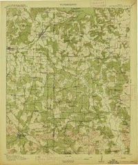
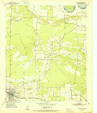
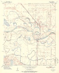
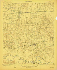 1909 New Boston1909 Print · USGSBowie County at the dawn of the twentieth century was a landscape shaped by competing railroads and the winding Sulphur River. Genealogists and local historians can locate early landmarks like Boston, Chalybeate School, and the historic Bigham Ferry crossing.2 unique versions available
 - 1909 Map of Texarkana
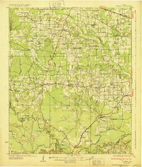
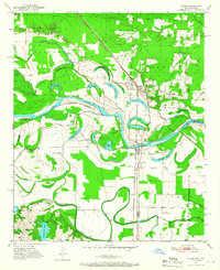
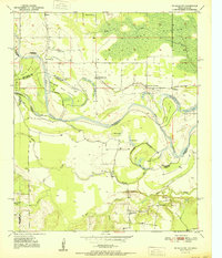
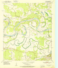
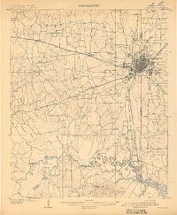 1909 Texarkana1909 Print · USGSTexarkana emerged as a bustling tri-state rail center at the dawn of the twentieth century, defined by its complex web of iron roads and river commerce. Genealogists and local historians can trace family roots at White Chapel, the Stateline Ferry, and rural sites like Alamo Mills.5 unique versions available
 - 1910 Map of Linden
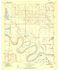
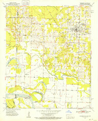
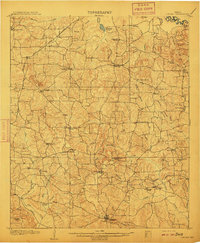 1910 Linden1910 Print · USGSNortheast Texas at the dawn of the century reveals a landscape defined by the timber industry and small rural hubs. You can trace the development of Cass County through landmarks like the T.P. Sawmill, Bryans Mill, and dozens of family-named sites like Harbucks Store.2 unique versions available
 - 1910 Map of Atlanta
 1910 Atlanta1910 Print · USGSNortheast Texas at the height of the timber boom is captured here, showing the intricate network of sawmills and rail lines crossing into Arkansas and Louisiana. Genealogists can locate family landmarks like Laws Chapel, Hosey's Store, and the Henderson Hill School among the many rural settlements.2 unique versions available
 - 1914 Map of Daingerfield
 1914 Daingerfield1914 Print · USGSNortheast Texas before the Great War is captured here through its bustling rail towns and timber-rich creek bottoms. Genealogists can trace hundreds of family sites, from Walkers Chapel and Boon Hall to the busy Jennings Lake Switch.2 unique versions available
 - 1930 Map of Bassett
 1930 Bassett1930 Print · USGSBowie and Cass Counties are captured here as the traditional rural landscape met the expanding reach of the railroad and early oil exploration. Genealogists can locate many namesake schools and churches like Big Woods Sch, Mt Zion Ch, and the settlement of White Cotton.2 unique versions available
 - 1950 Map of Redbank, 1954 Print
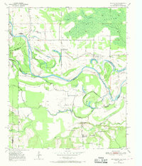
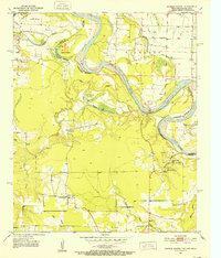
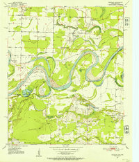 1950 Redbank1954 Print · USGSBowie County and the Arkansas border are defined by the winding Red River in the early fifties, showing a rural landscape of oxbow lakes and timbered bottoms. Researchers can trace local landmarks like Elizabeth Academy Ch, the Rifle Range (Abandoned), and Hughes Cem.3 unique versions available
 - 1950 Map of Ogden, 1966 Print
 1950 Ogden1966 Print · USGSThe riverlands of Southwest Arkansas are captured here in the mid-century, where the Red River meanders through a landscape of oxbow lakes and bayous. Researchers can trace the heritage of local communities through named schools and churches like Rosenwald Sch, Summer Hill Ch, and the settlement of Ogden.4 unique versions available
 - 1950 Map of De Kalb NW, 1969 Print
 1950 De Kalb NW1969 Print · USGSThe Red River valley at the Texas-Oklahoma border comes alive here during the mid-century, showing a landscape shaped by shifting waters and rural settlement. Researchers can trace family roots through sites like Harris Cem, Antioch Ch, and the many local schoolhouses like Field Ridge Sch.2 unique versions available
 - 1950 Map of Barkman, 1969 Print
 1950 Barkman1969 Print · USGSThe Texas-Arkansas borderlands are captured here at mid-century, where the Red River's shifting path created a rich landscape of oxbow lakes and bayous. Genealogists can trace rural life through landmarks like Rosenwald Sch, Barkman, and the Clear Lake Cem.5 unique versions available
 - 1950 Map of Tom, 1976 Print
 1950 Tom1976 Print · USGSMcCurtain County sits along the winding Red River at the Texas border in the mid-twentieth century. Family historians can trace local roots through numerous country schools like Pecan Grove Sch and Oak Ridge Sch, or explore the river's path around Severn Island.
 - 1950 Map of De Kalb, 1976 Print
 1950 De Kalb1976 Print · USGSBowie County at mid-century shows a landscape of rural schools and family cemeteries clustered around the De Kalb rail corridor. Genealogists can trace local landmarks like Woodman Cem, Bethlehem Sch, and the banks of the Red River.2 unique versions available
 - 1950 Map of Oak Grove, 1976 Print
 1950 Oak Grove1976 Print · USGSBowie County at the midpoint of the century shows a landscape of small rail-side communities and scattered country parishes. Genealogists can trace family footprints near Oak Grove, Garland, and rural landmarks like Gravel Hill Ch or the Garland Cem.
 - 1951 Map of De Kalb
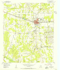
 1951 De Kalb1951 Print · USGSBowie County, Texas, was a landscape of small schools and rural churches in the years following the war. Researchers can trace the Texas and Pacific rail line through De Kalb or locate family markers at Woodman Cem and Harrell Cem.
 - 1951 Map of De Kalb NW
 1951 De Kalb NW1951 Print · USGSThe Red River valley at the Oklahoma-Texas border is captured here in the early fifties, showing a landscape shaped by shifting river bends. Genealogists and local historians can trace the locations of Riverside Sch, Antioch Ch, and family landmarks like Jim Jones Hill.
 - 1951 Map of Tom
 1951 Tom1951 Print · USGSSoutheast Oklahoma and Northeast Texas meet along the winding river valley during the early fifties, showing a rural landscape of scattered schools and family cemeteries. Genealogists can locate Harris Cem and Pine Ridge Sch or trace the route of the Clear Lake Ferry.2 unique versions available
 - 1951 Map of Oak Grove
 1951 Oak Grove1951 Print · USGSBowie County at the dawn of the 1950s shows a landscape of rural communities tied together by the Texas and Pacific rail line. Genealogists can trace family footprints at Mt Pleasant Sch, Garland Cem, and West Bowie Union Ch.
 - 1951 Map of Redbank
 1951 Redbank1951 Print · USGSThe Red River valley in the early fifties shows a landscape of oxbow lakes and rural settlements straddling the Texas-Arkansas line. Genealogists can locate family landmarks like Elizabeth Academy Ch, the Redbank community, and the Vocational School.
 - 1951 Map of Ogden
 1951 Ogden1951 Print · USGSThe Red River borderlands of Arkansas and Texas come alive in this mid-century survey, showcasing a landscape of shifting oxbows and rural crossings. Researchers can trace local heritage through the Rosenwald Sch, St Johns Ch, and the rail stop at Ogden.2 unique versions available
 - 1951 Map of Barkman
 1951 Barkman1951 Print · USGSBowie County, Texas, and the Arkansas borderlands are captured here in the early fifties, dominated by the serpentine coils of the Red River. Researchers can locate family landmarks like the Rosenwald Sch, Clear Lake Cem, and the riverfront settlement of Barkman.
 - 1951 Map of Foreman, 1952 Print
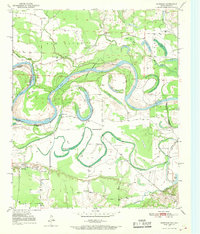
 1951 Foreman1952 Print · USGSThe Arkansas-Oklahoma-Texas borderlands are captured here in the early fifties, where the Red River and St Louis San Francisco rail line shaped local commerce. Genealogists can locate family landmarks like Sand Hill Cem, Matteson Gin, and Lanesport.5 unique versions available
 - 1951 Map of Daniels Chapel, 1952 Print
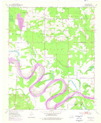
 1951 Daniels Chapel1952 Print · USGSThe Red River valley at the Texas and Arkansas border is shown here in the early fifties, capturing a landscape of shifting river islands and rural settlements. Genealogists can trace family landmarks like Spring Branch Cem, Daniels Chapel, and Lewis Ferry.4 unique versions available
 - 1953 Map of Texarkana, 1964 Print
 1953 Texarkana1964 Print · USGSThe Texas-Arkansas borderlands are captured here in the mid-fifties, during a decade of massive military and hydraulic engineering projects. Genealogists and researchers can locate family landmarks like Old Boston Cem, Siloam Ch, and the vast Red River Arsenal.4 unique versions available
 - 1954 Map of New Boston, 1955 Print
 1954 New Boston1955 Print · USGSNew Boston and the Red River Arsenal area are captured here in the mid-fifties, showing the intersection of military expansion and rural life. Trace the former county seat at Boston, the Bowie County Courthouse, and old sites like Antioch Ch.4 unique versions available
Showing maps 1-25 of 167
Top cities of Bowie County
- Texarkana historical maps
- Wake Village historical maps
- New Boston historical maps
- Nash historical maps
- Hooks historical maps
- De Kalb historical maps
See more
Frequently asked questions
- What are the different types of historical maps available for Bowie County?
- What is the oldest map of Bowie County?
- Where can I purchase historical maps of Bowie County for my home or office?
- Where can I download high-res historical maps of Bowie County?
- Are there historical topographic maps available for Bowie County?
- Is there historical aerial imagery available for Bowie County?
- Where are historical maps of Bowie County sourced from?