Old Maps of Port O'Connor, Texas for Genealogy
Trace your family roots with 11 historic maps of Port O'Connor. These high-res maps reveal old neighborhoods, homesites, landmarks, and streets — helping you uncover where your ancestors lived and how the area evolved over time.
- Explore historic neighborhoods: Identify where your relatives may have lived in the 1800s or 1900s.
- Compare maps over time: Trace the changes in streets, buildings, and landmarks for multi-generational research.
- Perfect for genealogy & ancestry research: Used by family historians and researchers to map out lineage and migration.
These maps are an incredible resource for exploring your personal connection to Port O'Connor's past.
Port O'Connor, TX maps
(11)- 1952 Map of Port O'Connor, 1954 Print
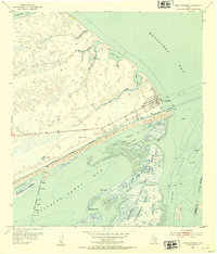 1952 Port O'Connor1954 Print · USGSThe Texas Gulf Coast comes to life in the early fifties as Port O'Connor anchors a landscape of barrier islands and military ranges. Trace coastal heritage through the U S Coast Guard Station, Submerged Ruins, and the sprawling Matagorda Island Bombing and Gunnery Range.3 unique versions available
 - 1953 Map of Beeville
 1953 Beeville1953 Print · USGSThe Texas Coastal Bend in the early fifties shows a landscape of growing regional hubs and vital maritime corridors. Trace the rail-and-river economy through Goliad, locate the Matagorda Lighthouse, and explore the sprawling Aransas National Wildlife Refuge.
 - 1956 Map of Beeville
 1956 Beeville1956 Print · USGSCoastal Texas and the brush country interior are shown in the mid-fifties, from the coastal bays to the inland oil fields. Trace the old rail lines of the Southern Pacific RR or locate the historic Matagorda Lighthouse and the Aransas National Wildlife Refuge.2 unique versions available
 - 1960 Map of Beeville
 1960 Beeville1960 Print · USGSCoastal Texas in the mid-fifties reveals a landscape of growing towns and vital military outposts like Foster AFB. Researchers can trace old rail lines including the Missouri Pacific and explore the vast Aransas National Wildlife Refuge.
 - 1983 Map of San Antonio Bay
 1983 San Antonio Bay1983 Print · USGSThe Texas Coastal Bend in the early eighties is a landscape of expansive estuaries and barrier islands. Local historians can trace the development of Port O'Connor and Seadrift, the boundaries of the Aransas National Wildlife Refuge, and the path of an Old RR Grade near Tivoli.
 - 2010 Map of Port O'Connor, 2010 Print
 2010 Port O'Connor2010 Print · USGSCovers Port O'Connor, including Matagorda County, Calhoun County, and other nearby areas
 - 2013 Map of Port O'Connor, 2013 Print
 2013 Port O'Connor2013 Print · USGSCovers Port O'Connor, including Matagorda County, Calhoun County, and other nearby areas
 - 2016 Map of Port O'Connor, 2016 Print
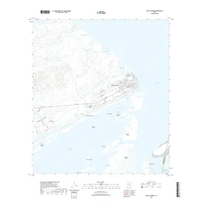
 2016 Port O'Connor2016 Print · USGSCovers Port O'Connor, including Matagorda County, Calhoun County, and other nearby areas
 - 2019 Map of Port O'Connor, 2019 Print
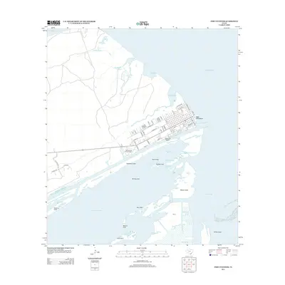
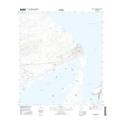
 2019 Port O'Connor2019 Print · USGSCovers Port O'Connor, including Matagorda County, Calhoun County, and other nearby areas
 - 2022 Map of Port O'Connor, 2022 Print
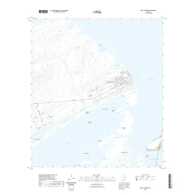 2022 Port O'Connor2022 Print · USGSCovers Port O'Connor, including Matagorda County, Calhoun County, and other nearby areas
 - 2025 Map of Port O'Connor, 2025 Print
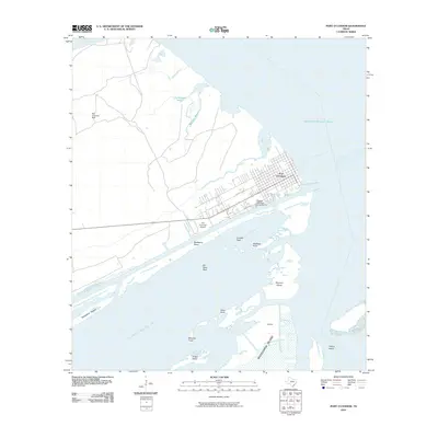
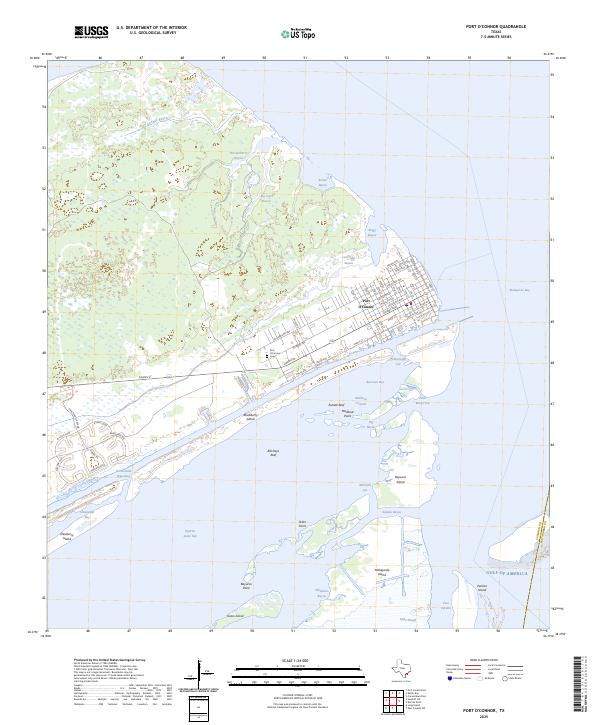 2025 Port O'Connor2025 Print · USGSPort O'Connor's coastal layout and maritime geography are captured here in the early twenty-first century. Genealogists and local historians can trace the town's grid and find the Port O'Connor Cem, or explore the surrounding waters of Espiritu Santo Bay and Pass Cavallo.
End of results
Showing maps 1-11 of 11
Top cities near Port O'Connor
Frequently asked questions
- What are the different types of historical maps available for Port O'Connor?
- What is the oldest map of Port O'Connor?
- Where can I purchase historical maps of Port O'Connor for my home or office?
- Where can I download high-res historical maps of Port O'Connor?
- Are there historical topographic maps available for Port O'Connor?
- Is there historical aerial imagery available for Port O'Connor?
- Where are historical maps of Port O'Connor sourced from?